Sea of Constellations: Exploring La Paz & the Islands of Espíritu Santo
Where bioluminescent seas, volcanic cliffs, and desert islands tell an ancient story
We arrived in La Paz with hesitation still lingering from our brief and overstimulating stop in Cabo San Lucas… Another city was the last thing we thought we wanted. However, La Paz turned out to be very different than we expected; it felt softer and more laid back than what we were imagining. Despite being the capital of Baja California Sur, home to a population of roughly 250,000 people, it never carried the weight of a “big city.” It lacked the rows of high-rises and sprawling waterfront resorts that so often define modern beach destinations. Life here moved at a different pace – Families lingered along the malecón (the local name for the waterfront area) well after sunset, children chased one another between sculptures that lined the sidewalk, and conversations drifted from nearby cafés and bars long into the evening air. The whimsical bronze sculptures featured mermaids rising from the sea, dolphins suspended mid-motion, figures that blurred the line between myth and coastline. There was a sense of ease to it all; it felt not a place to rush through, but one to settle into. And settle we did.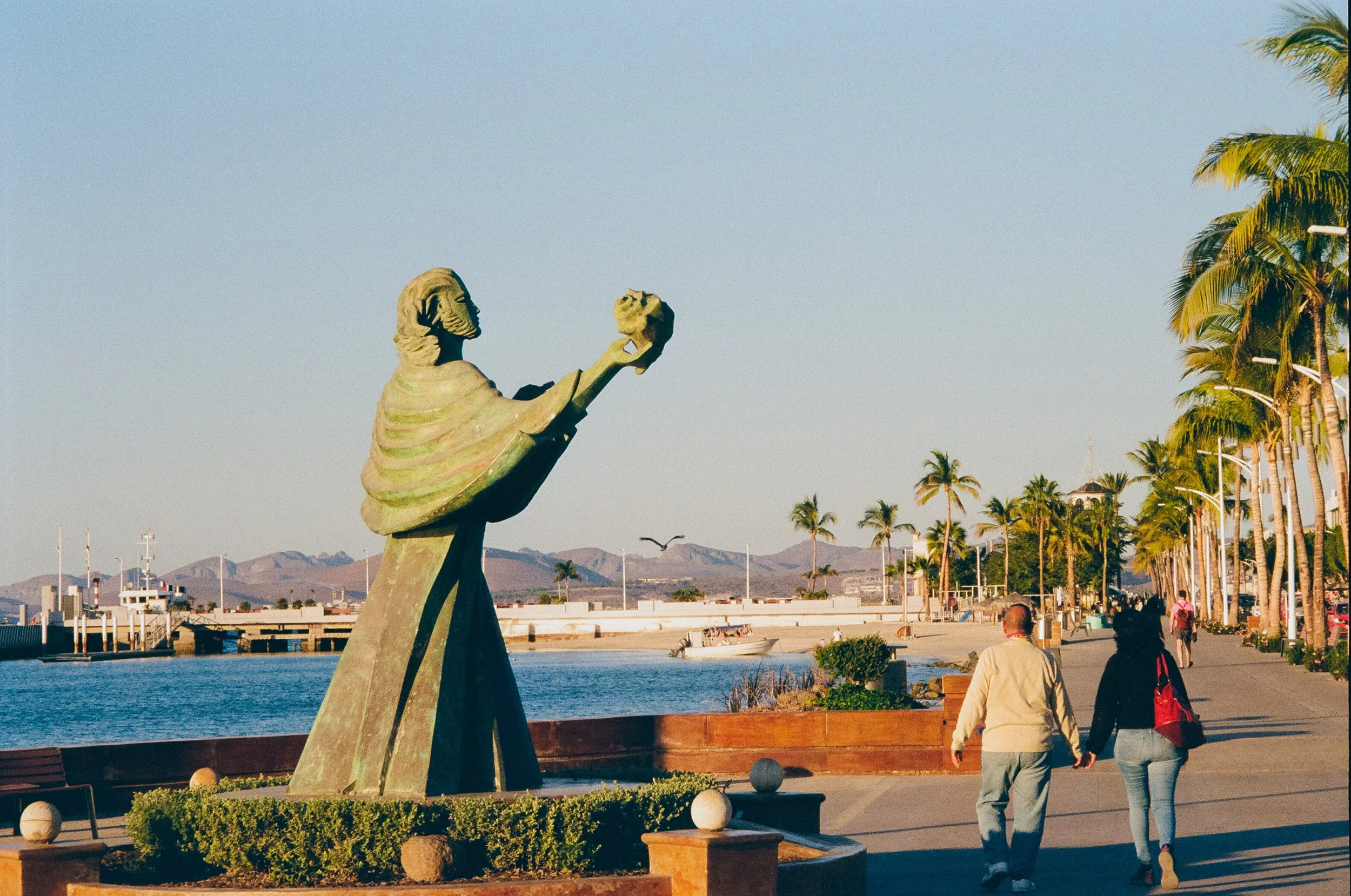
Malecon of La Paz

Malecon of La Paz

Malecon of La Paz
What was intended to be a brief stop for provisions became our home base for the next two months, a place we found ourselves eagerly returning to after each excursion among the surrounding islands. La Paz turned into a kind of revolving door: friends arriving to join us, stepping into life aboard, then heading back to shore while others took their place. Between these comings and goings, we built a rhythm. Morning walks into town to visit the Saturday farmers market off the malecón and enjoy tacos for lunch, followed by long afternoons preparing the boat while anchored in the bay among over 50 other sailboats... and they too had a rhythm that swung with the tide changes every 6 hours. Because the bay of La Paz has a very thin choke point in the channel that all the water flows into and out of, the surrounding sailboats would flip 180 degrees with the tide changes. By looking out one could visually tell whether the tide was incoming or outgoing.
Murals of La Paz

Malecon of La Paz

Malecon of La Paz
Although we still had two months before crossing the vast Pacific Ocean, this is when we began installing our “water maker” – a desalination system that would be needed for the journey ahead into the remote areas of the south pacific. The rhythm continued with evenings often spent lingering over delicious local foods – fresh ceviche, small tucked-away spots that became favorites, the discovery of a vermouth bar, a farmers and artisan market rich with color and spice. We also paid a visit to the CONANP office to acquire wristbands and passes for visiting the surrounding national park islands.Provisioning became both ritual and adventure. We wandered small neighborhood markets and larger supermercados, returning with armfuls of fresh tortillas, fresh citrus, unfamiliar hot sauces, a variety of beloved local cheeses like oaxacan and cotija cheese, and whatever other local delicacy caught our eye that day. Each visit added another piece to the puzzle of preparing not only for the next anchorage, but for the vast Pacific crossing that waited beyond the horizon. La Paz was not just a place to pause, it was where everything began to gather.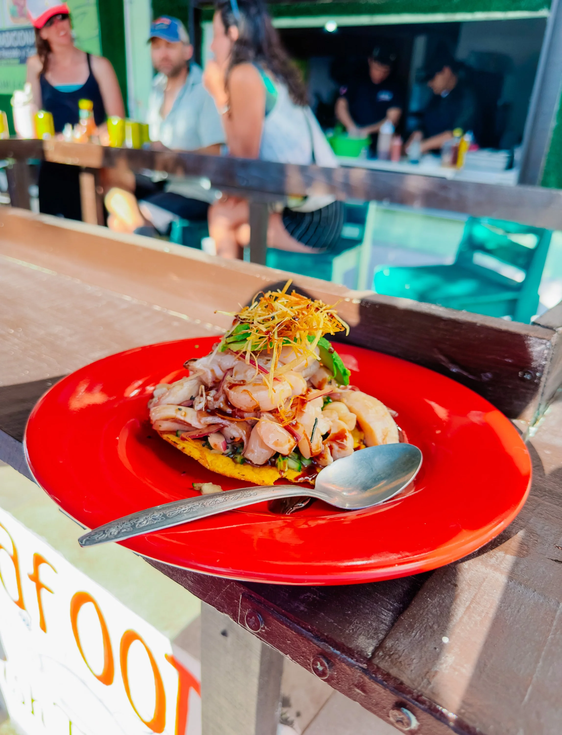
Ceviche in La Paz

Ceviche in La Paz
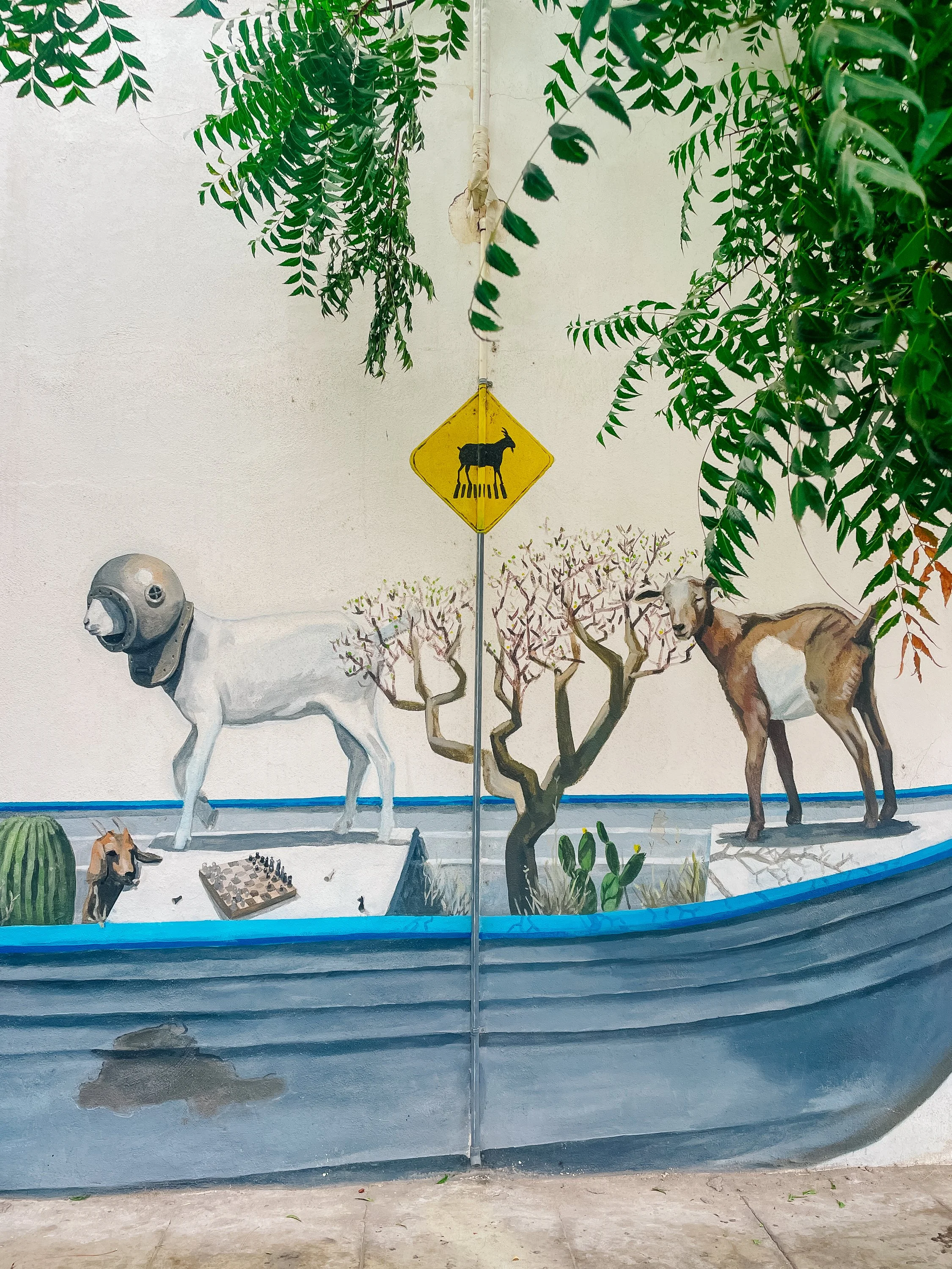
Murals in La Paz

Aloe Plant on Arcturus

Museo de Arte de Baja California Sur (MUABCS)
It was also where the sea offered one of its most unforgettable encounters. We had arrived at the height of whale shark season, and on the winter solstice (our birthdays) we slipped into the water beside them. There is something deeply humbling about sharing space with the largest fish in the world. At first only their shadows appeared, materializing from the blue beneath us before resolving into an animal larger than seemed possible, moving with a calm that makes their enormity feel almost weightless. As they passed beneath us, their backs revealed patterns of white, like intricate, deliberate, like constellations scattered across a night sky. It is said that a group of whale sharks is called a constellation, and in their presence, the name felt less like metaphor and more like truth.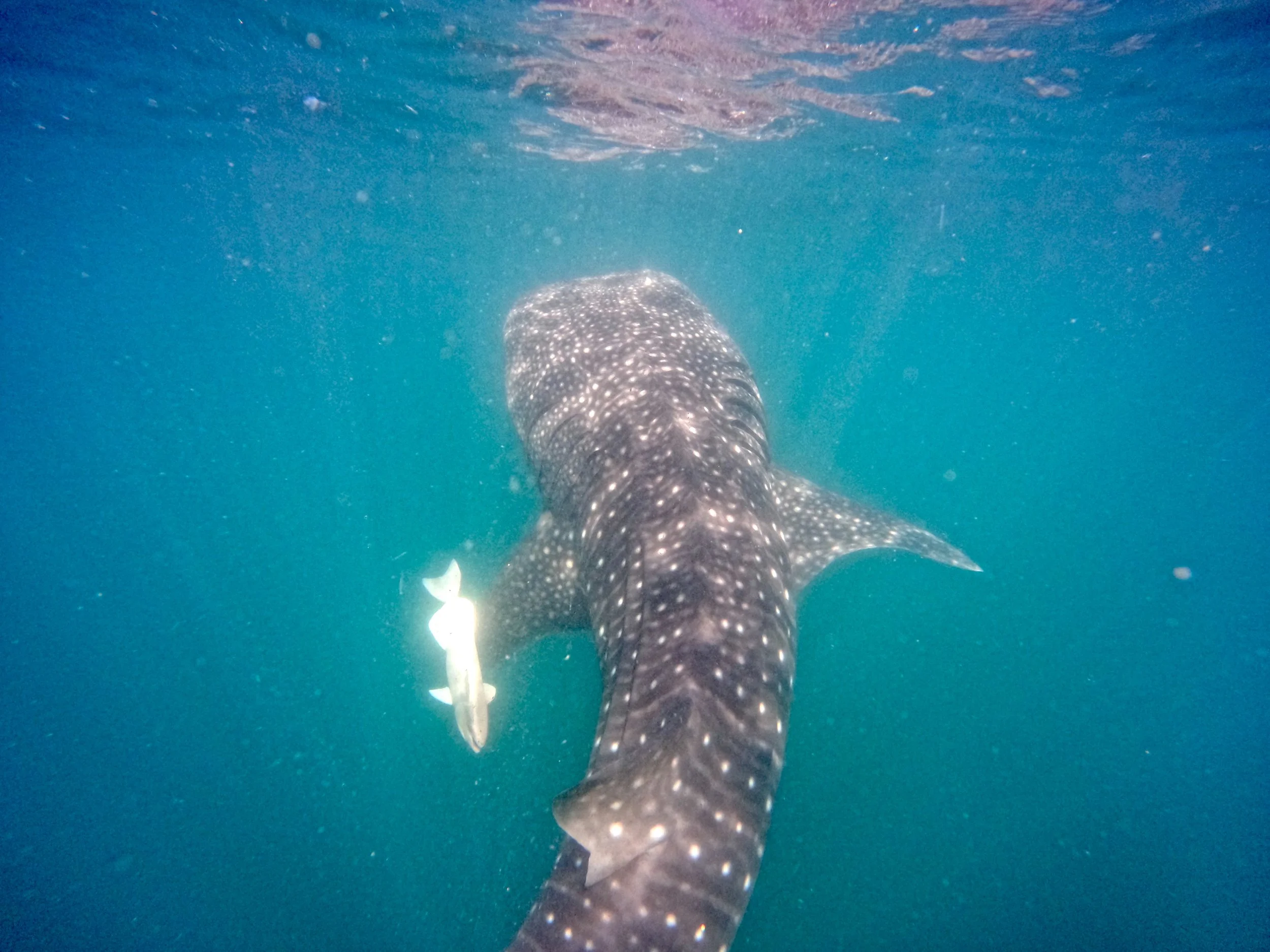
Swimming with whale sharks in la paz
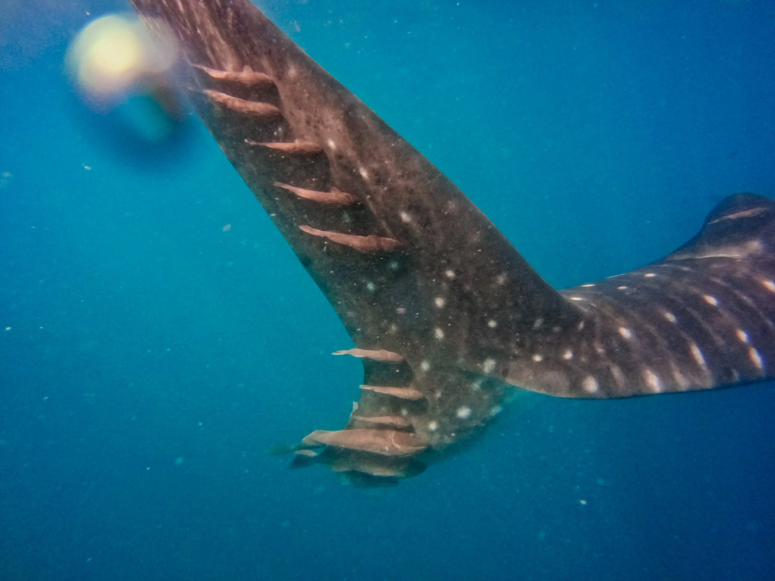
Swimming with whale sharks
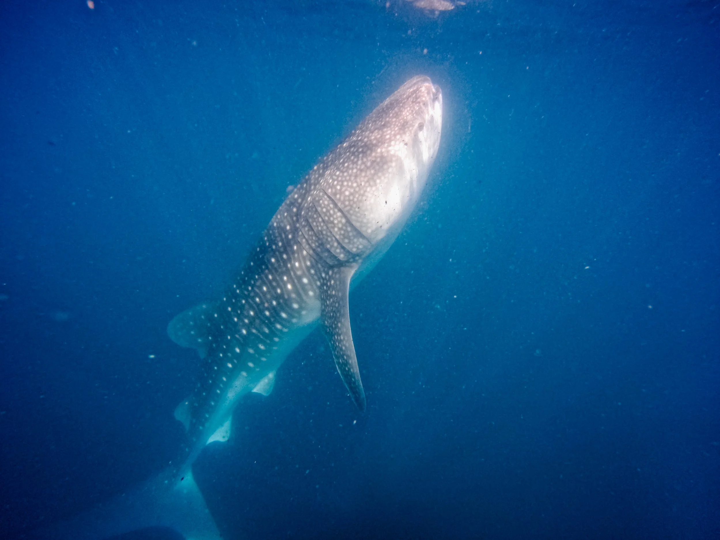
Swimming with whale sharks
Several days later, we attended the local Christmas parade where nearly 100 decorated vehicles drove along the malecón road, blasting Christmas music in Spanish and honking their horns. This was my second holiday season spent in a Latin American country, and the Christmas spirit is certainly strong with them. The cruising guide we would wholeheartedly recommend for traversing the Sea of Cortez is Sea of Cortez: A Cruiser's Guidebook by Shawn Breeding and Heather Bansmer. We found its charts, photographs, and navigational information invaluable throughout our voyage. In the La Paz area, it was on our list to pay a visit to Puerto La Bandera but never found the opportunity to… it is a popular mainland beach and spot for locals and visitors of the mainland to enjoy a day at the beach.
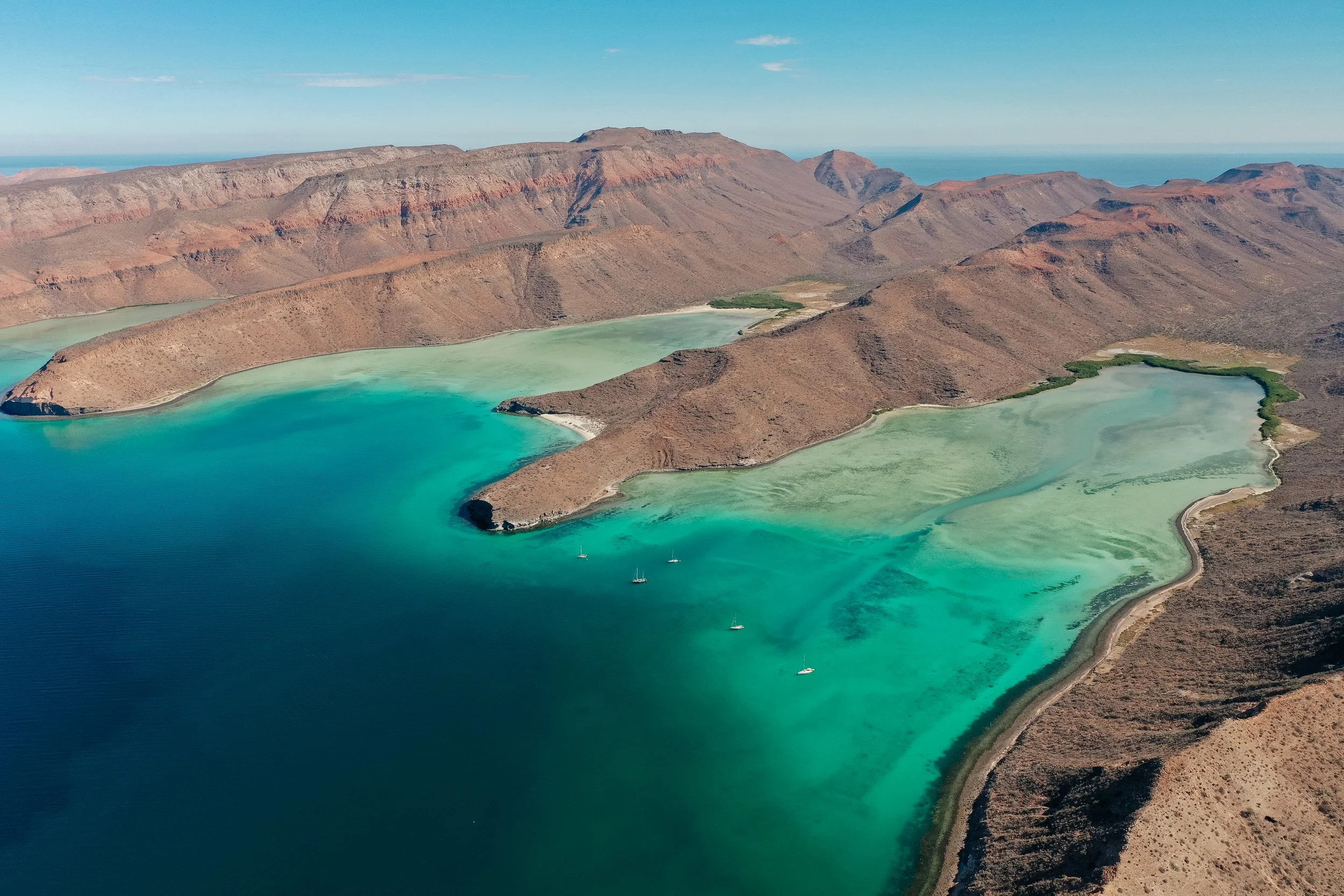
Isla Espíritu Santo
ISLA ESPIRITU SANTO
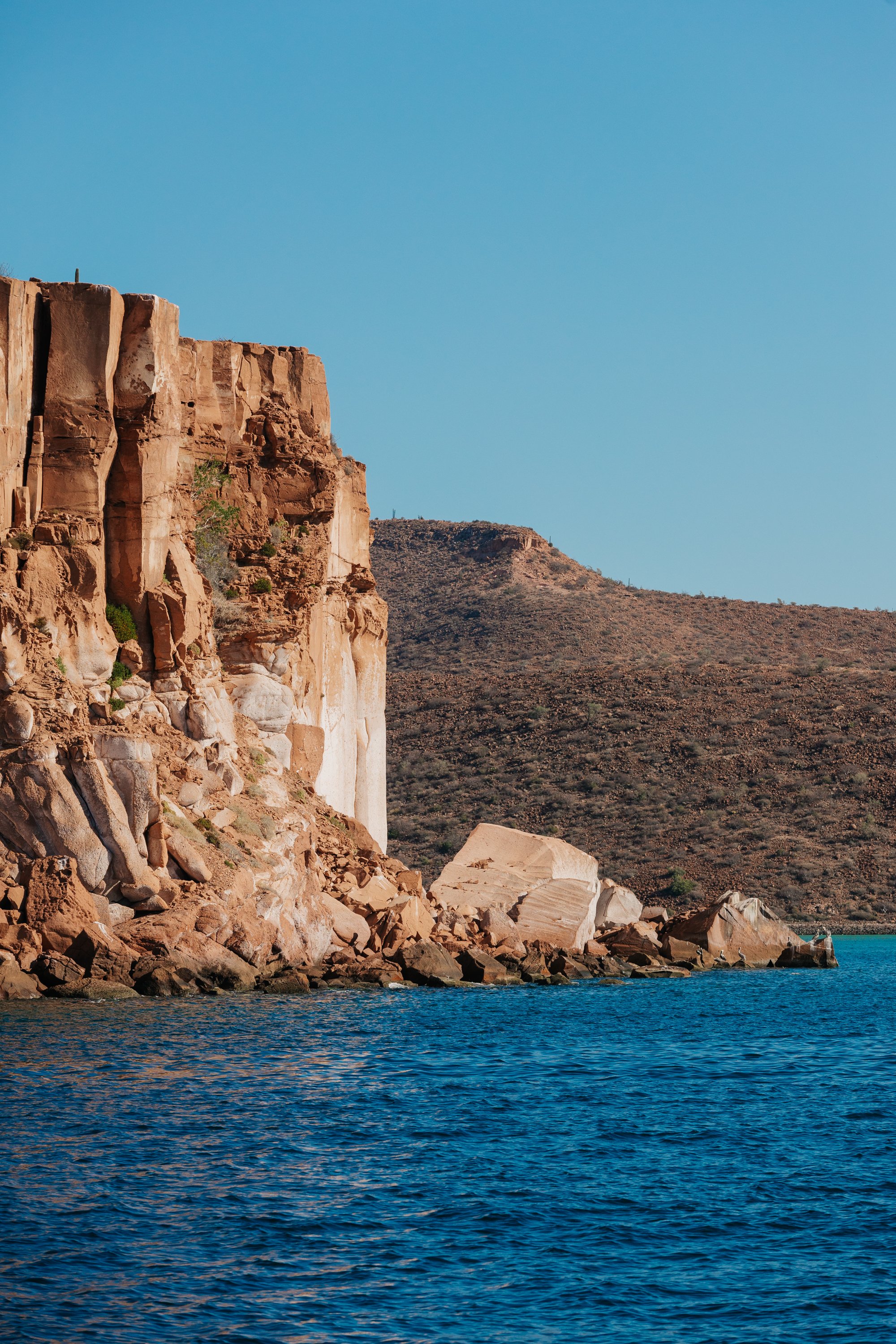
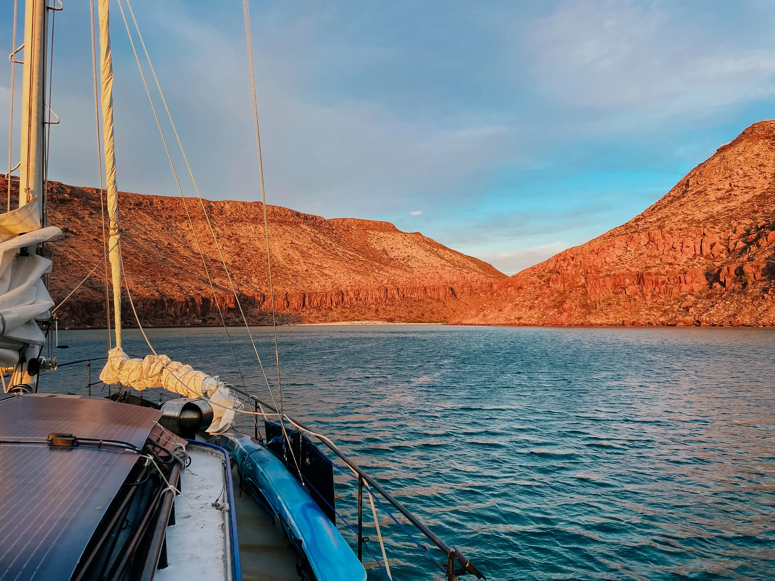
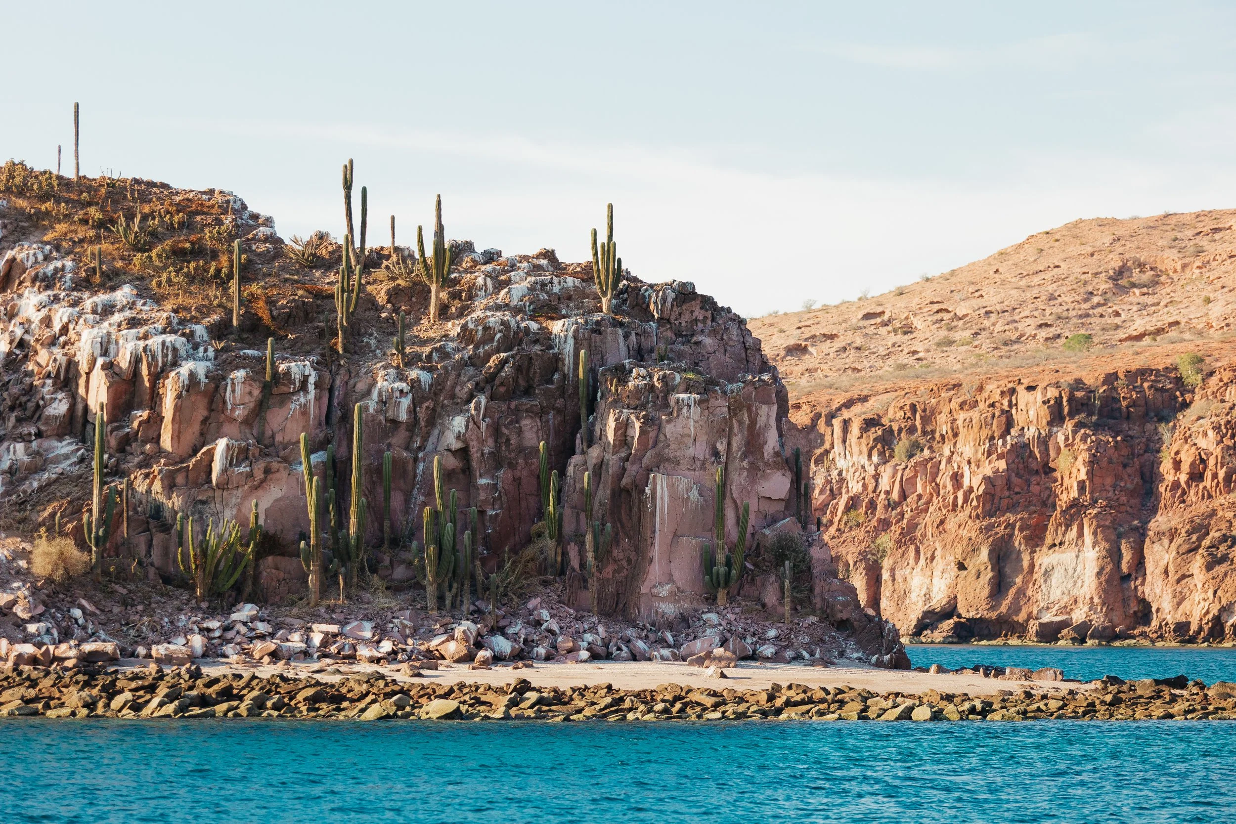
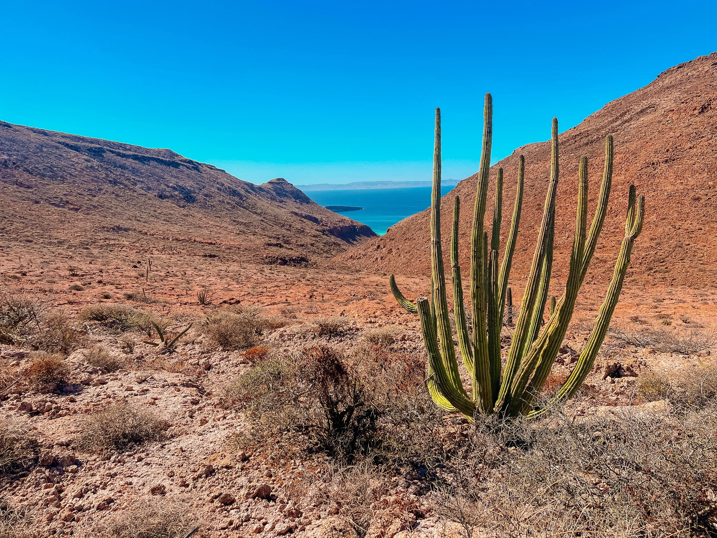
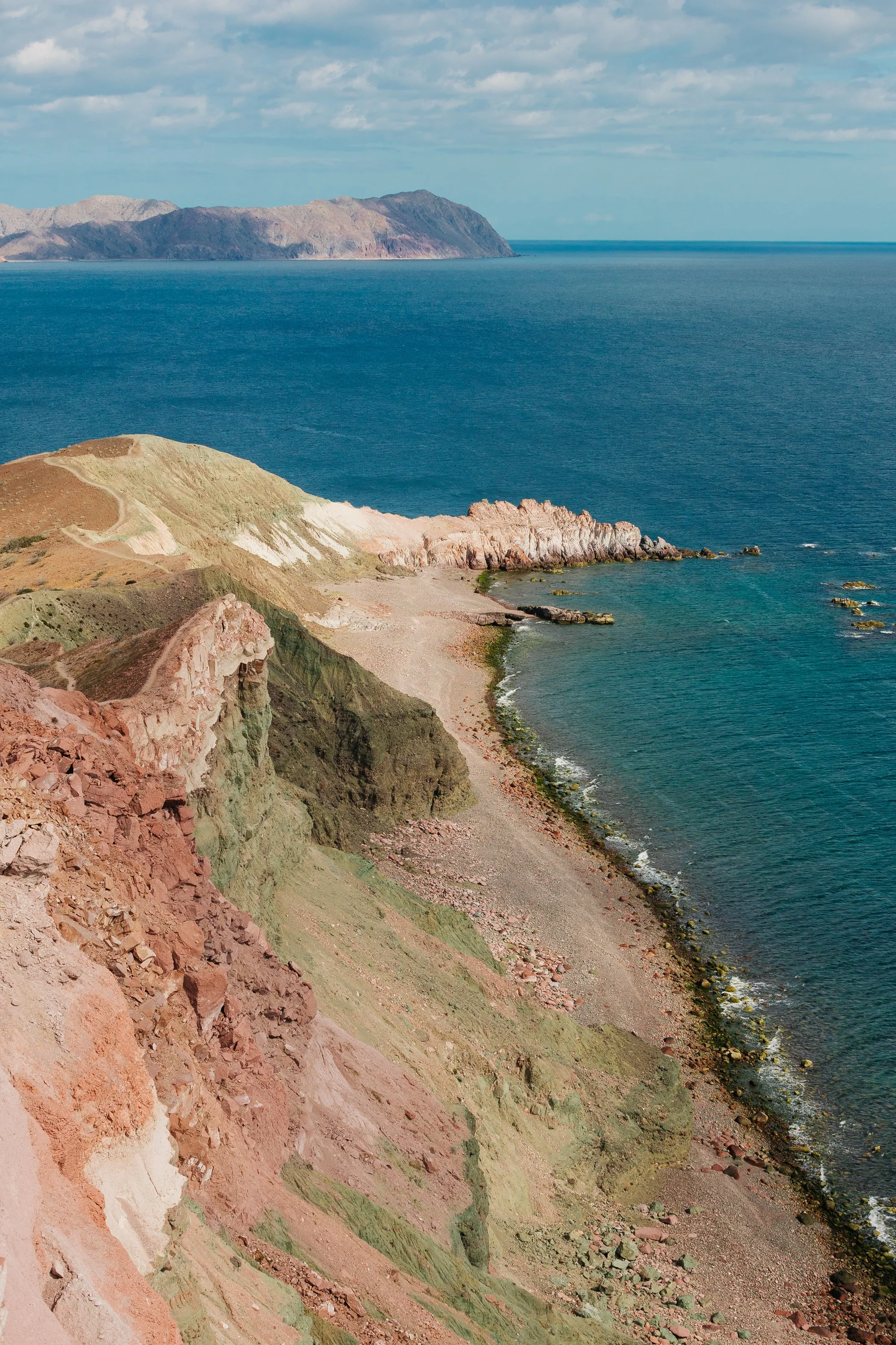
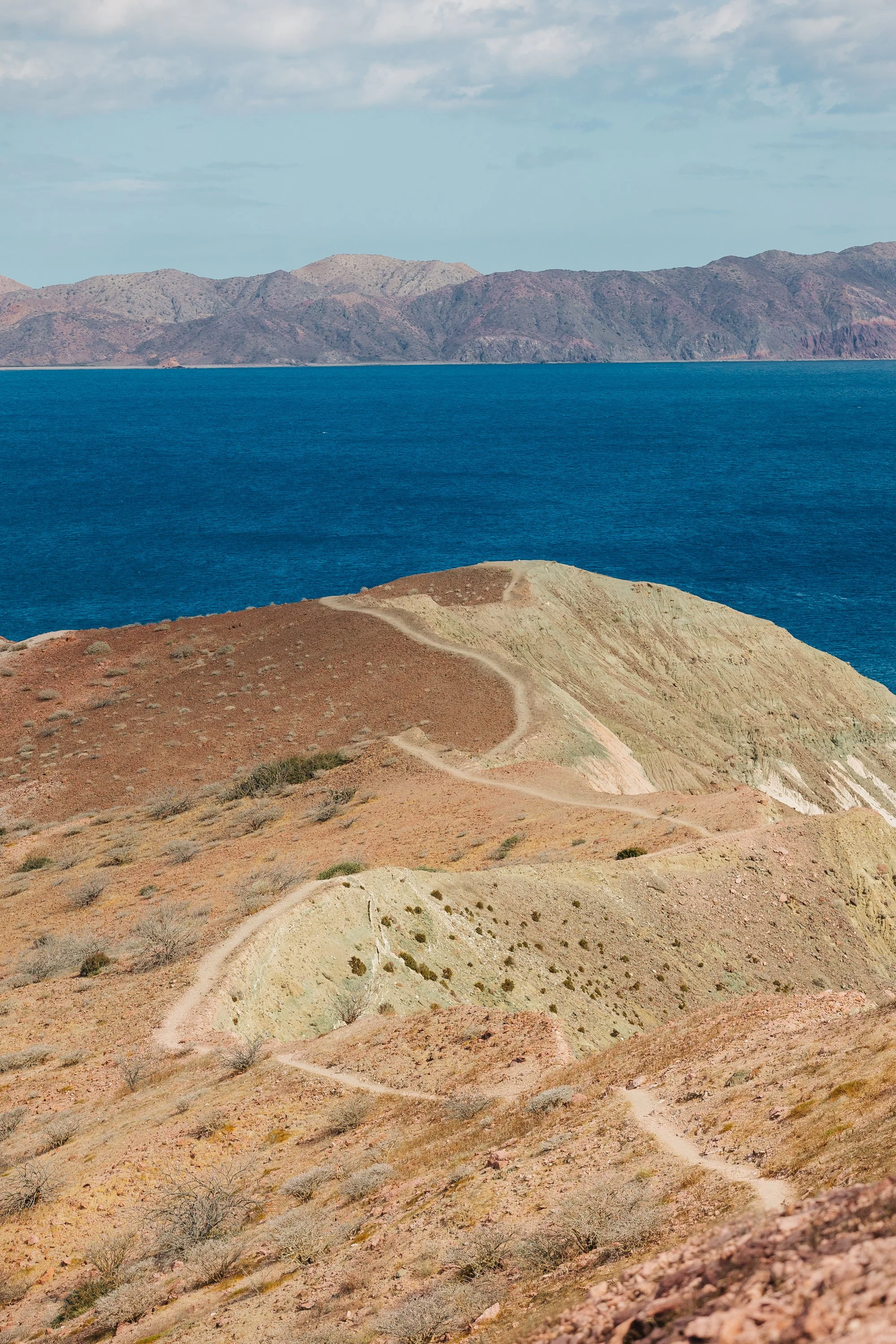
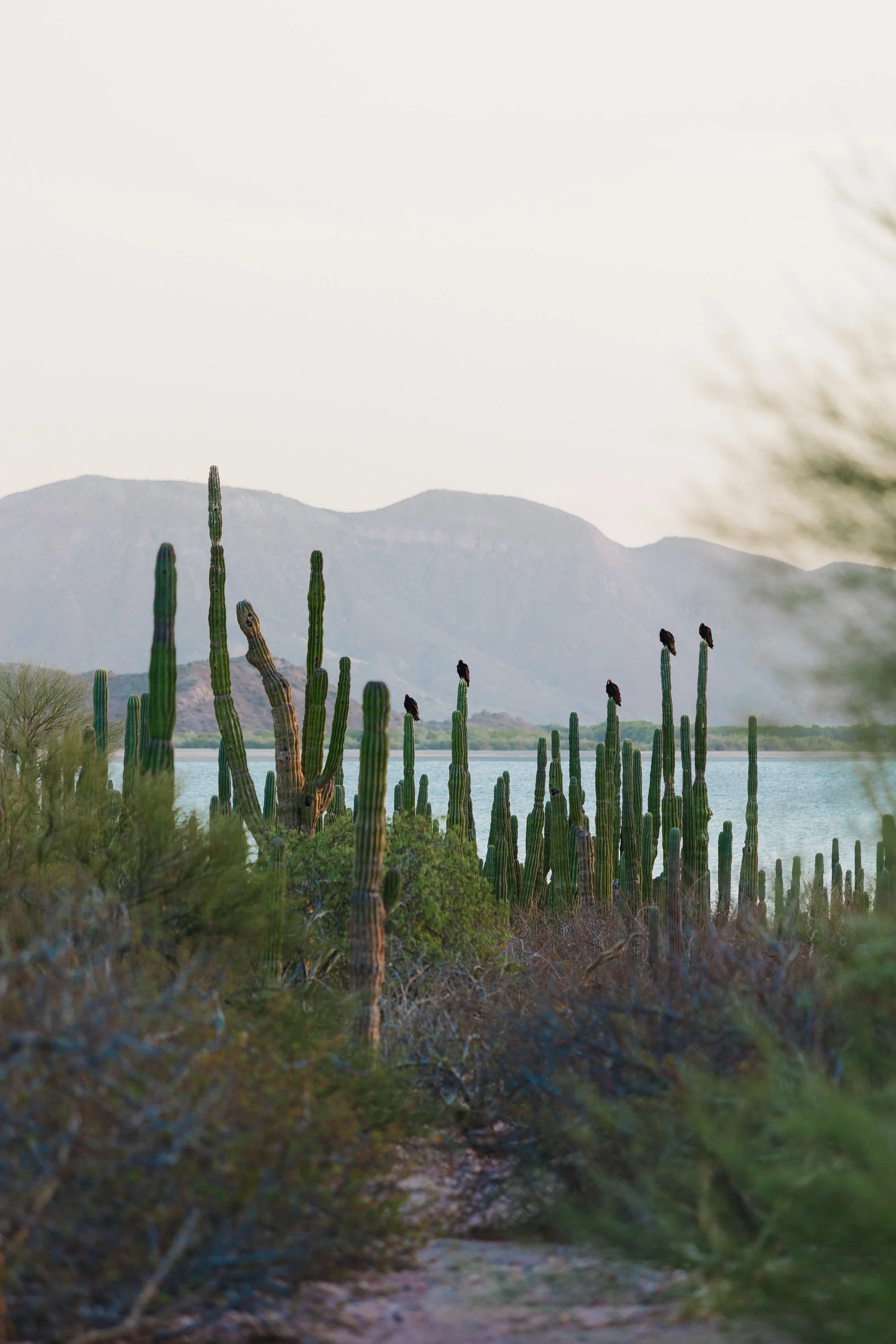
North of La Paz, the coastline begins to fracture, a brilliant red rock desert breaking apart into islands that rise abruptly from the sea, all red stone and wind-carved ridgelines. Isla Espíritu Santo was the first of these, and stepping ashore there felt like entering something elemental. The landscape was immediately familiar and entirely foreign at once, like Utah meeting the ocean, desert stone meeting saltwater, a place where stillness and motion existed side by side. Espíritu Santo feels less like an island and more like a drowned desert mountain range, its cliffs layered in volcanic ash and ancient lava, painted in the same reds and ochres that define the American Southwest. When sailing north, we could look west toward the mainland and see the towering cliffs in the far distance. At sunrise their cliffs looked painted in crimson tones, while evenings glowed lavender and gold that lingered long after the sun disappeared.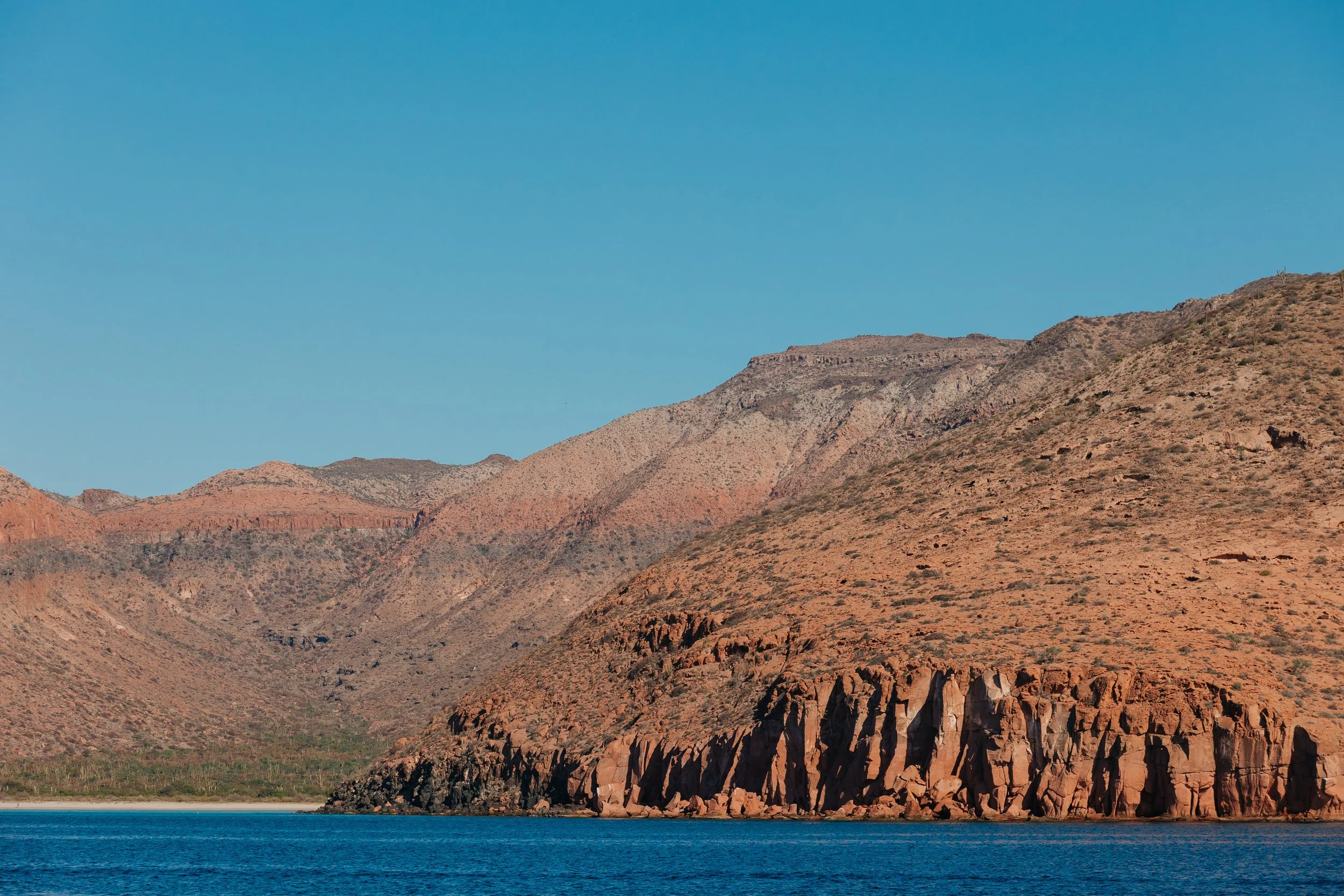
Isla Espíritu Santo
Isla Espíritu Santo

Isla Espíritu Santo

Isla Espíritu Santo
The Espíritu Santo Archipelago has been visited by humans for roughly 10,000 years. Archaeological sites, rock shelters, and caves throughout the islands have yielded evidence of ancient hunter-gatherer peoples who traveled among the Gulf islands long before European arrival. The island remained largely undeveloped through modern history, though it was used intermittently by fishermen, ranchers, and pearl divers. Unlike much of the Baja coastline, Espíritu Santo remains largely untouched, not because development never arrived, but because the people of Baja fought to keep it wild. In 2003 it became federal land, development was prohibited, and later the archipelago gained national park and UNESCO protections.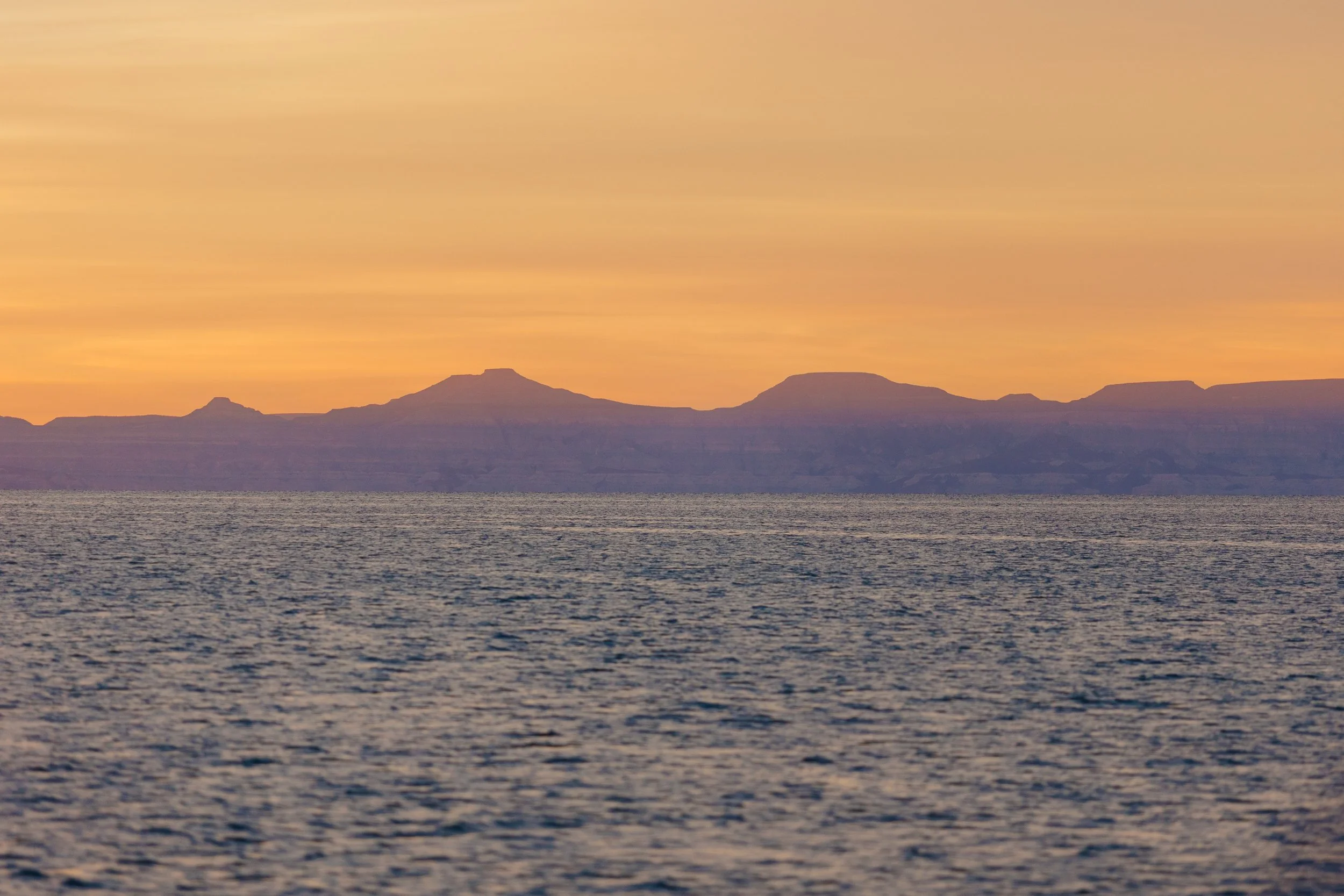
Overlooking the mainland from Isla Espíritu Santo

Isla Espíritu Santo

Isla Espíritu Santo
Isla Espíritu Santo
The inner Sea of Cortez is a popular breeding and calving ground for the North Pacific Population of Humpback Whales, and one of our traverses up to the island we encountered a mother and calf breaching. We watched for nearly half an hour as the pair alternated between breaching and slapping their enormous pectoral fins against the surface, the sound carrying across the calm morning water like distant cannon fire. The humpbacks wintering around Baja are generally part of the Mexico Distinct Population Segment, which breeds throughout Baja California and mainland western Mexico during winter. Their summer feeding grounds extend from California all the way to the Gulf of Alaska and Aleutian Islands. As we watched humpbacks surface in the Sea of Cortez, it was entirely possible that these whales had spent the summer in the same waters we call home. Like us, they had traveled the length of the Pacific coast, trading glacial fjords for warm desert seas.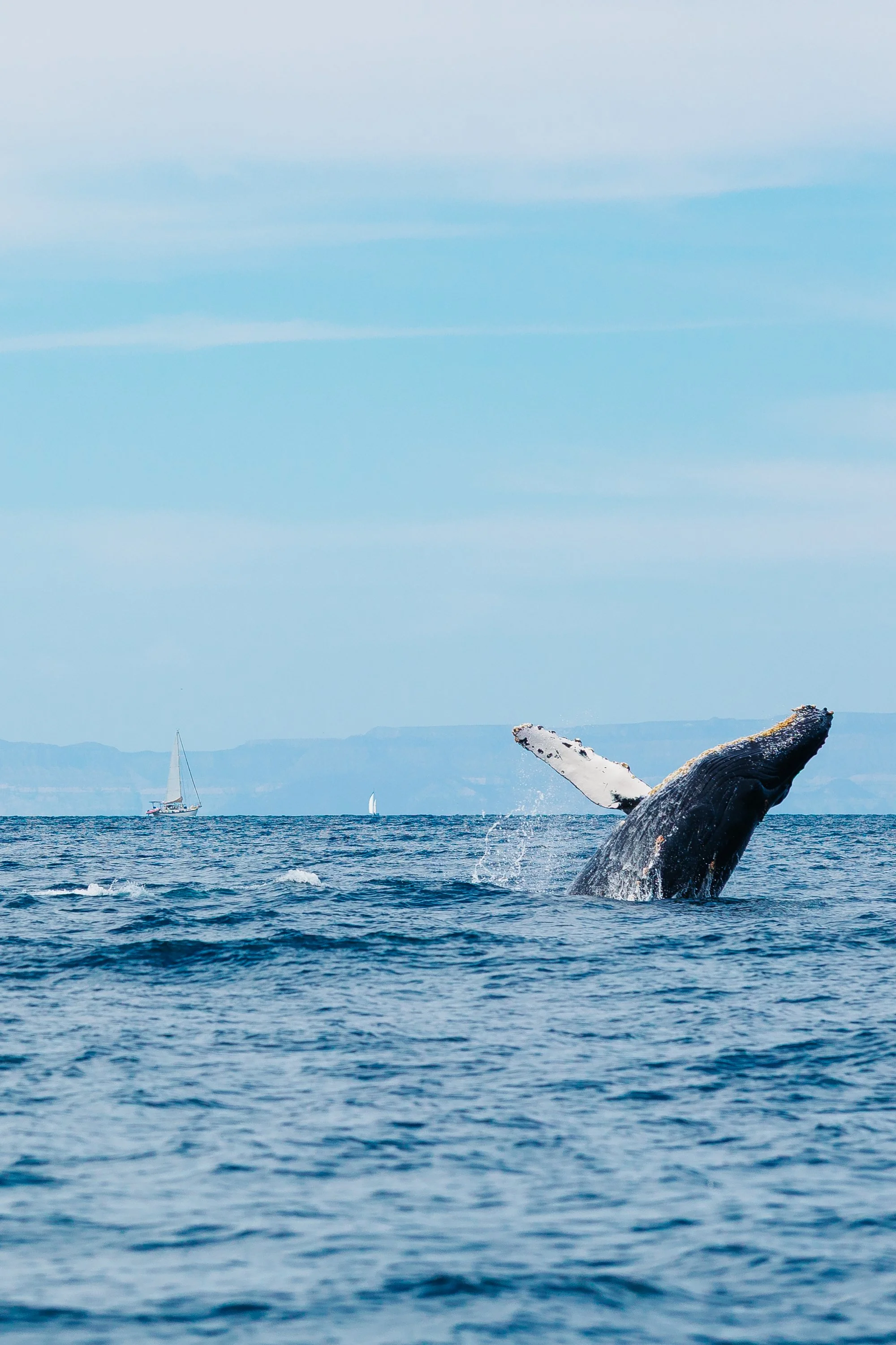
Humpbacks breaching in the sea of cortez
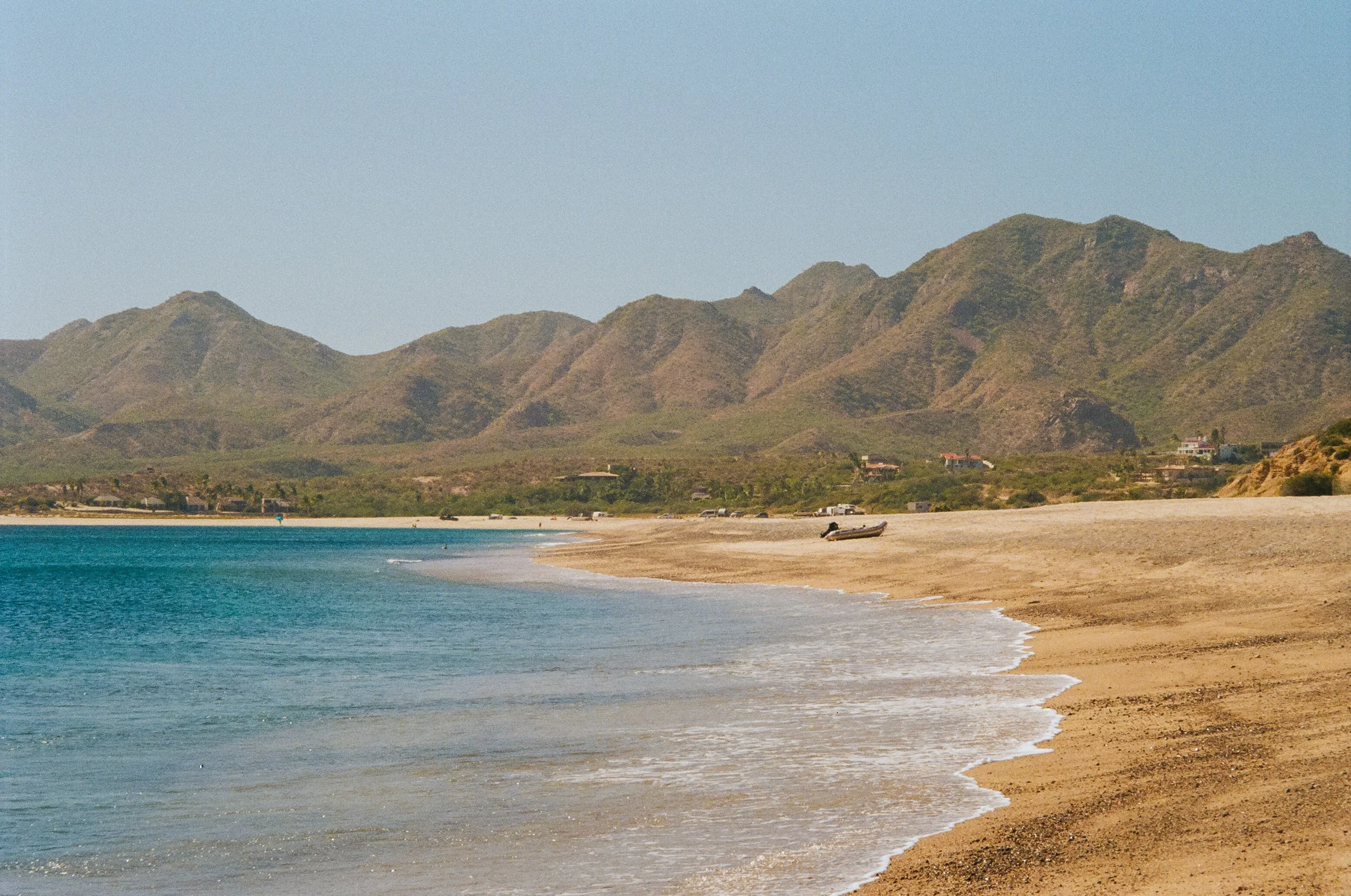
We began our time on the islands at Playa La Bonanza, where the beach stretched wide and open, an easy landing that invited us ashore. Beneath the surface, patches of coral and schools of brightly colored fish animated the shallows, feeling rounded, sculptural, improbable… The surrounding landscape felt reminiscent of distant desert landscapes, like Joshua Tree reimagined at the edge of the sea. It was an introduction that didn’t overwhelm, but gently revealed what was to come.One day, I went ashore with a group of our friends with the intention of hiking across to the beach on the other side, leaving the boat behind altogether. While Louie sailed it around to meet us, we set out on foot, crossing the island through a dry arroyo that carved its way through the land. The hike was quiet, the kind of quiet that feels suspended, broken only by the wind, and the distant calls of wild goats echoed through the canyon. Though they feel like part of the landscape today, these animals are descendants of livestock left behind by sailors and ranchers centuries ago.
Playa La Bonanza on Isla Espíritu Santo
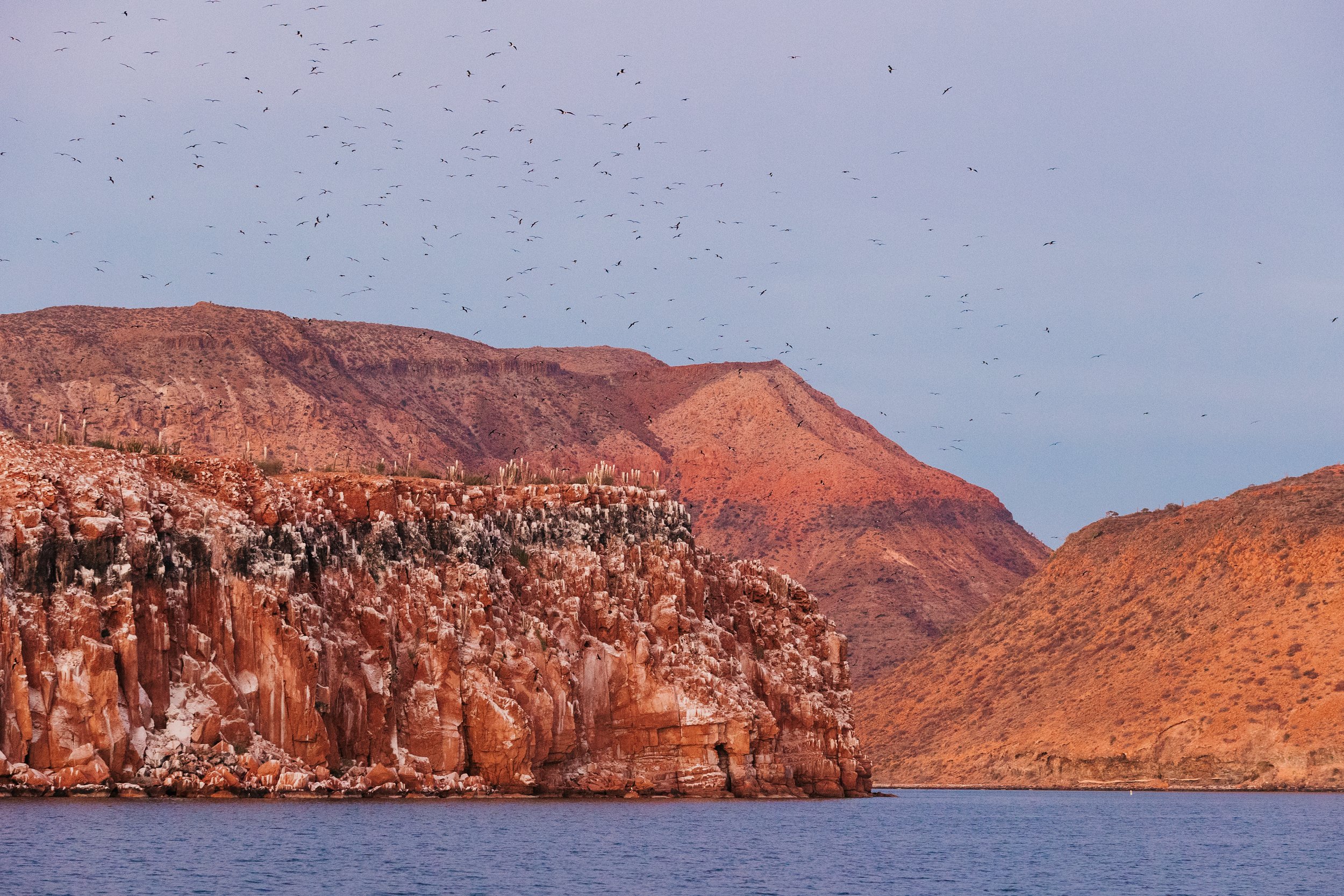
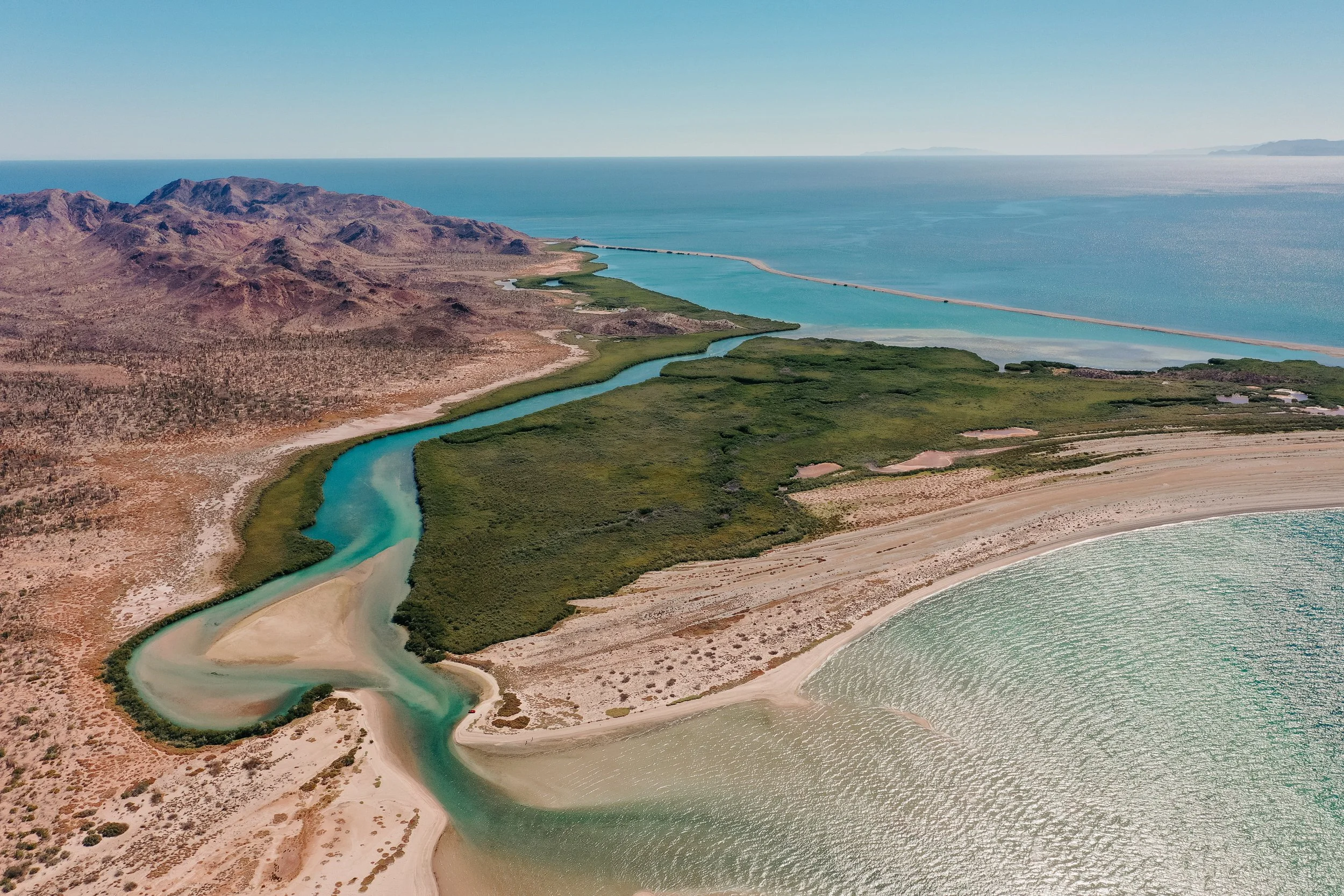
Frigate estuary on Isla Espíritu Santo
When we descended into Bahía San Gabriel, the landscape opened into one of the most expansive beaches we had seen: wide, shallow, and pale, and nearly untouched. Frigate birds circled above an estuary tucked just beyond the shore, which was one of their nesting sites; the entire place carried a sense of careful preservation. Louie and I had explored this beach a week earlier one afternoon before we were later joined by our friends. Since the entire bay is a no-anchoring zone, we anchored Arcturus in the bay to the north and landed the dinghy on the beach to watch the sunset…We sat waist-deep in water so clear and shallow that sunlight danced across rippled sand beneath us. Behind us stretched an immense ribbon of white beach, untouched except for the occasional track left by birds moving between the shoreline and estuary.
Isla Espíritu Santo
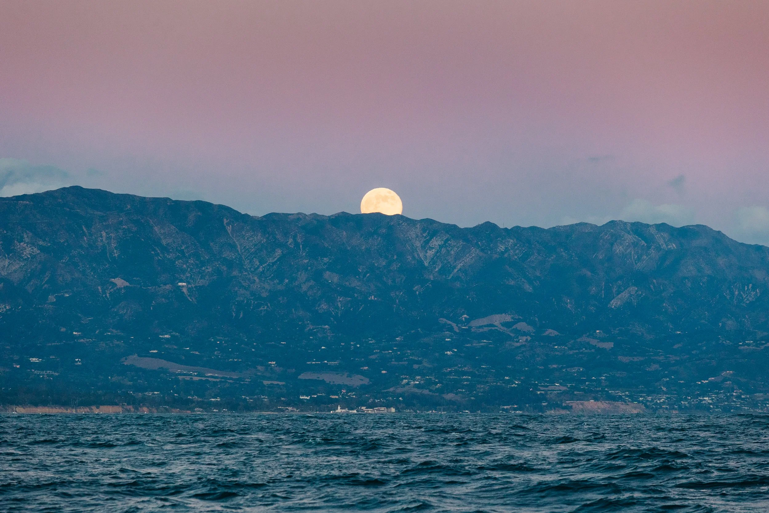
Sunset from Isla Espíritu Santo
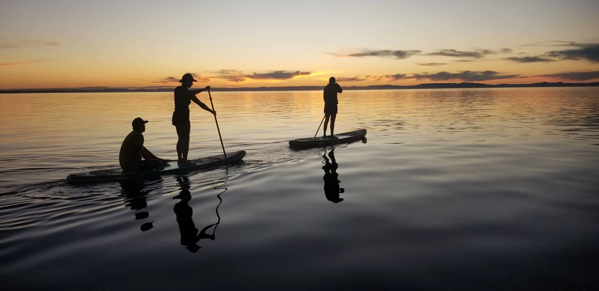
Paddleboarding on Isla Espíritu Santo
North of there was Puerto Ballena, within it were several inlets and islands, each well worth exploring... The southernmost was Ensenada La Gallina, where the water turned murkier, softer in visibility but no less alive. Turtles moved through it with quiet ease, appearing and disappearing beneath the surface. We spent our days paddleboarding through the bay, drifting without direction, and returned again at night, when the entire world seemed to shift. One night, we set off aboard paddle boards and kayaks, and found ourselves surrounded by bioluminescence, each movement in the water igniting, light blooming in soft bursts with each stroke and ripple. Beneath the surface we could see the sea turtles swimming, the unseen made visible only through motion in the water, as though the sky itself had descended.
Isla Espíritu Santo

Isla Espíritu Santo

Isla Espíritu Santo
Isla Espíritu Santo
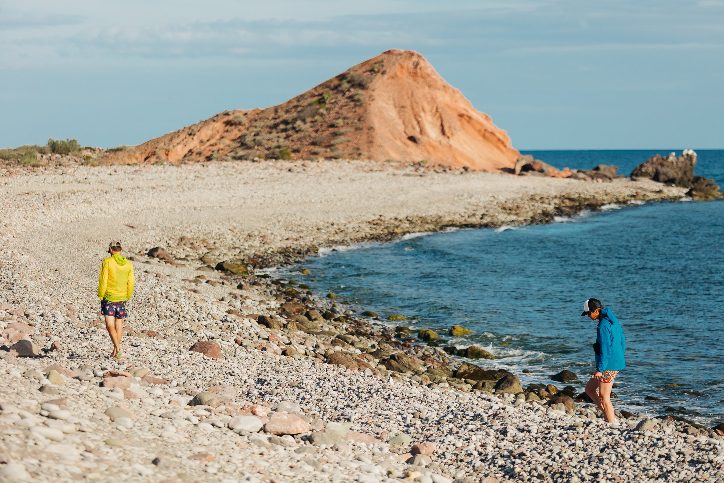
Ensenada Candelero was a bay surrounded by rocky hills and red rock sandstone cliffs. There are two islands in the bay that host great snorkeling, the main Candelero reef was found to have great diving and had concrete walls placed at roughly forty feet of depth that now serve as artificial reefs. They appeared suddenly, quite out of nowhere, and diving it felt like finding an underwater maze, one that you could actually swim through, and swim we did following one another through the winding walls. From shore there was a hike up to the sandstone cliff amphitheaters that overlooked the bay, which proved to be a wonderful place to enjoy the sunset. The hike took less than an hour, and en route we could see plenty of goats of every color, white, black, and chestnut brown, picking their way effortlessly across impossibly steep cliffs.One visit with friends found us hiking the canyon dressed in the contents of our onboard costume closet, an absurd procession of brightly colored mismatched outfits, promenading as adventurers, and miscellaneous characters wandering through one of Baja's most spectacular landscapes. It proved to be one of the most beautiful sunset views on the island as well.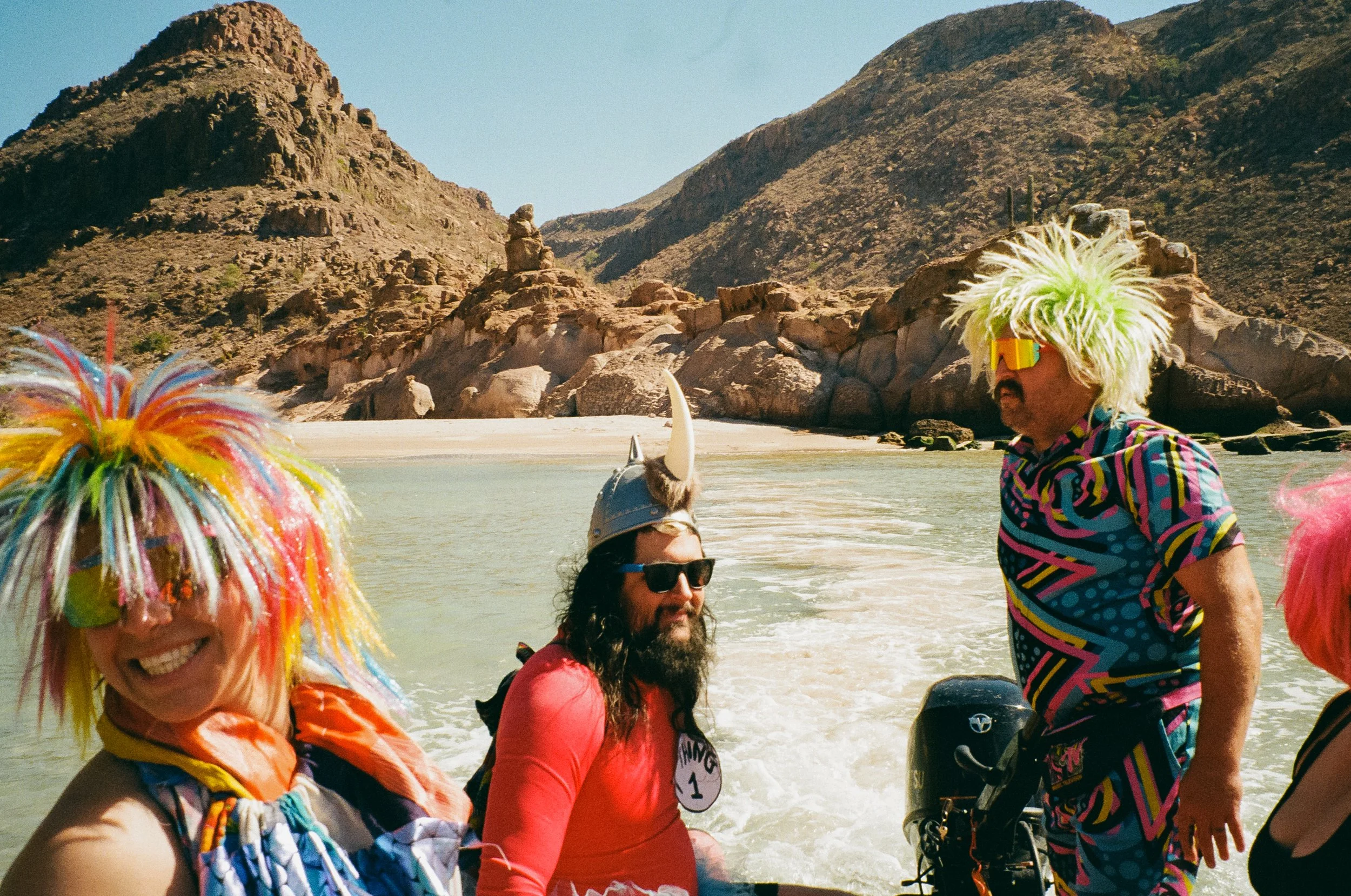
Dress up on Isla Espíritu Santo

Dress up on Isla Espíritu Santo

Dress up on Isla Espíritu Santo

Dress up on Isla Espíritu Santo

Dress up on Isla Espíritu Santo

Dress up on Isla Espíritu Santo

Dress up on Isla Espíritu Santo
A popular thing for visitors to do is a kayaking tour from Espiritu Santo where they glamp on the beaches; there can also be various day tours from La Paz. During our four or five visits to the islands, we noticed varying patterns and that certain anchorages and beaches did not seem to be more or less popular than others, so it was always a bit of a surprise which beaches might host a kayak expedition or day tour. Even on days when a kayak expedition occupied one beach, it was usually possible to round the next headland and find an empty cove where only pelicans and a handful of cruising sailboats shared the shoreline.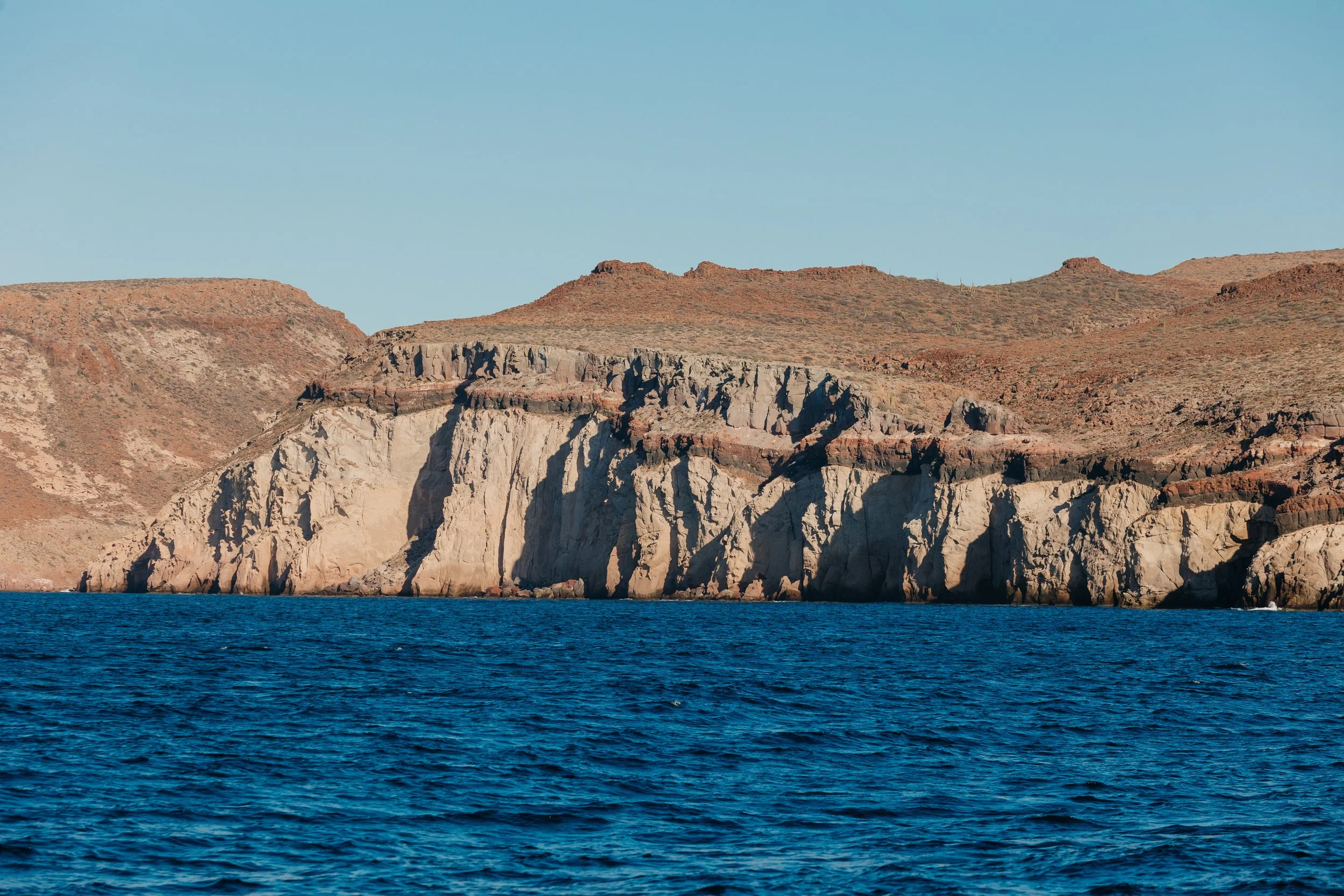
Isla Espíritu Santo
ISLA PARTIDA
Further north, the island became more intricate, more playful. A narrow cut between Isla Espíritu Santo and Isla Partida revealed itself in shallow water, just deep enough for us to thread through by raft. It felt like slipping between worlds, speeding along past a local fish camp as we navigated over the sand shoals. On the more exposed eastern side of the island, sea caves carved into the rock offered fleeting shelter, their interiors echoing with the rhythm of the swell. 
Waterway between Isla Espíritu Santo & Isla Partida
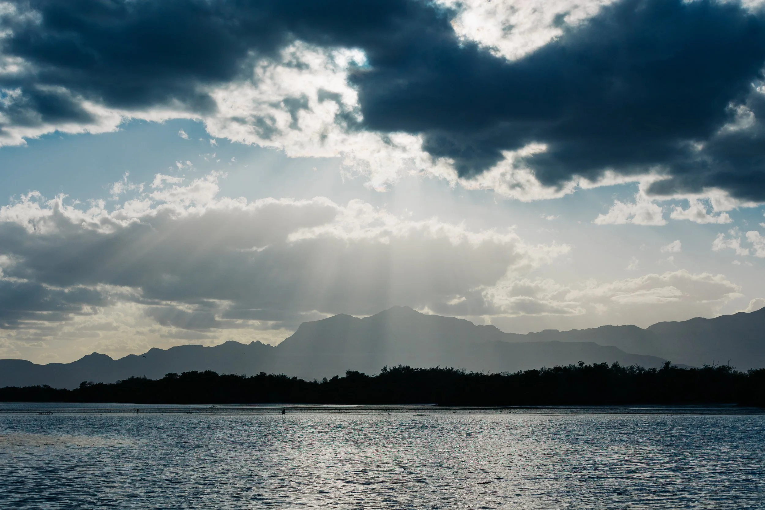
As we continued north to Ensenada Grande, I could not believe how much each inlet and beach differed from the last. From this anchorage, a bouldery hiking trail leads from the beach landing to the eastern shore, rewarding hikers with dramatic views of the rugged cliffs beyond. Back at the anchorage, the beach itself was a wonderful place to spend the afternoon. One evening, while anchored beneath the towering cliffs, we watched mobula rays erupt from the sea in the fading light. For a brief moment each became airborne, gliding above the water before disappearing beneath the surface once more.
Isla Partida

Isla Partida

Isla Partida

Isla Partida
Isla Partida
And then there was Ensenada El Embudo, an anchorage so small and particular it felt almost secret, protected only in the right conditions and with space for just one or two boats. We arrived to find it empty and stayed long enough to feel, briefly, as though it belonged only to us. At night, sea lions from nearby Los Islotes rocks come to visit. At first, we only heard them… the sudden rush of movement through the water, until the darkness began to flicker. Their bodies traced arcs of light beneath the surface, igniting the bioluminescence into glowing trails. They moved like ghosts – fast, playful, untouchable – leaving behind nothing but fading constellations in their wake. It is worth noting that swimming with the sea lions at nearby Los Islotes is only permitted with a local guide.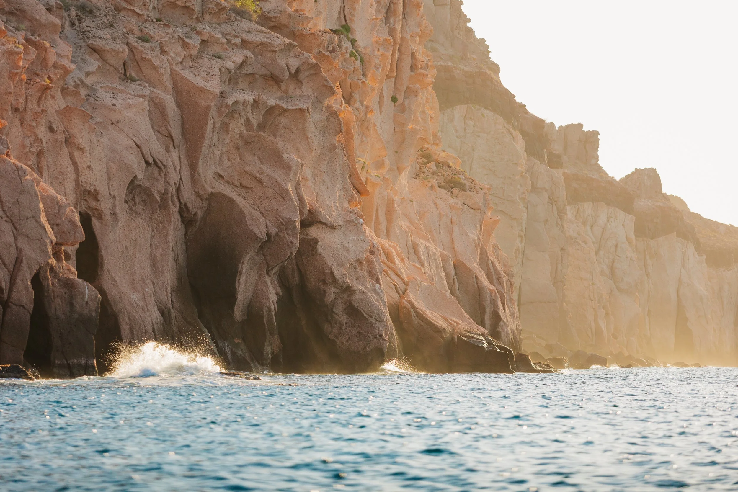
Isla Partida
Sunset from Isla Partida
ISLAS SAN FRANCISCO
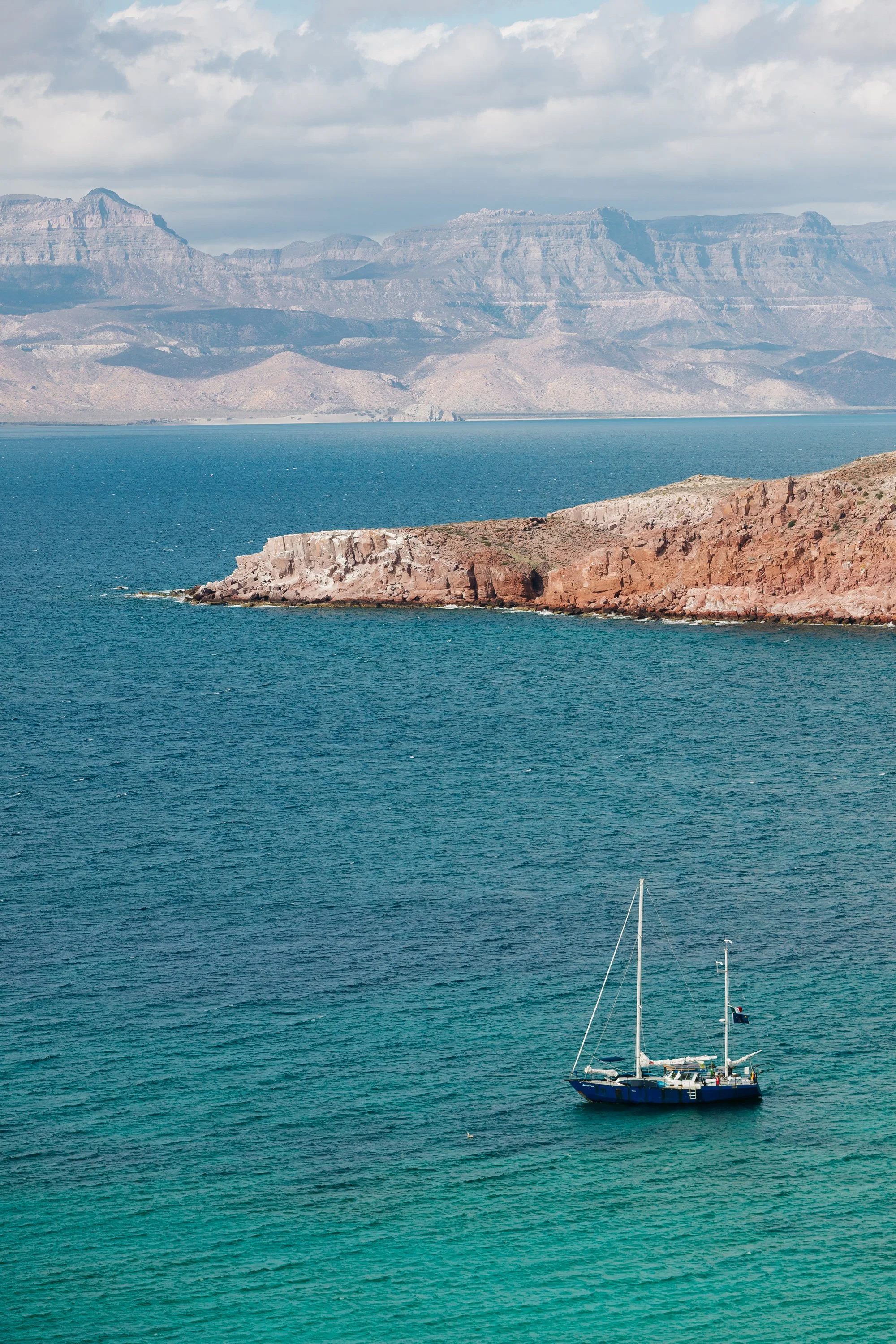
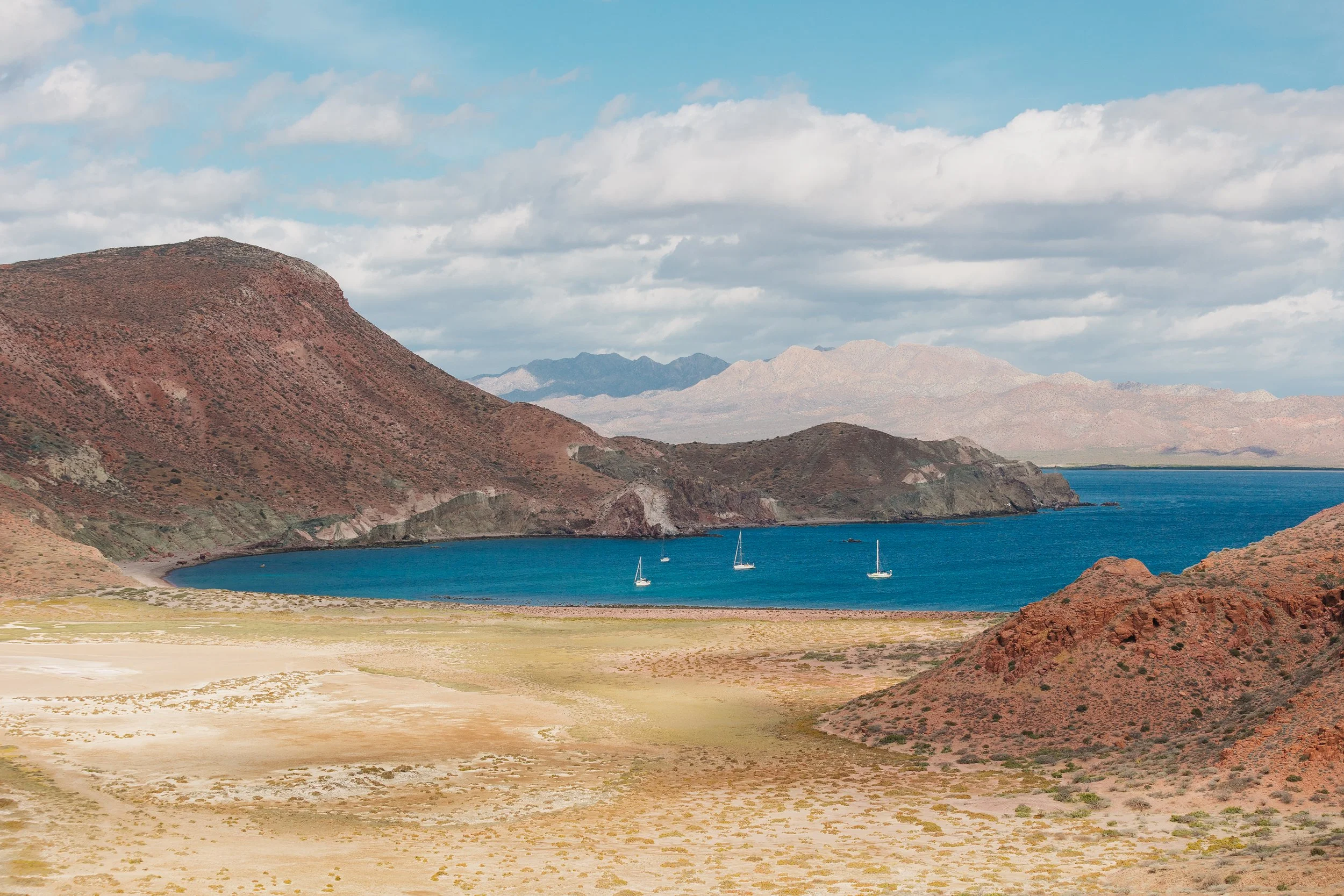
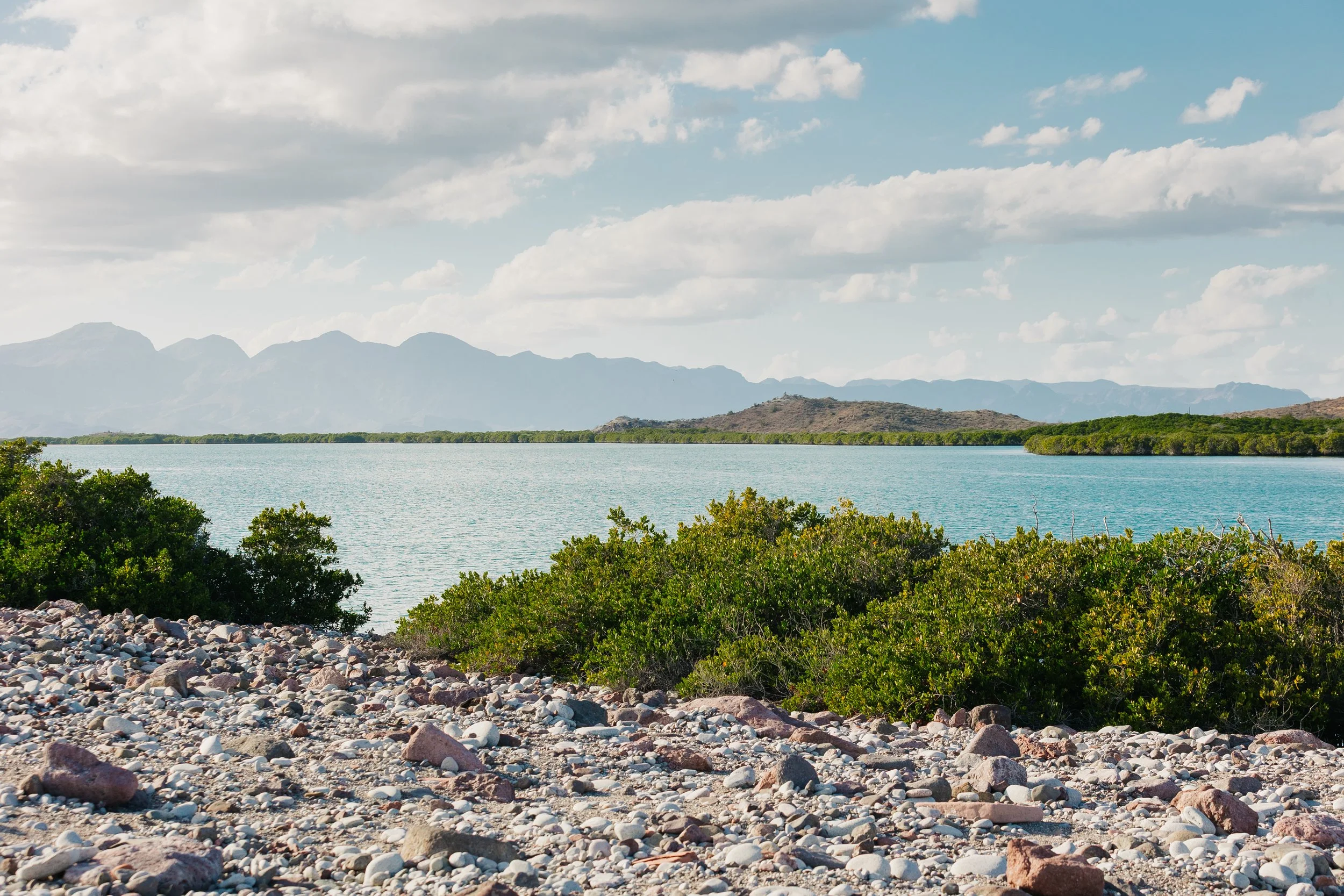
From Espíritu Santo, we continued north to Isla San Francisco, a smaller island, but one that held an entire world within it. Its two neighboring crescent-shaped bays curved perfectly along the shoreline, offering protection no matter the wind’s direction. Its dramatic crescent-shaped anchorage is essentially a flooded volcanic basin surrounded by uplifted ridges. From the water, we gazed up at multicolored sandstone cliffs streaked with reds, greens, and ochres. The channel separating the islands from the mainland had narrowed considerably here, and we could see much more detail in the towering cliffs of the mainland from where we were anchored.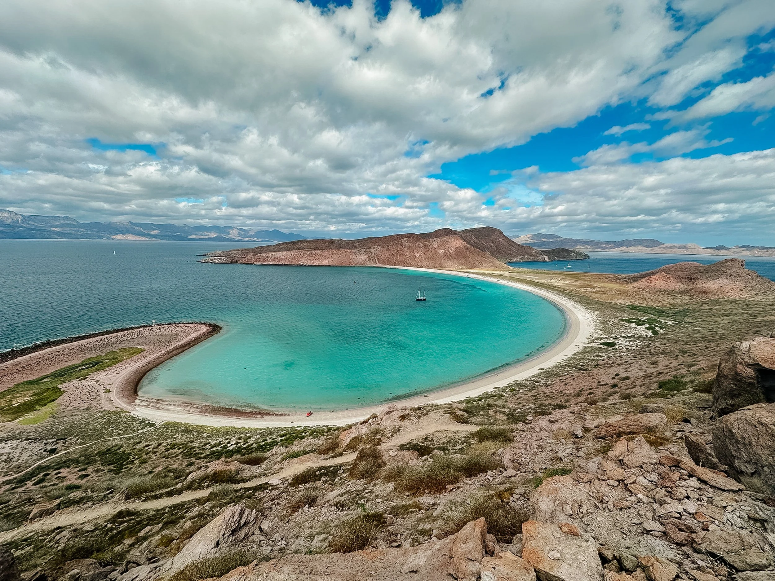
Isla San Francisco
Isla San Francisco

Isla San Francisco
Isla San Francisco
Isla San Francisco
A steep but manageable hike carried us quickly up the ridgeline along the eastern curve, where the perspective shifted all at once. The bay revealed its full symmetry, while on the opposite side of the island, layers of exposed rock unfolded in unexpected color, greens and reds meeting in sharp contrast. Beyond it all, the mainland rose in towering cliffs, the geology stacking itself in endless repetition. One thing I grew to love about hiking throughout the Sea of Cortez was how quickly the landscape revealed itself. Many trails were steep but short, gaining enough elevation in less than an hour to reward you with sweeping views of entire bays, neighboring islands, and distant mountain ranges. 
Isla San Francisco
Isla San Francisco
Isla San Francisco

Isla San Francisco
Near the saddle sits a cruiser's logbook, where passing sailors leave notes, stories, and observations from their travels. We paid a visit to this island and this hike on three occasions and paused here each time, taking note of how different it looked at different times of day. On each hike down we went a slightly different way back to the beach near where we were anchored, wandering once through a salt field, once to the beach on the other side, and once taking the shortest route possible so darkness did not descend on us before we could make it back to the boat.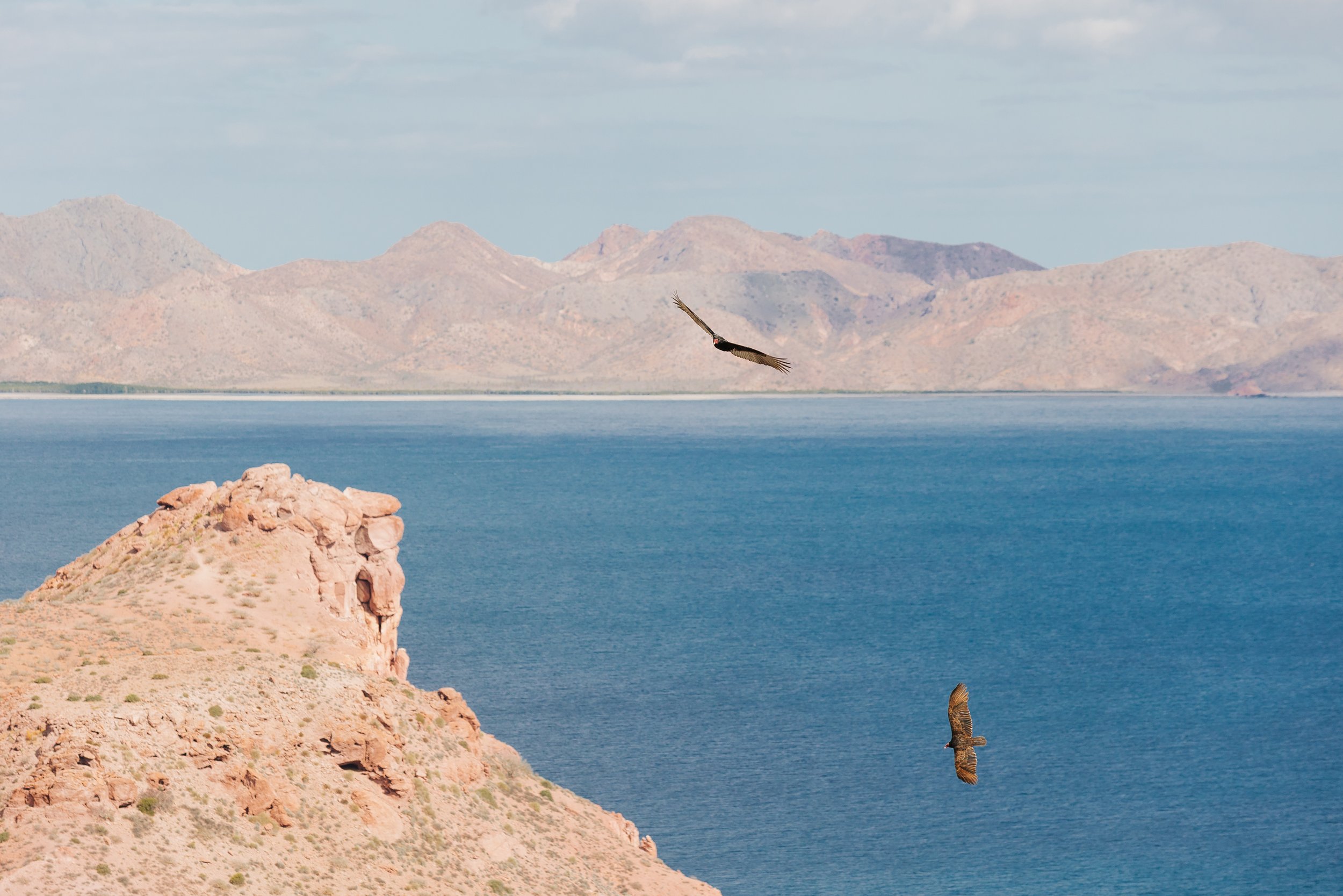
Isla San Francisco

Isla San Francisco
Isla San Francisco
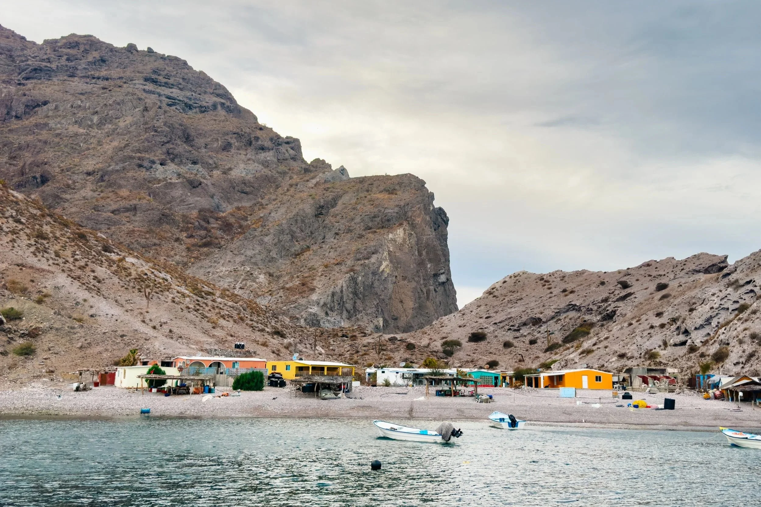
Between Isla San Francisco and Isla San José sits the small fishing settlement of El Coyote, a quiet outpost where a handful of families continue to make their living from the sea. Sea lions can often be found resting on the nearby rock outcropping, and once we paid a visit to their underwater home and scuba dove with them.
El Coyote
ISLA SAN JOSE
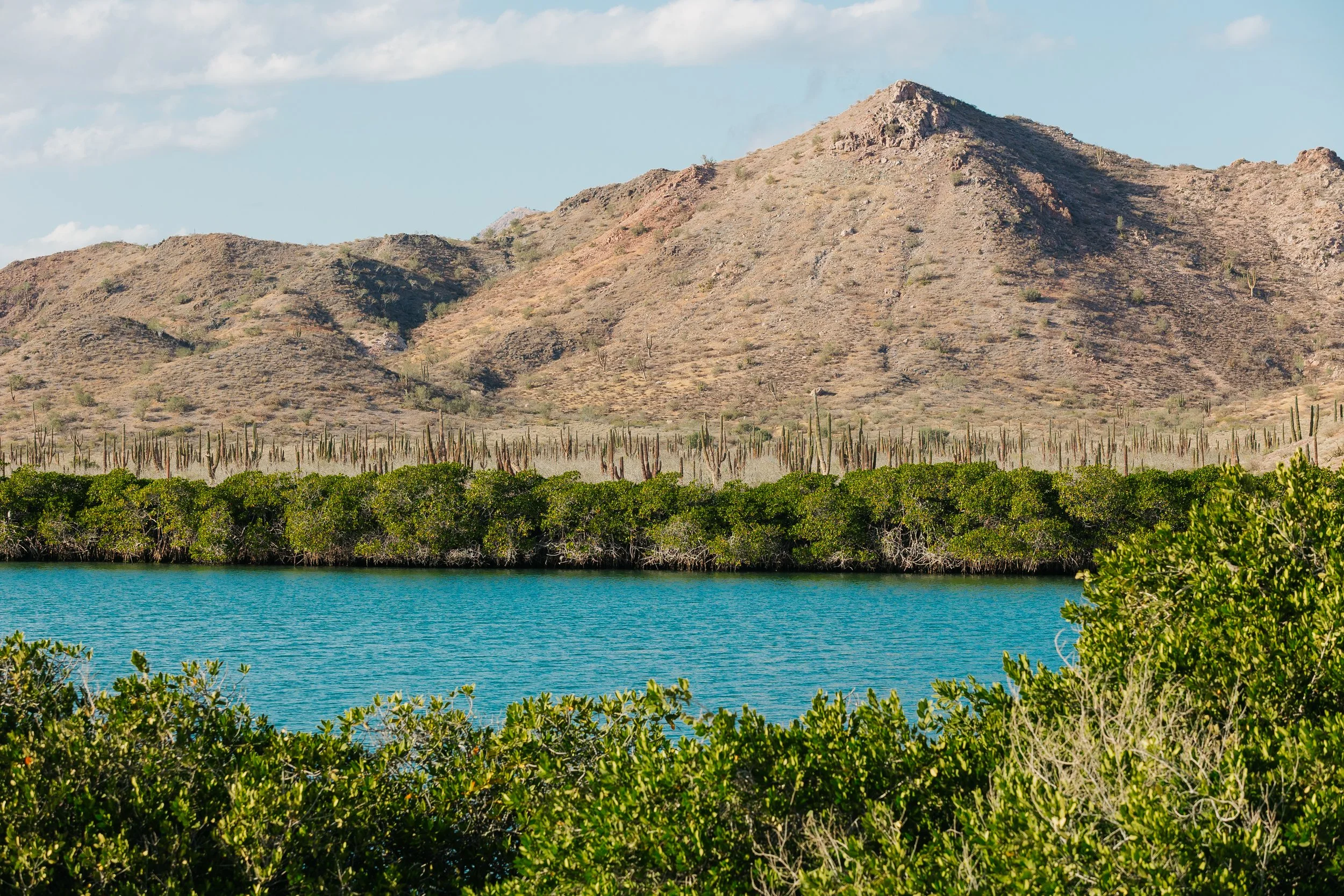
On Isla San José, the desert softened again into something more alive. We anchored in calm conditions and took the dinghy into a broad mangrove estuary, Amortajada, entering a world that felt concealed from the sea itself. The air was still, filled with the distant calls of more wild goats echoing through the hills. Along the shoreline, we found the remnants of life: a turtle shell resting in the sand, white herons standing motionless in the shallows, their reflections perfectly mirrored in the water.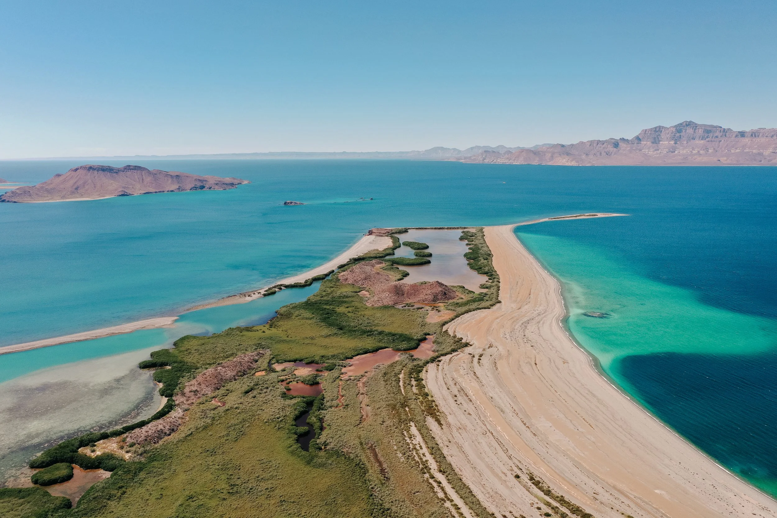
Isla San José,
Isla San José,
Isla San José,
Isla San José,
Isla San José,
Isla San José,
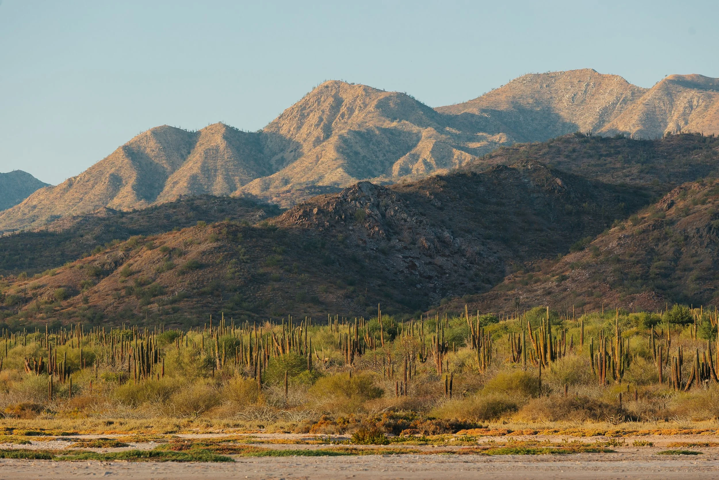
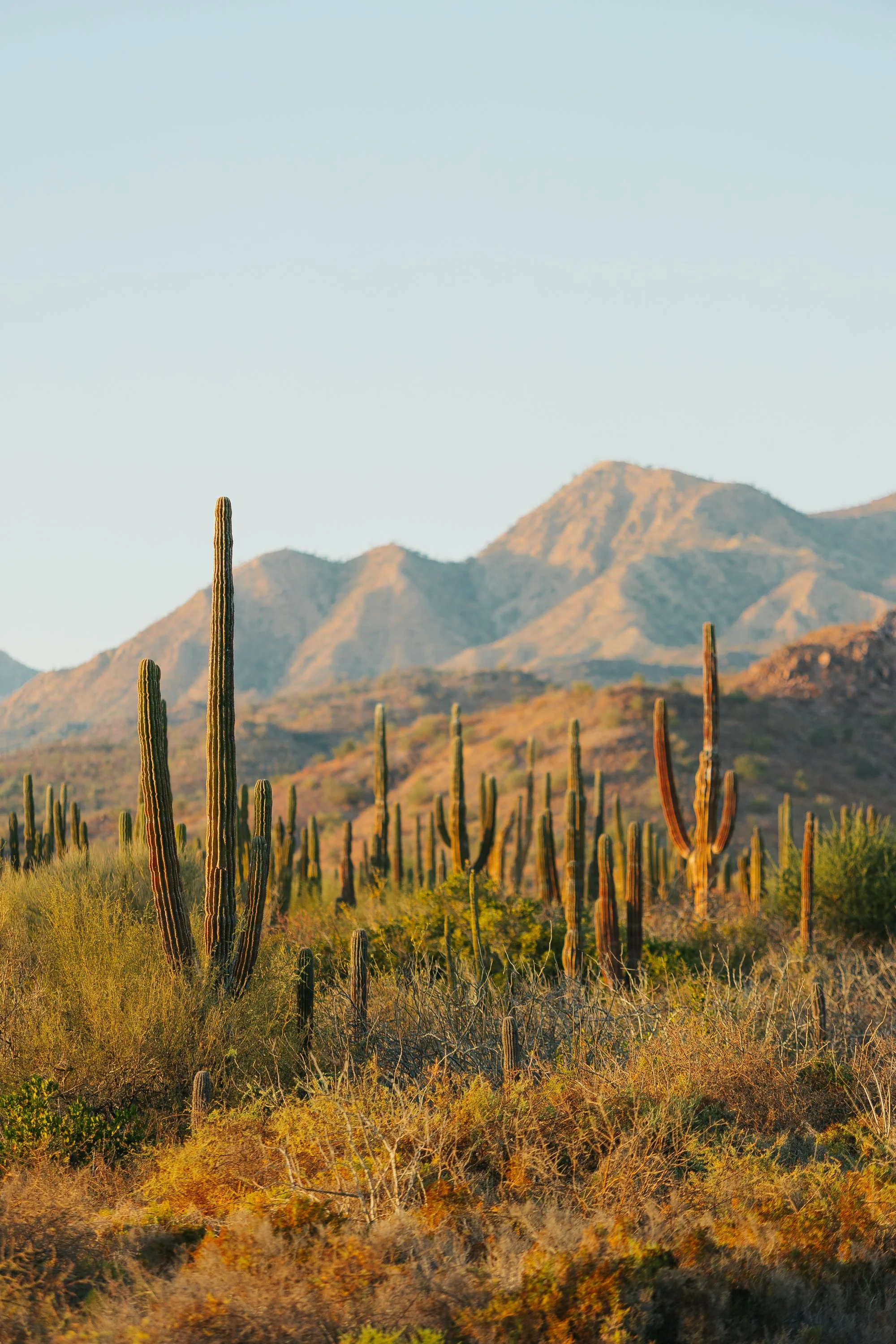
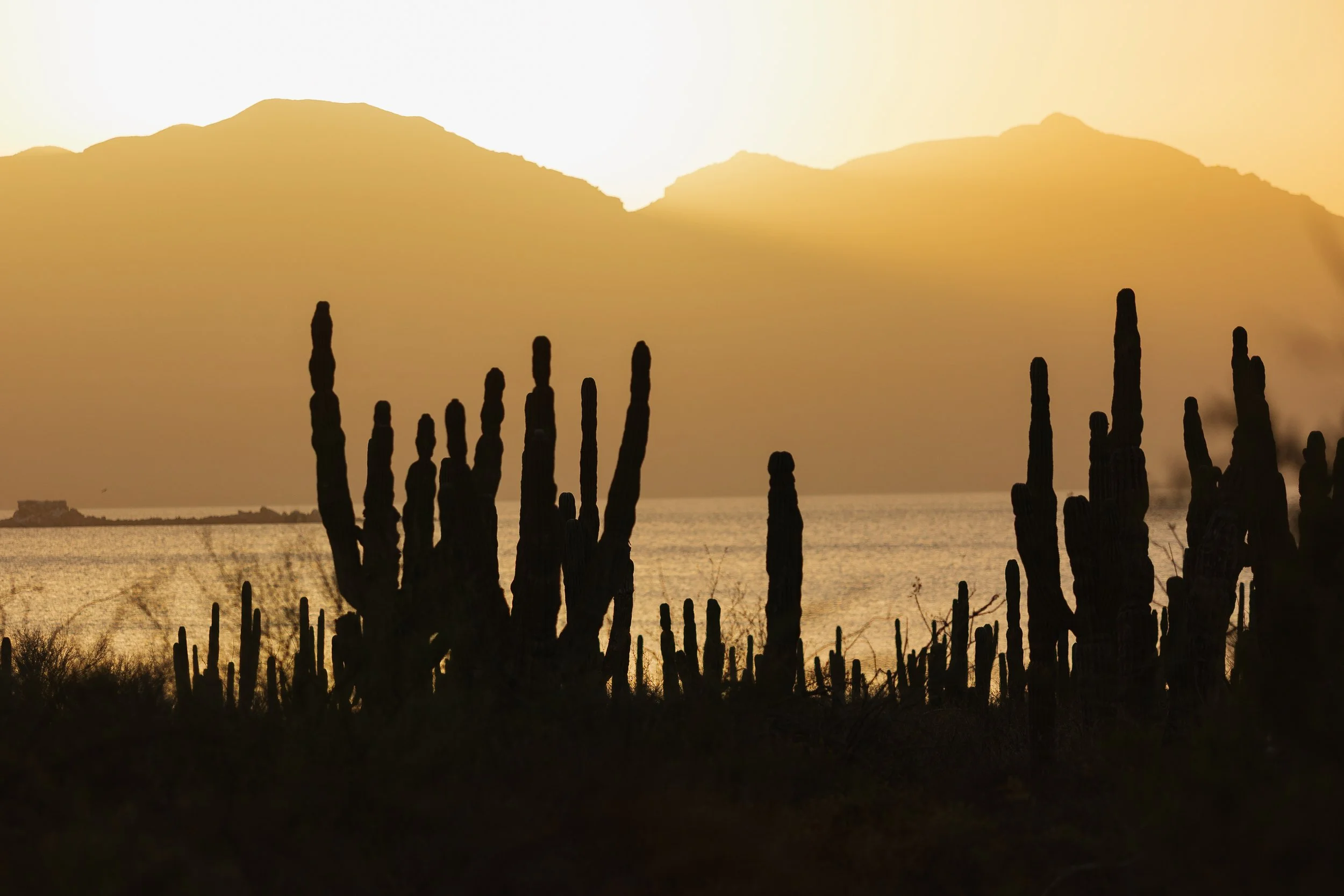
It felt like an oasis suspended within the desert. West of the mangroves, a cactus forest rose along the arroyo, towering saguaros stretching skyward as we followed the winding wash inland. It felt strikingly similar to the landscapes surrounding Tucson and Phoenix in the Sonoran Desert… dry, expansive, and yet full of quiet life. The cactus-filled washes and desert landscapes lit up in sunset colors, bathed in what felt like liquid golden sunlight.
Isla San José,
Isla San José,
Isla San José,
Isla San José,
Isla San José,
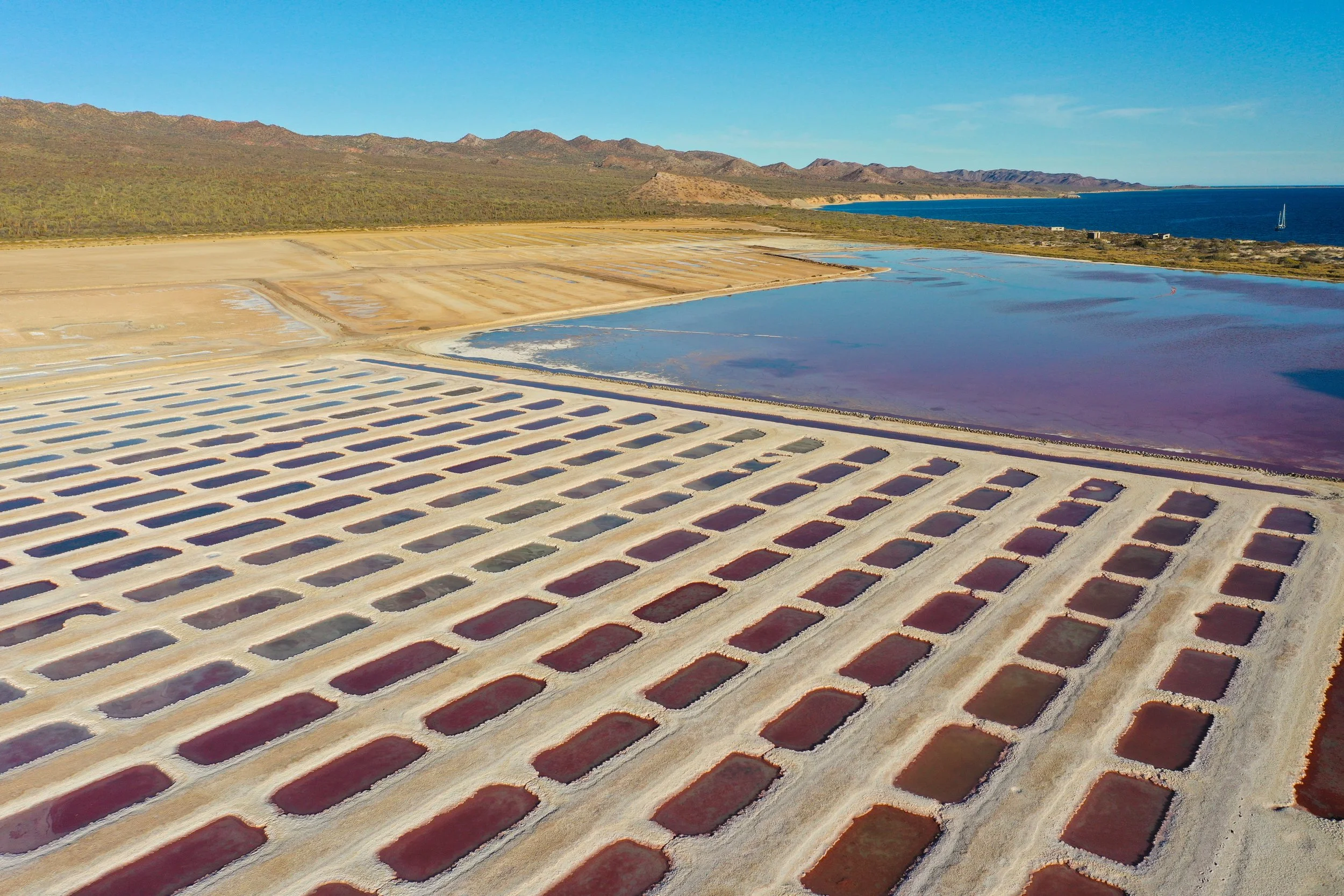
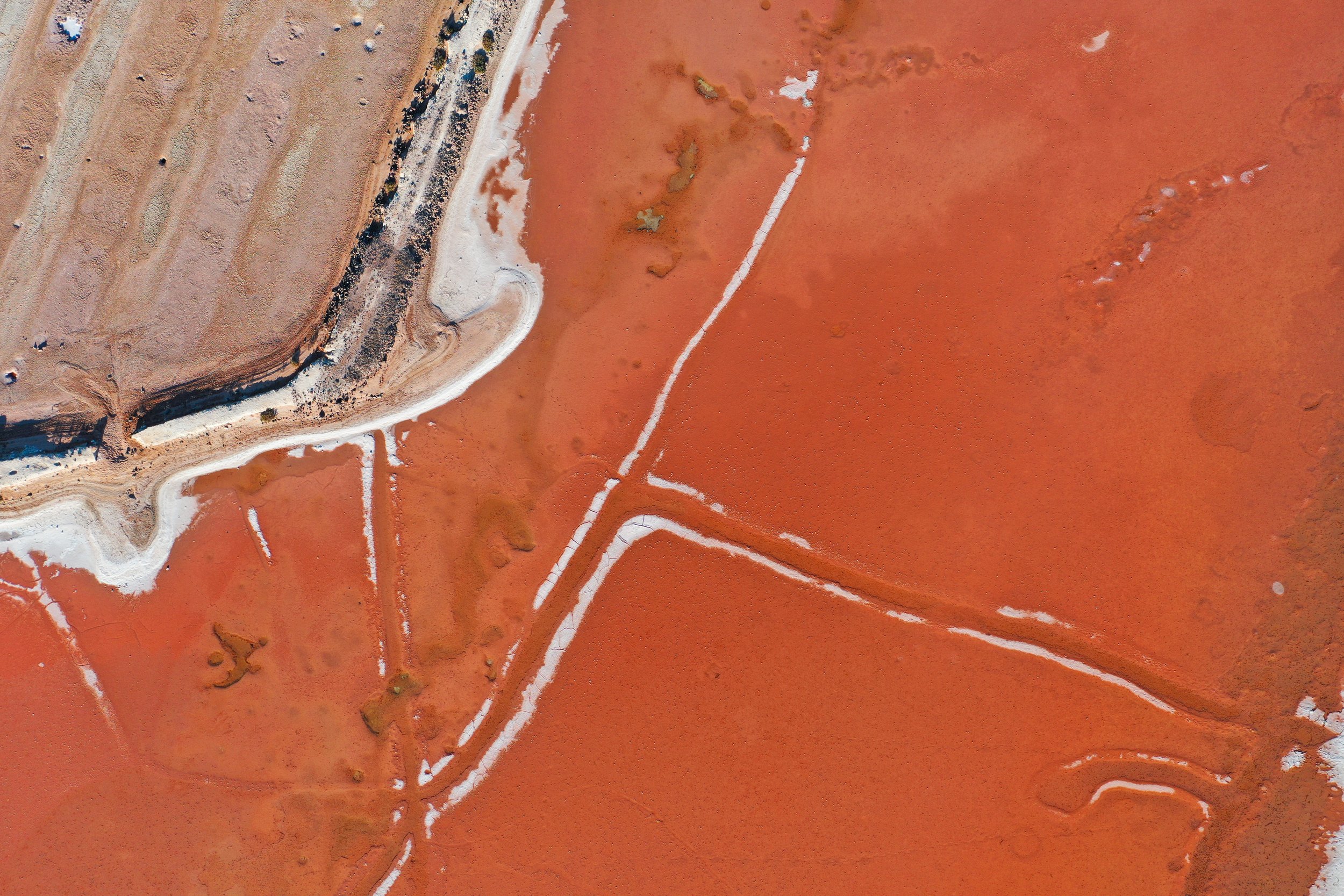
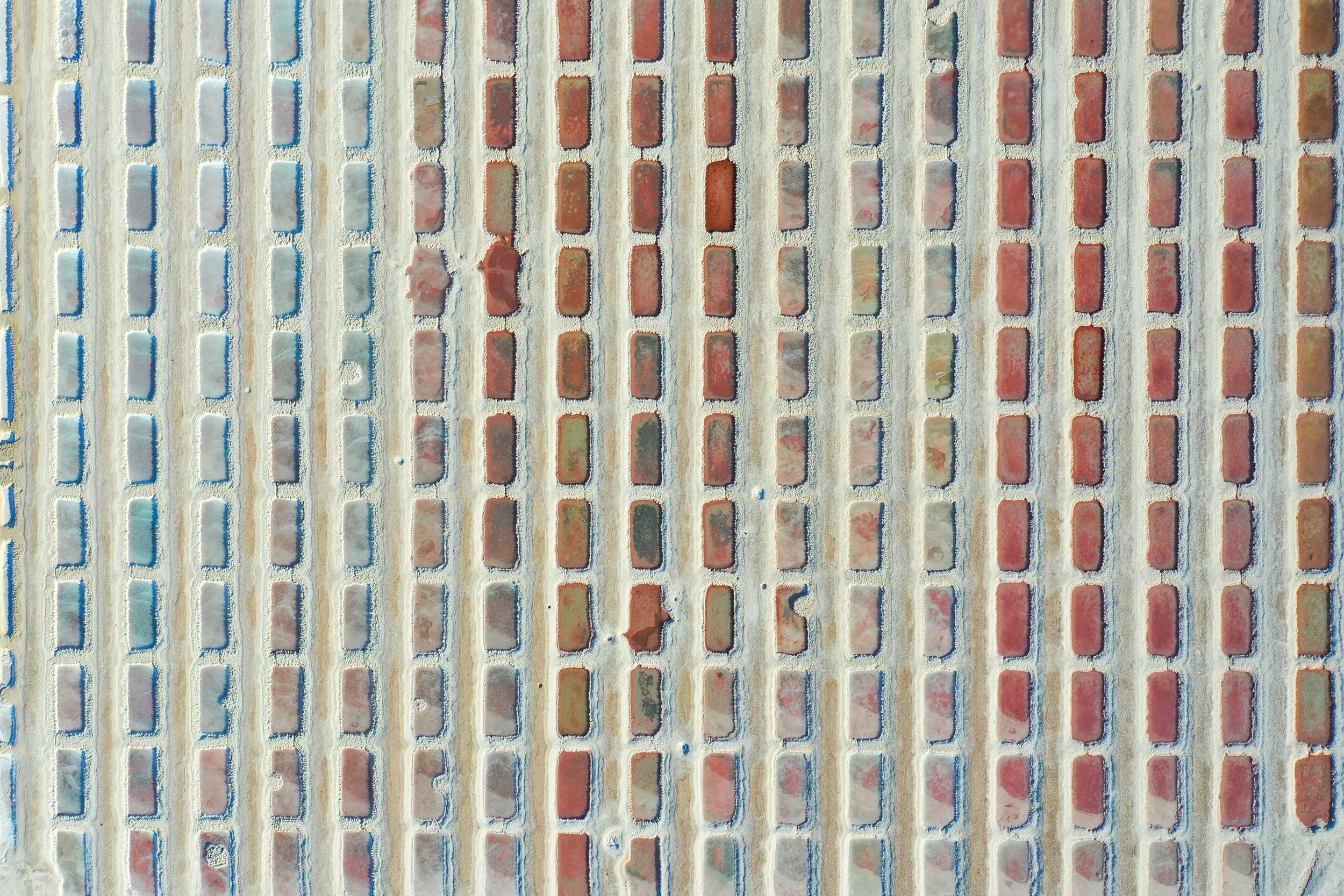
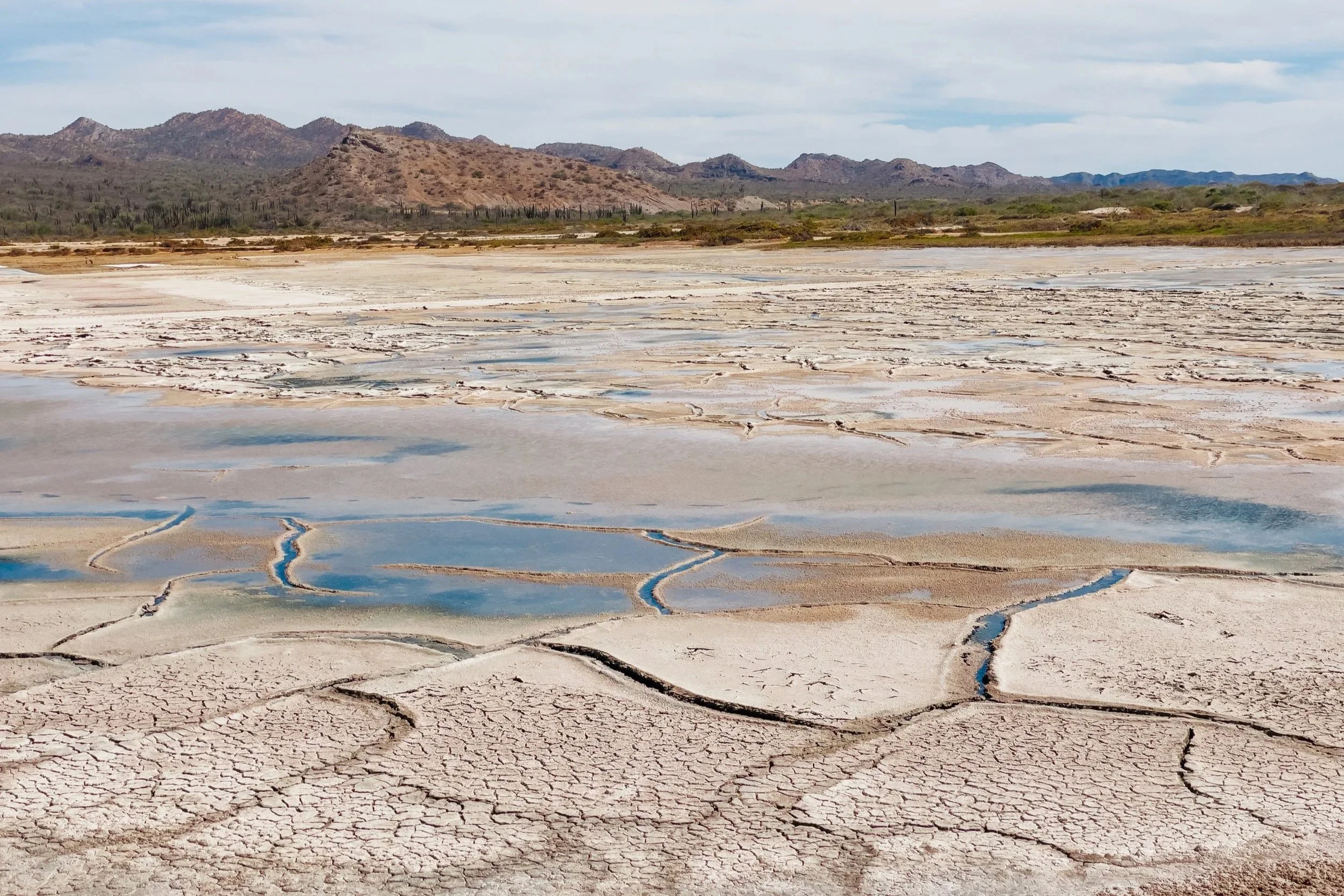
Even farther to the west, we found the remains of an abandoned salt mine called Punta Salinas. The geometry of it was unexpected, a sense of order imposed upon an otherwise wild coastline. Pools stretched in deliberate patterns, their surfaces bright and crystalline, their colors arranged in a palette unlike anything else we encountered in Baja: shades of white fading into muted earth tones, pinks, and deep reds. Equipment from the once-bustling operation lay scattered throughout the site, slowly surrendering to the same elements that had created the salt in the first place. From the air, the evaporation ponds formed precise geometric patterns against the chaos of the desert, a reminder that even these remote islands once participated in the commerce of the sea. We walked across the salt flats, crunching beneath our feet, half-joking that it felt like snow… if snow belonged to the desert. Calm conditions allowed us to anchor at Bahia Mortajada while we visited. 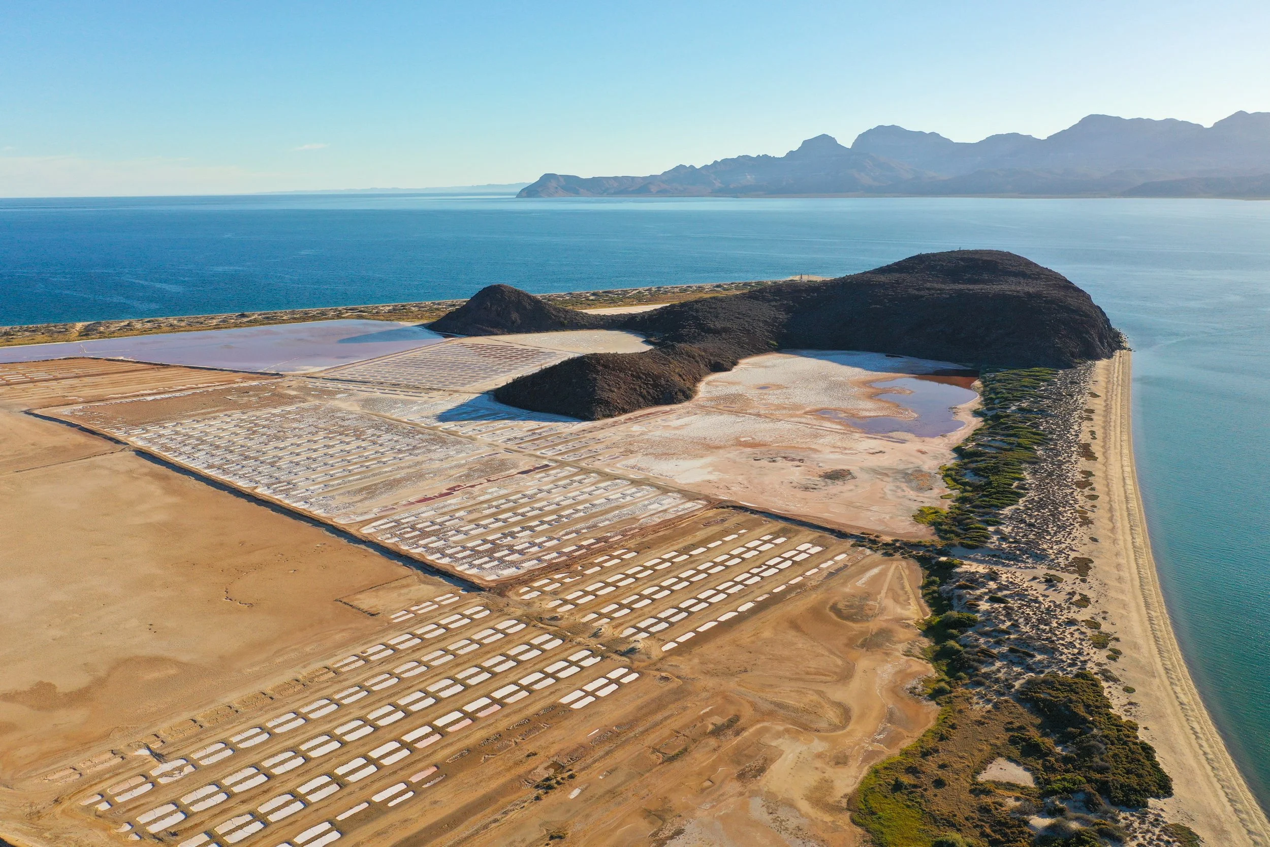
Punta Salinas Salt Mine, Isla San José

Punta Salinas Salt Mine, Isla San José

Punta Salinas Salt Mine, Isla San José

Punta Salinas Salt Mine, Isla San José
Punta Salinas Salt Mine, Isla San José
Punta Salinas Salt Mine, Isla San José
Punta Salinas Salt Mine, Isla San José
Punta Salinas Salt Mine, Isla San José

Punta Salinas Salt Mine, Isla San José
While we explored these islands, we couldn’t help noticing the connection between their names and the cities of San Francisco and San Jose in what is now the state of California. Before the names of these remote islands became major California cities, missionaries and explorers had already spent generations traveling among Baja's islands and missions from Loreto northward. Loreto served as the launching point for the colonization of Alta California. So the irony is less that California cities were named after the islands, and more that the entire California mission system grew out of this comparatively remote corner of Baja.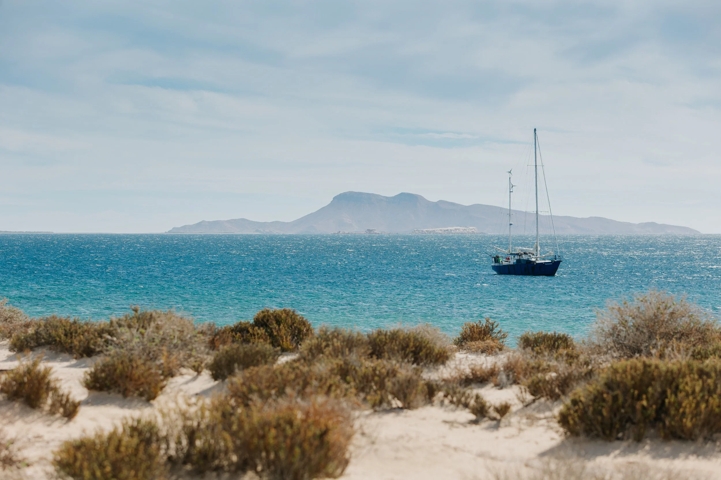
Punta Salinas Salt Mine, Isla San José
THE BEGINNING OF OUR TRIP TO LORETO
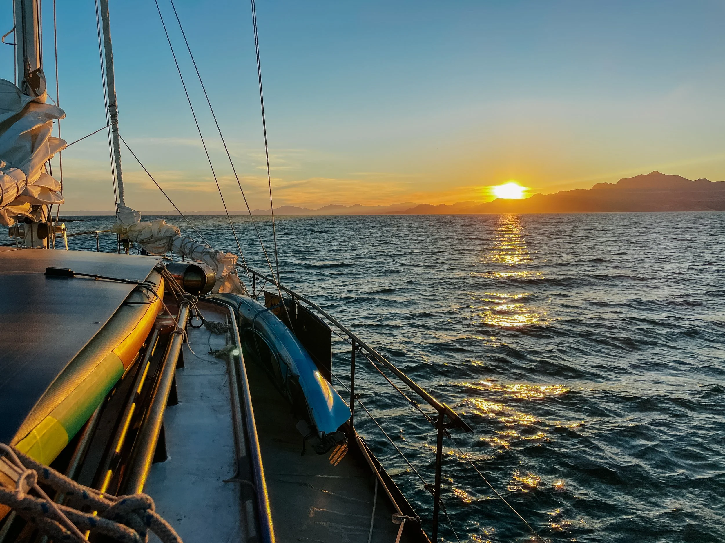
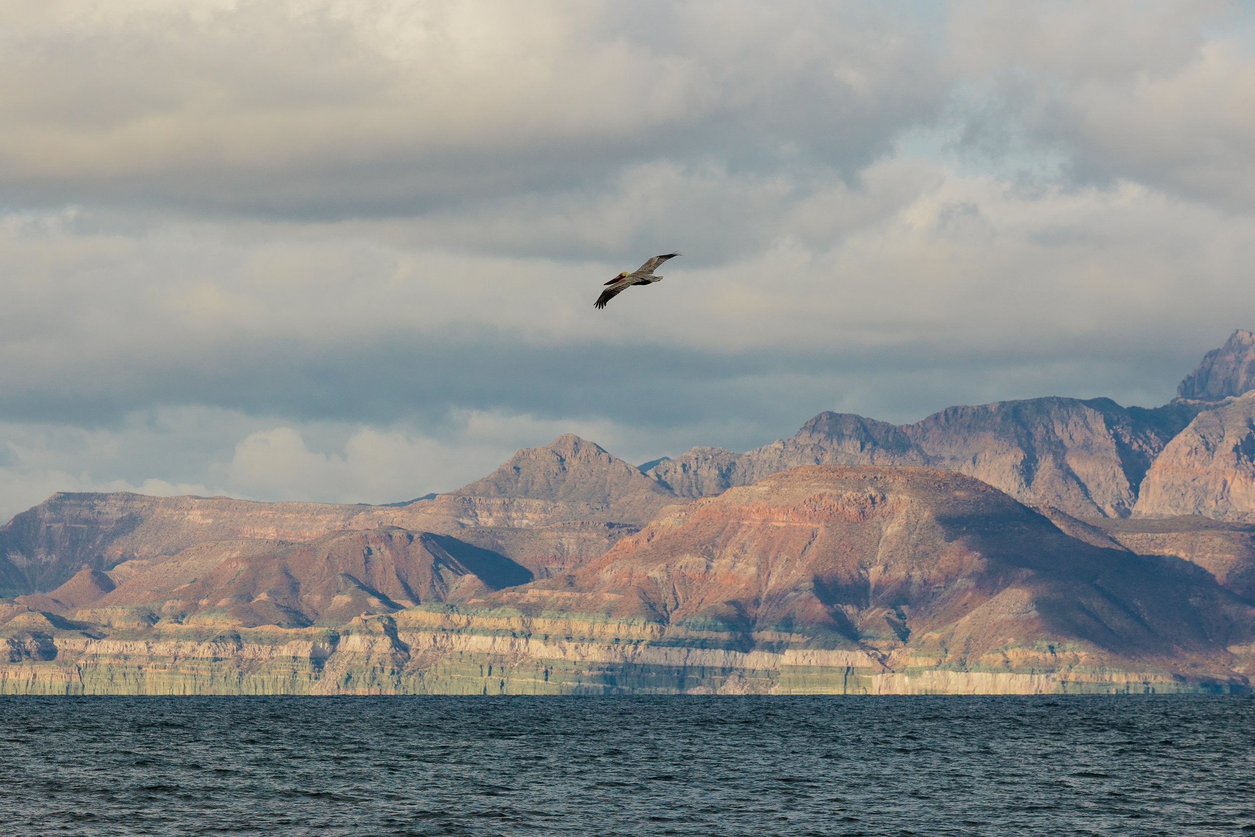
As we continued north, the coastline began to change. The land grew more rugged, the cliffs steeper and more severe, the spaces between anchorages longer and more exposed. With views of Isla San José still in sight, we anchored near the small fishing settlement of Caleta Nopoló, families running out to the beach to wave at us during our arrival. This marked the true beginning of our traverse to the Loretto area. The sea, too, began to assert itself. We quickly found that the long fetch of the Sea of Cortez allowed wind-driven waves to build over hundreds of miles of open water, driven southward by persistent northerly winds, rising into a steady resistance that made northbound travel a test of patience. Progress was no longer given easily; it had to be worked for, mile by mile, against wind and swell.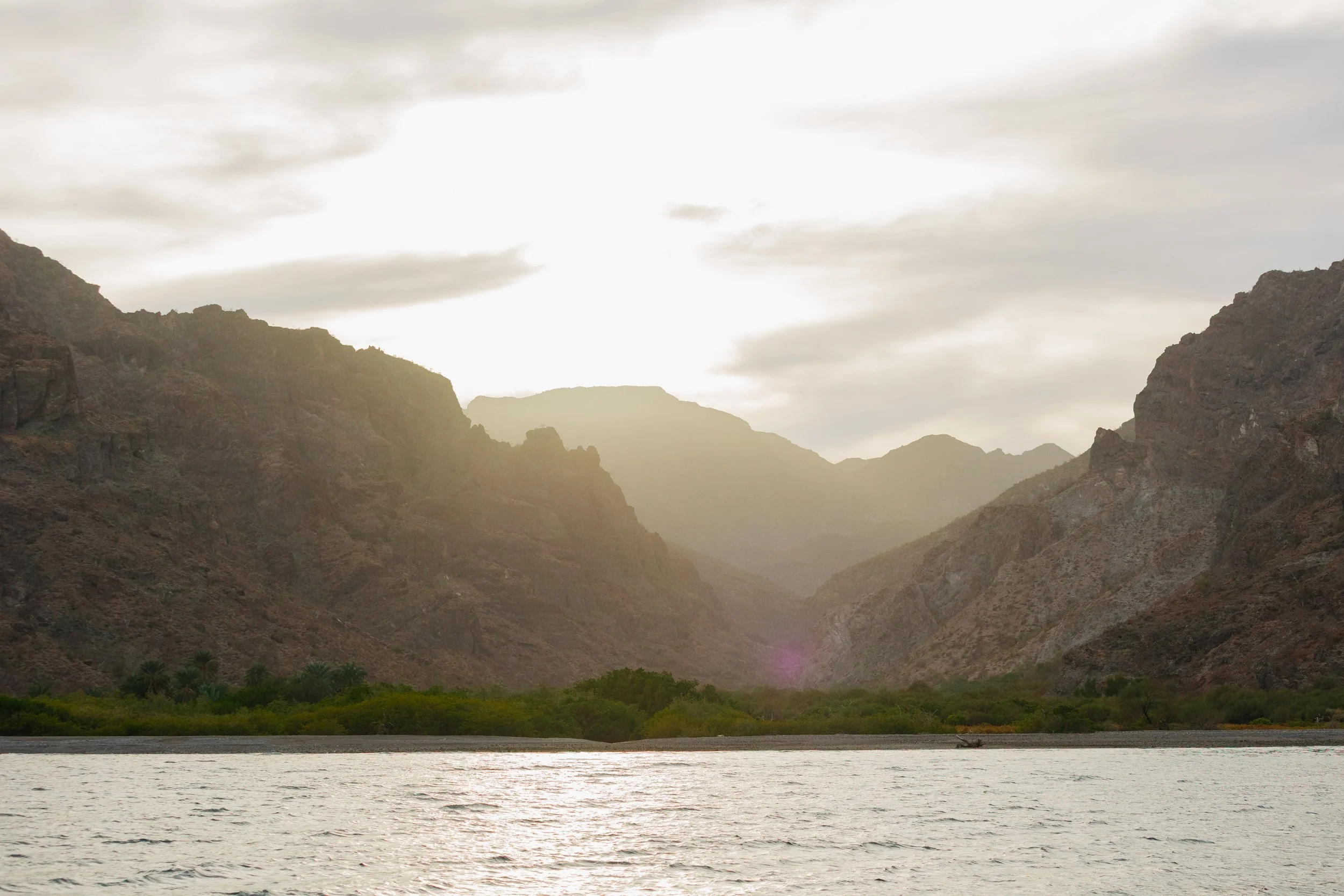
Caleta Nopoló
Caleta Nopoló
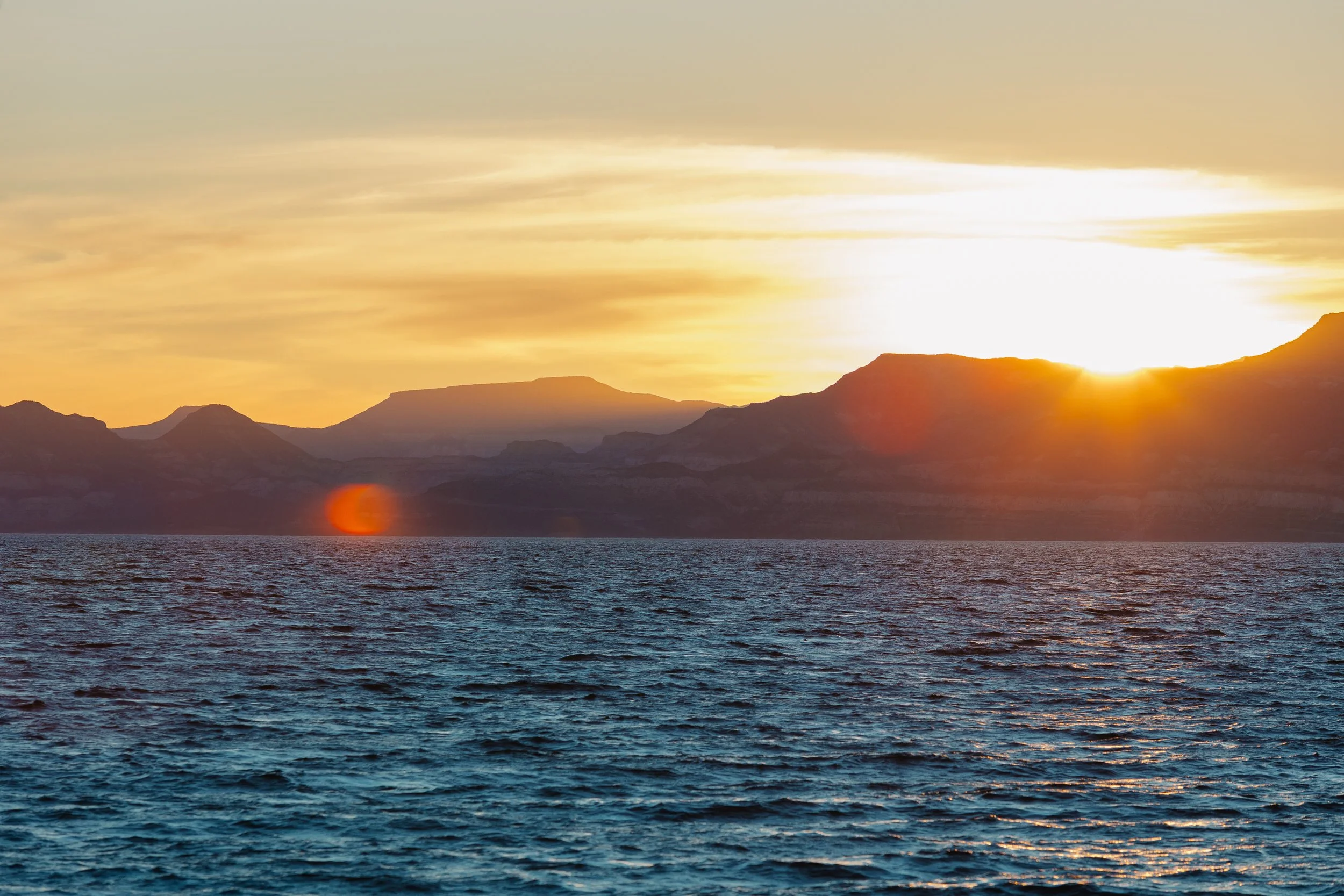
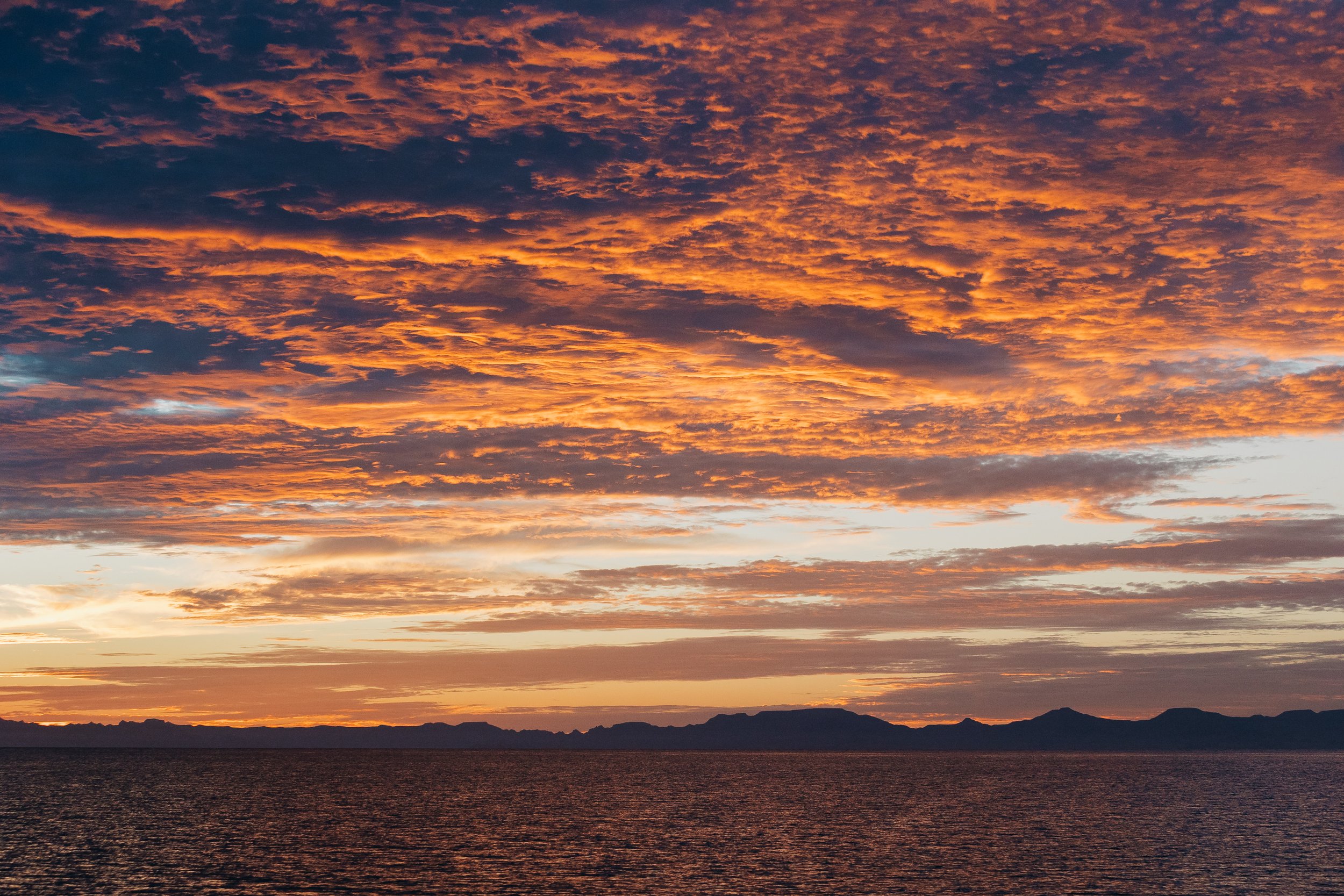
Sunset over mainland baja from the sea of Cortez
It was a subtle shift, but an unmistakable one. The desert stretched on, the sea deepened, and somewhere ahead, the next chapter was already beginning to take shape. Ahead lay Bahía de Loreto, a scattering of islands, anchorages, and stories we had yet to discover. With each mile north, anticipation grew for whatever awaited beyond the next headland.Adventures, Words & Photos by Lerina Winter & Captain Louis Hoock
Originally Published: June 27th, 2026
See Where S/V Arcturus is now on No Foreign Land: