Alaska’s Emerald Isle: Circumnavigating Kodiak Island

From forested peaks to windswept headlands, a journey around Alaska’s storied isle
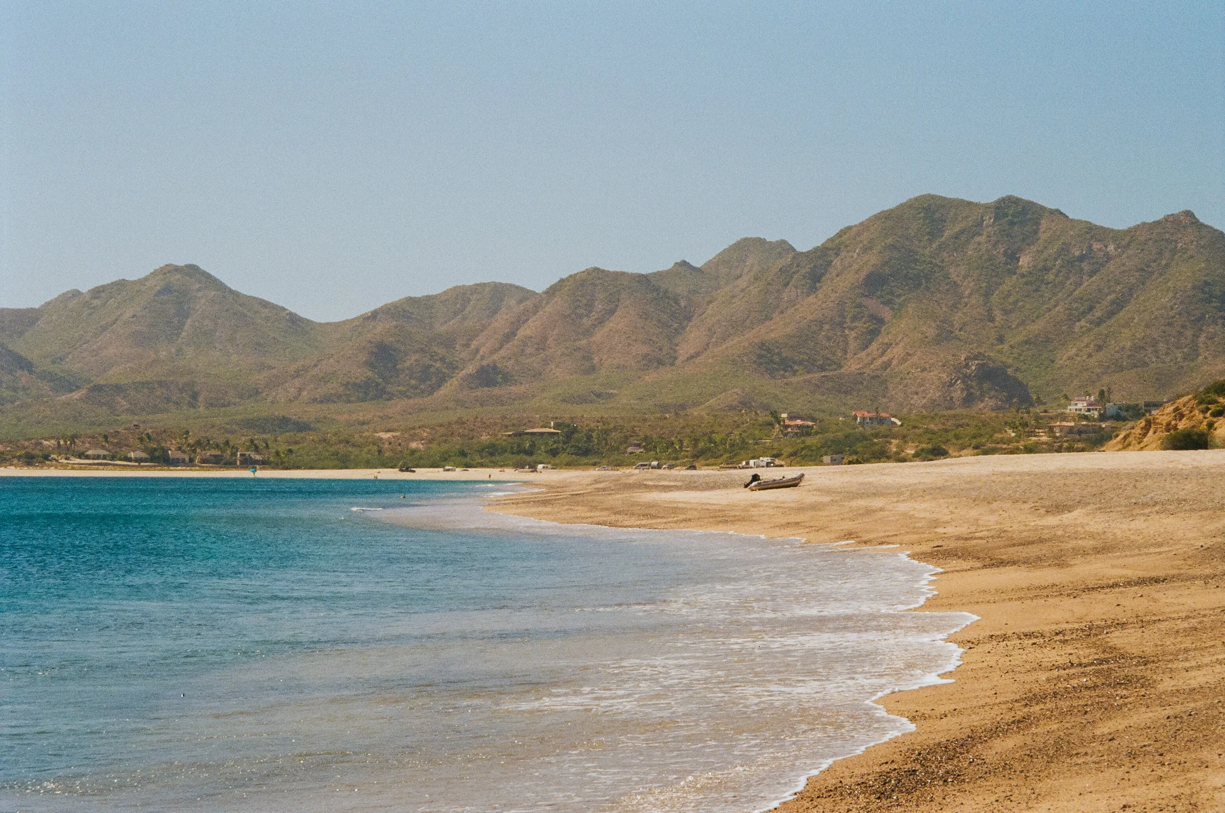
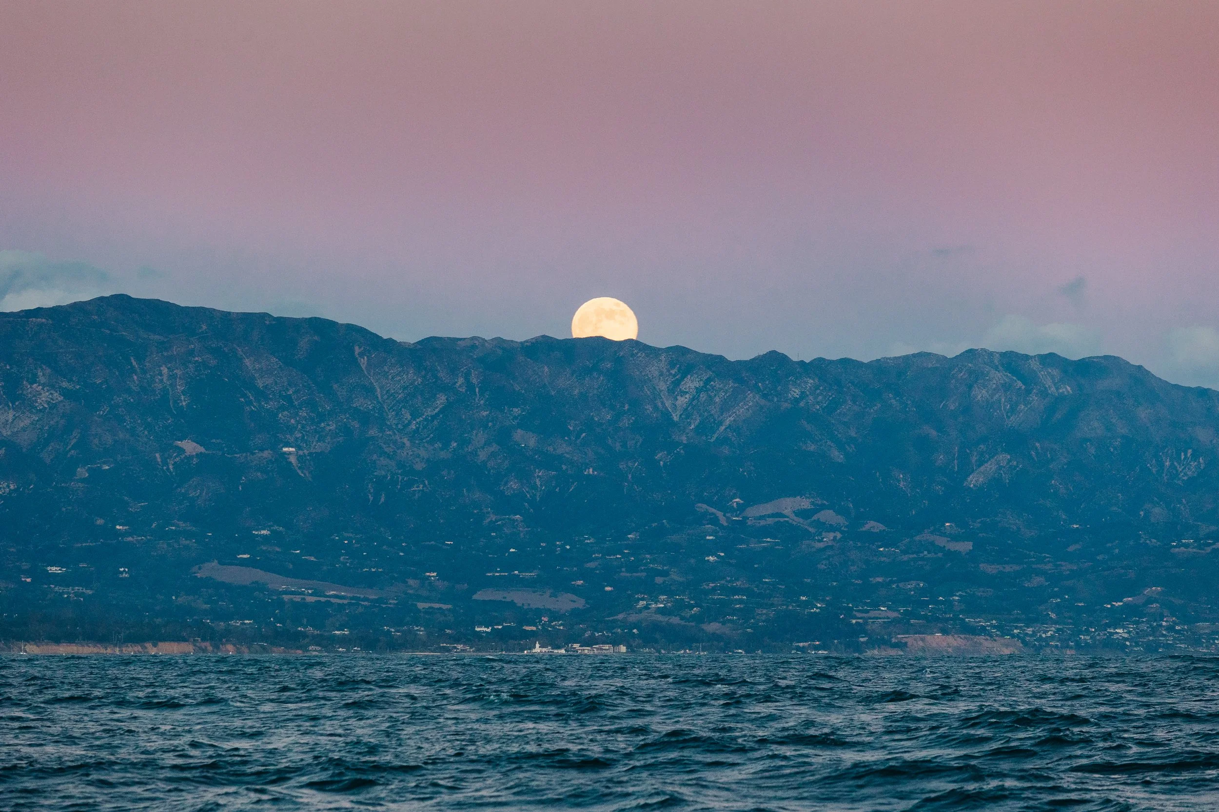
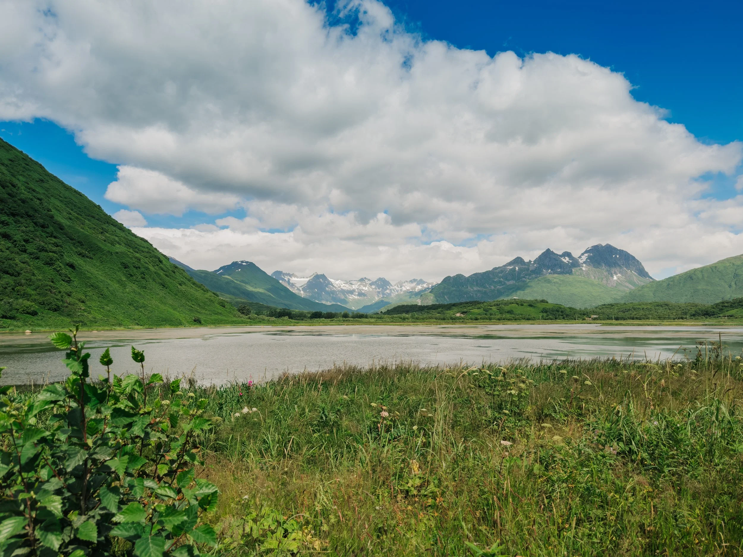
There are places you arrive at expecting little, and they bloom into grandeur so sudden and staggering, you wonder how you ever doubted their majesty. Such was the case with Kodiak. There’s a moment when the sea hushes and the sky leans in, a stillness that settles over the Gulf of Alaska as you near the Kodiak Archipelago. During our fog-laden crossing, we sailed S/V Arcturus past the rocky Barren Islands between Homer and Kodiak. Coming from Homer Harbor, our first landfall was Afognak Island, a low-slung, forested place that whispered of quiet harbors and gentle hills. Once we settled in on our first night, the skies cleared to reveal one of the most beautiful sunsets I’ve ever seen in Alaska: molten light spilling over glassy calm waters, the low-lying islands etched in silhouette. It looked like a Tycho show poster. I assumed Kodiak would be much the same: pleasant, perhaps, but lacking the mainland’s drama of glacial spires. I could not have been more wrong.
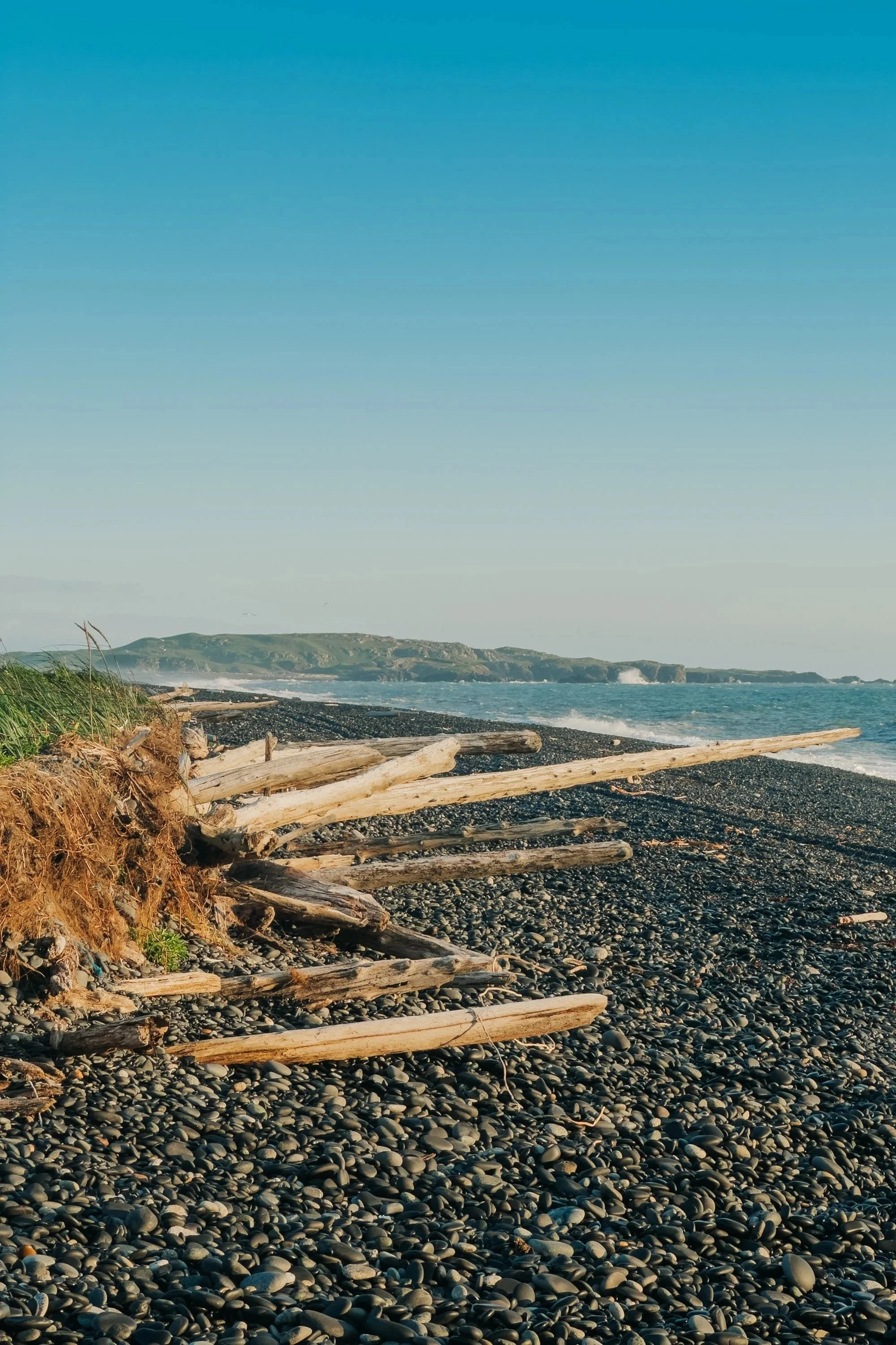
Rocky Outcroppings near Afognak Island
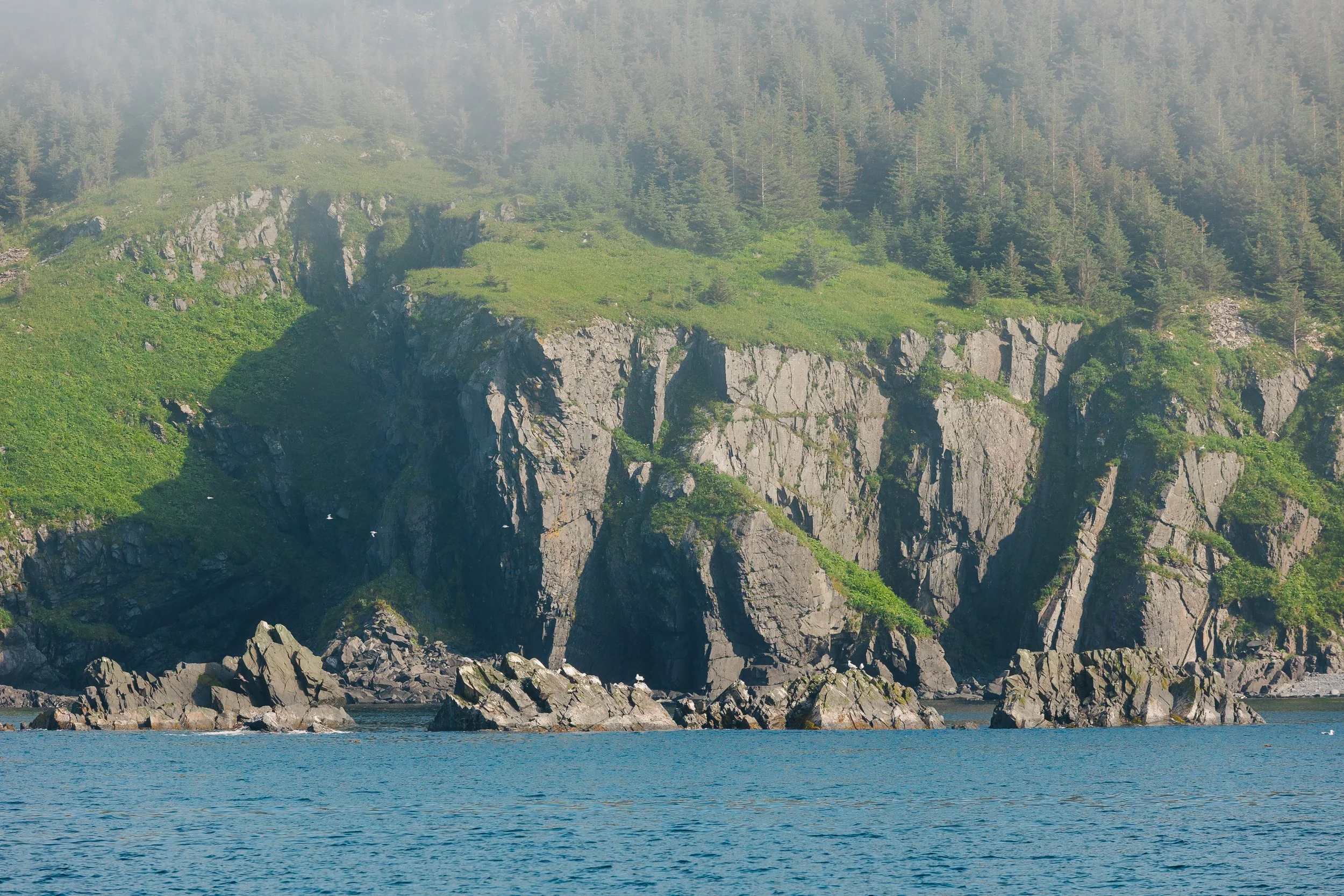
Rocky Outcroppings near Afognak Island

Sunset from Afognak Island
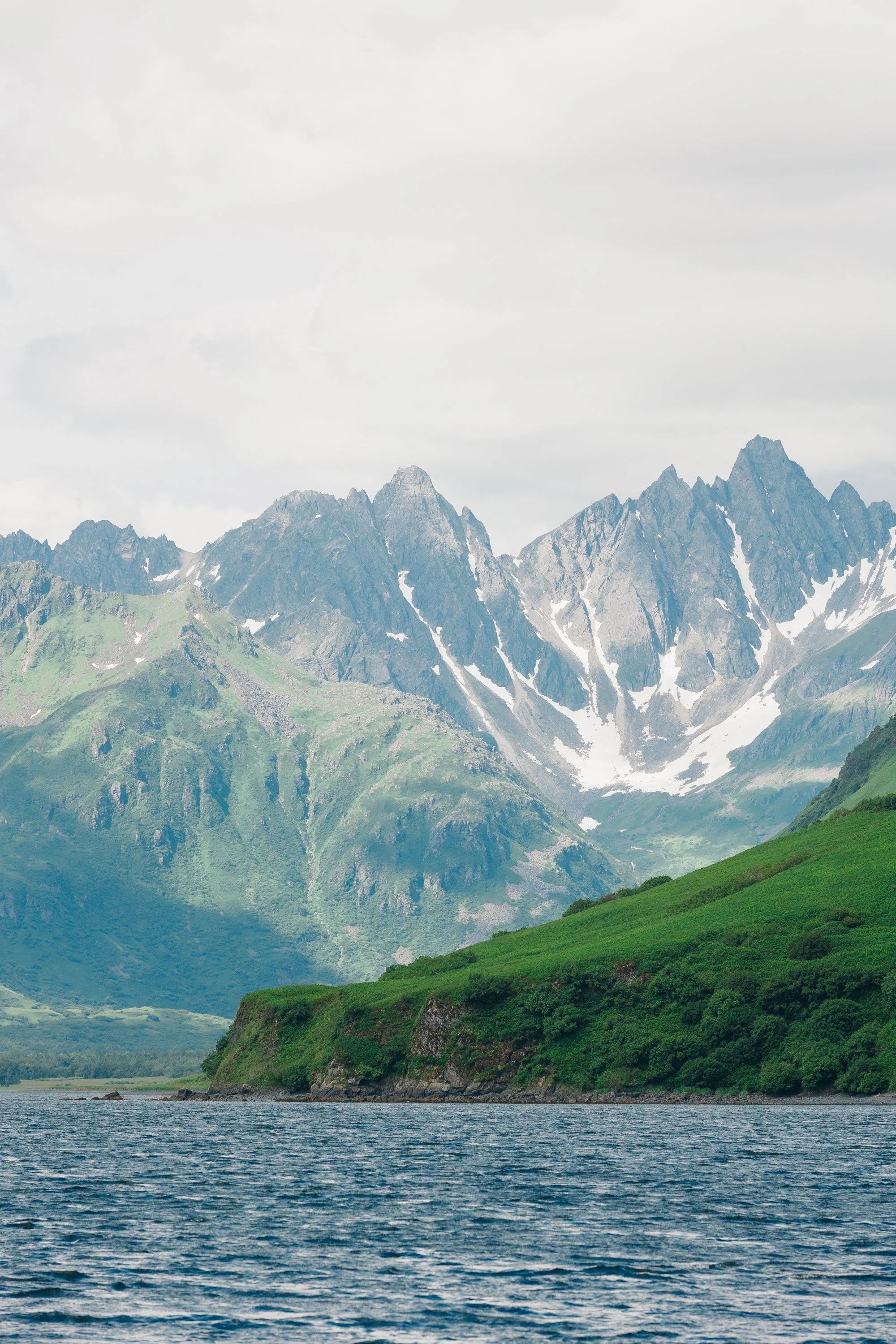
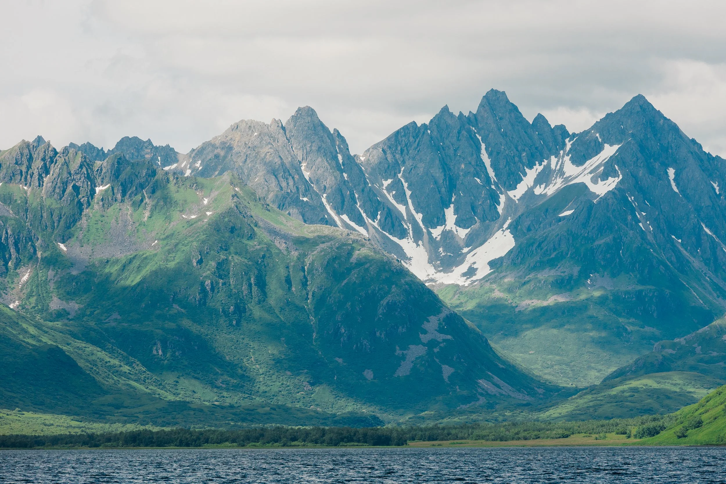
On our first night on Kodiak Island we anchored in Monashka Bay and were soon greeted by local authorities checking if we had been fishing or crabbing. In conversation, we mentioned wanting to hike the Three Sisters Trail. One officer lit up, describing the hike as one of his favorites, with the warning that it was steep but worth it. From the road, there was no trailhead sign, only a faint path and the promise of ascent. We climbed straight up, no warm-up, no gentle prelude, just a punishing incline that tested both legs and resolve, especially given that the fog was again thick that day, and we couldn’t see where we were ascending to. Midway through our hike, the clouds began to lift, revealing the coastline below. We spotted Arcturus cradled in the bay, and ahead, a ridgeline unfurling like a green ribbon. 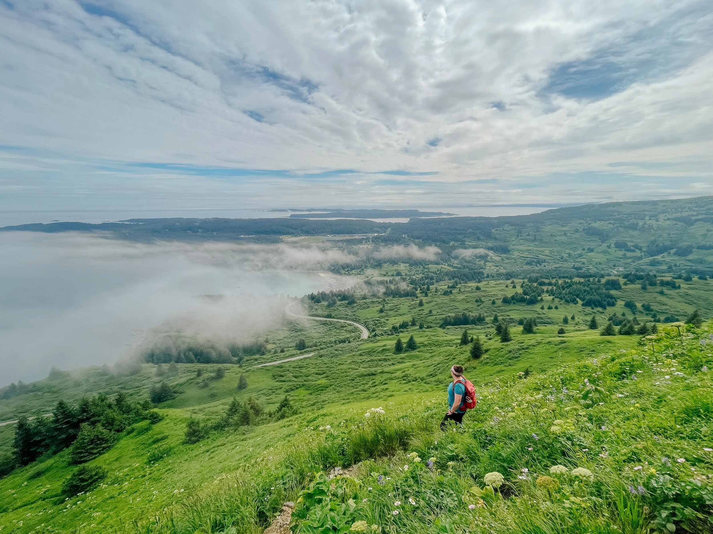
Three Sisters Trail on Kodiak Island
Three Sisters Trail on Kodiak Island
Three Sisters Trail on Kodiak Island

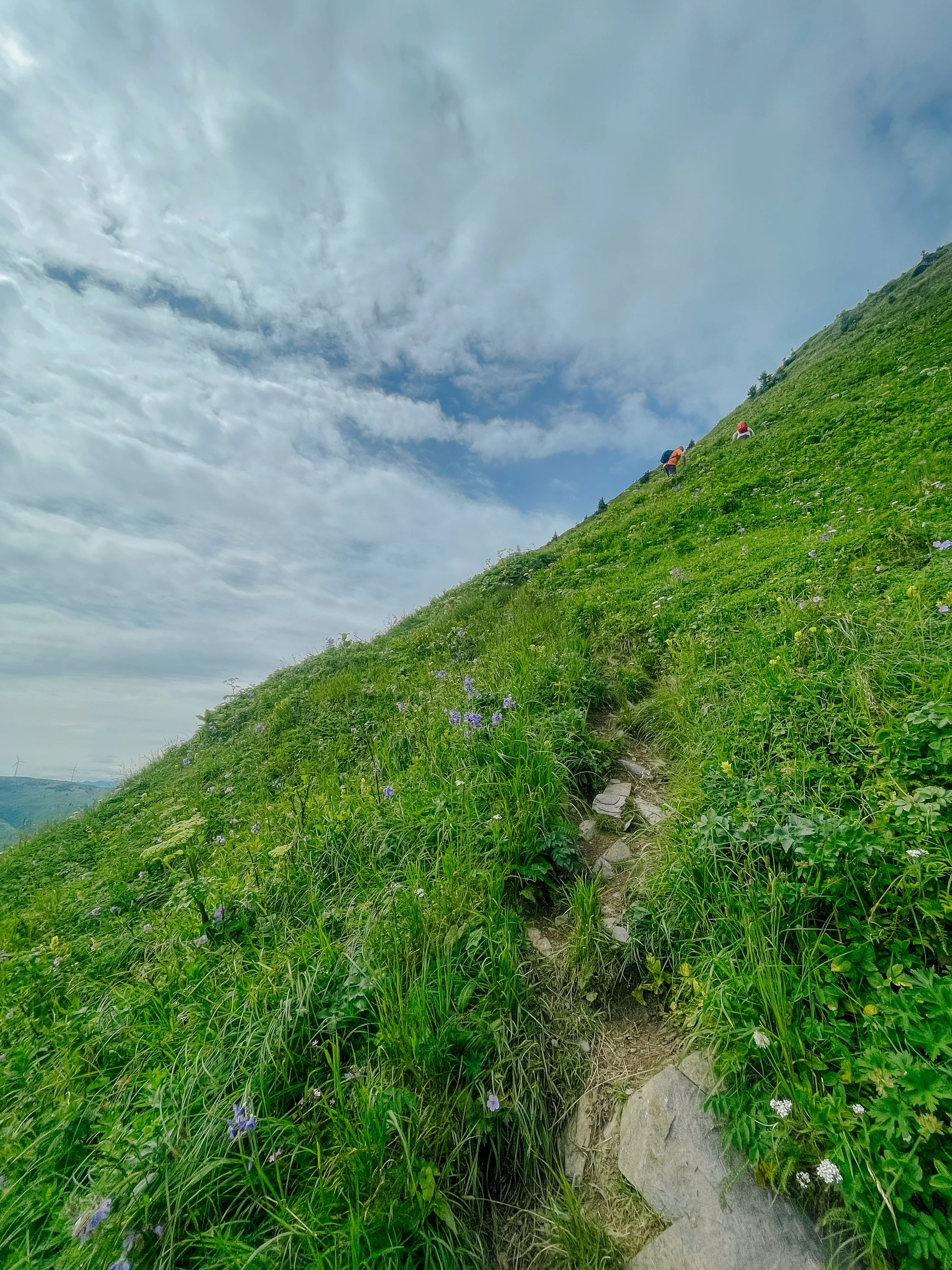
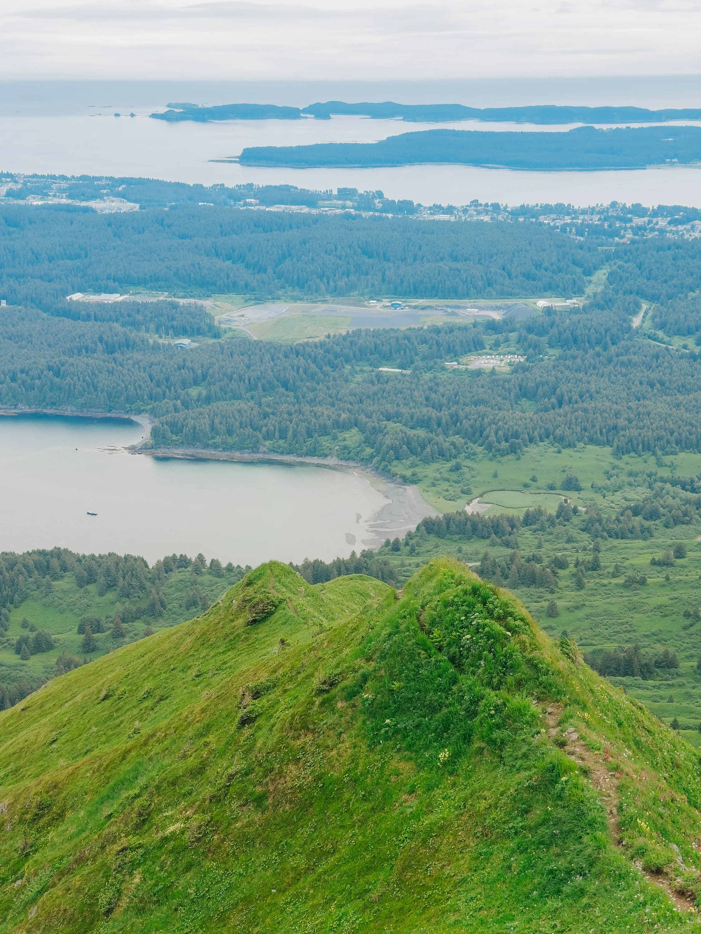
Three Sisters Peaks
Wildflowers blanketed the ground from top to bottom of our climb. At the summit, we marveled at the Three Sisters peaks, jagged and graceful against the high summer’s green-draped slopes. Peering down the slope on the other side, we spotted a hiker and waited to speak with him, keen to know if we could make our hike into a loop back to the road. Information online had been sparse, and Alaska is the last place you want to wander down a trail only to find yourself bushwhacking. Luckily, a loop back to the road did exist, offering both a new perspective and a gentler descent.
Wildflowers with Three Sisters Peaks in the background

Three Sisters Peaks

Three Sisters Peaks
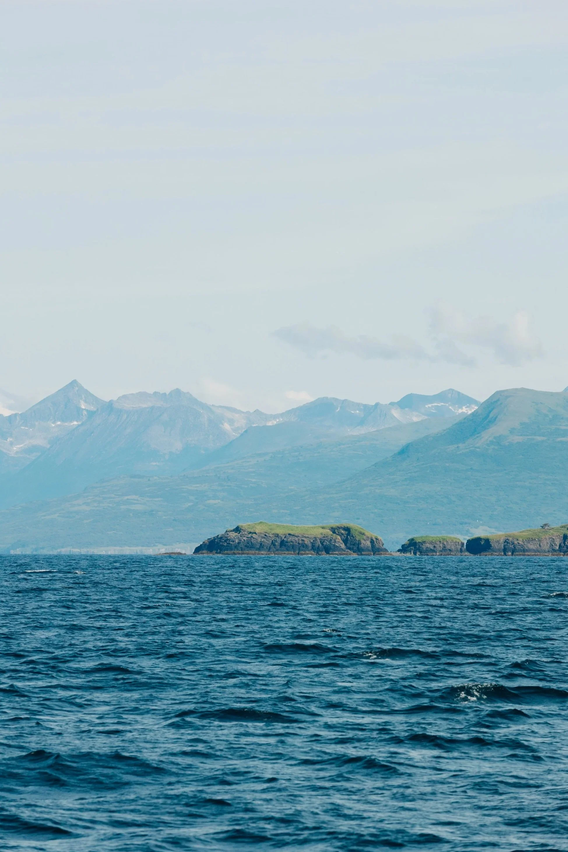
Kodiak, Alaska’s “Emerald Isle,” is a place where ocean and forest, history and wilderness, myth and memory converge. Sized at roughly 3,595 square miles (only 400 smaller than Hawai‘i’s Big Island), it is the second-largest island in the United States. Its archipelago holds 16 major islands and a constellation of smaller islets and skerries, together forming a realm of bold coastlines, ice-free bays, and shifting tides. Forested mountains dominate the north and east; bare, tundra-like grasslands stretch across the south. Much of it lies within the vast Kodiak National Wildlife Refuge, home to more than 3,500 Kodiak brown bears, among the largest on Earth. Bald eagles patrol the skies, red foxes weave through underbrush, and in summer, otters, seals, and whales fill the surrounding waters.
Map of Kodiak & Surrounding Islands, circa 1912
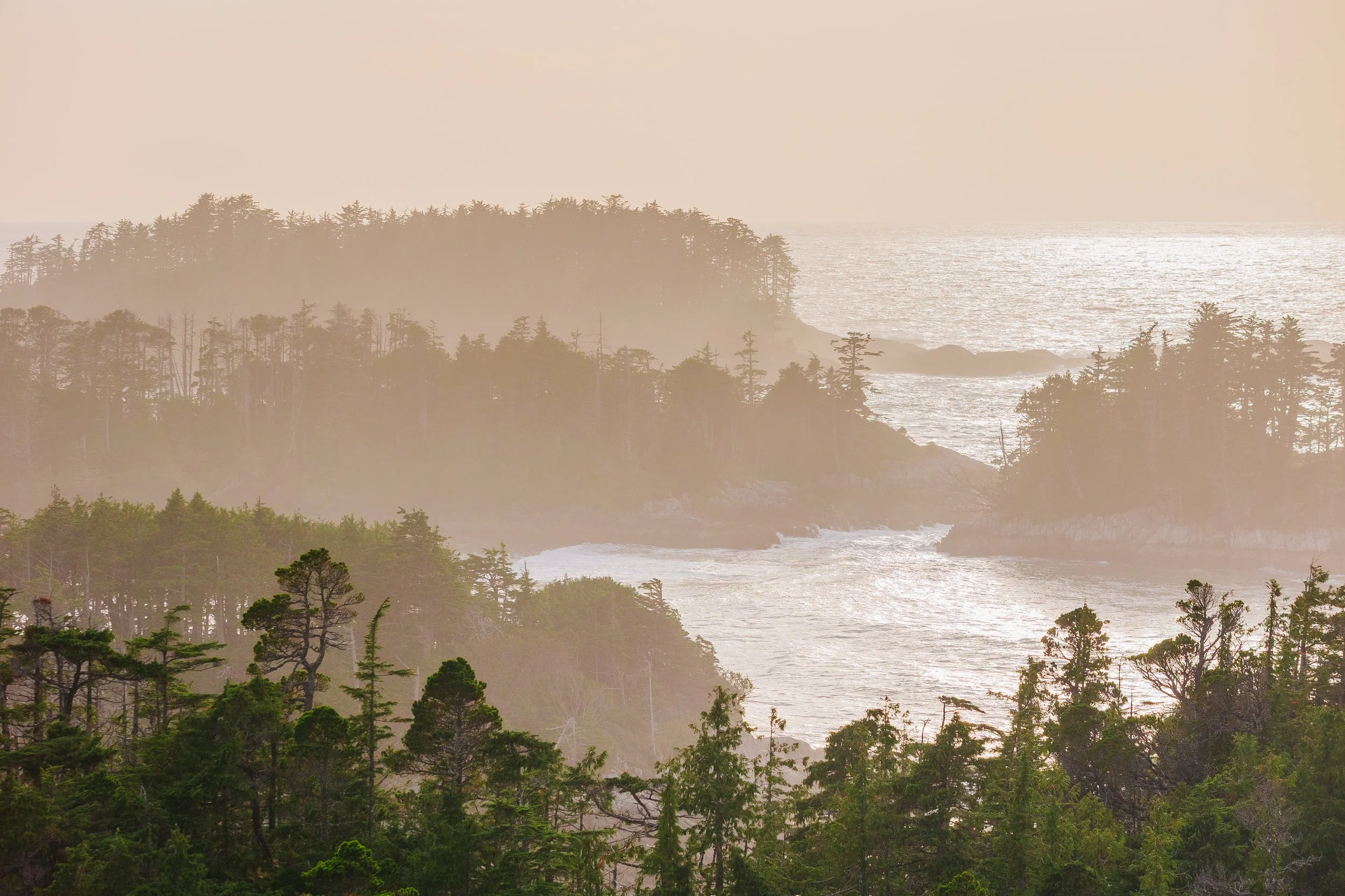
Before heading into Kodiak Town, we anchored at nearby Long Island, its mossy hills scattered with abandoned WWII Ruins. Kodiak’s history is layered: in 1784, Grigory Shelikhov established a Russian fur trading outpost at Three Saints Bay, marking the first Russian settlement in North America. Today, Russian Orthodox churches still stand across the island and surrounding isles. WWII left its own imprint here, with fortifications now softened by grass and salt air, still watching the sea.
Sitkalidak Island
With friends from Juneau and Southern California aboard, we gave ourselves a week to circumnavigate Kodiak Island – which was not enough time, in hindsight. The weather demanded patience, and the sheer size of the island begged for more days to explore. The tidal currents, driven by Cook Inlet’s massive surges, shaped each day’s route. During much of our journey, the wind ripped in the opposite direction we needed to go, leaving us nose into the waves. Leaving town, we pushed as far as daylight allowed, anchoring at Sitkalidak Island. Along the way, we passed Narrow Cape, which hosts the Pacific Spaceport – a modern counterpoint to the prevalence of WWII ruins. Mariners should note that on launch days, the Coast Guard sets temporary safety zones that close water near the cape.
Mountains near Old Harbor

Mountains Near Old Harbor

Humble homestead on the outskirts of Old Harbor
After our first night at anchor, we made our way to Old Harbor, a warm, welcoming Native community. As we walked the dirt roads, we were greeted by nearly every resident (approximately 207 in the entire town), with children riding bikes along the streets.The town's Three Saints Orthodox Church stands above the bay, its cemetery overlooking the sea. Across the water on Sitkalidak, bison graze, which was just one of several species humans introduced here over the last century, alongside Sitka black-tailed deer, mountain goats, Roosevelt elk, snowshoe hares, beavers, and red squirrels.
Sailboat anchored near Old Harbor

Russian Orthodox Cemetery

Three Saints Russian Orthodox Church
It is worth noting that large swaths of shoreline in Kodiak and throughout Alaska are private Alaska Native corporation lands (in the Kodiak Archipelago, this includes Koniag, Afognak, Leisnoi, and Old Harbor). Many areas require land-use permits for camping, hiking, or hunting, and even quick shore time. Mariners should note that it’s respectful to check ownership and permit rules before you beach the dinghy, and to call the offices of the local Native corporation to ask permission before landing in town.
Three Saints Peaks & Inlet

Three Saints Peaks & Inlet
Three Saints Peaks & Inlet
Three Saints Peaks & Inlet
Continuing southeast from Old Harbor, we passed the mountains towering over Three Saints Bay their snowcapped rocky peaks giving way to green rolling foothills that met the ocean far below. We made our way next to Kaguyak Bay, sailing past Two Headed Island, a blend of rocky outcroppings and smooth verdant slopes. Louie noted how, as we sailed farther southwest, the landscape began to resemble the Aleutian chain: fewer trees, more steep rocky mountains and windswept grasslands. I’d never been to the Aleutians, but it made us wish we were continuing our adventure westward, rather than preparing to turn back toward Southeast Alaska in the weeks ahead. But alas, this would be the farthest west we reached on our voyage thus far.
Two Headed Island

Two Headed Island

Two Headed Island

Two Headed Island
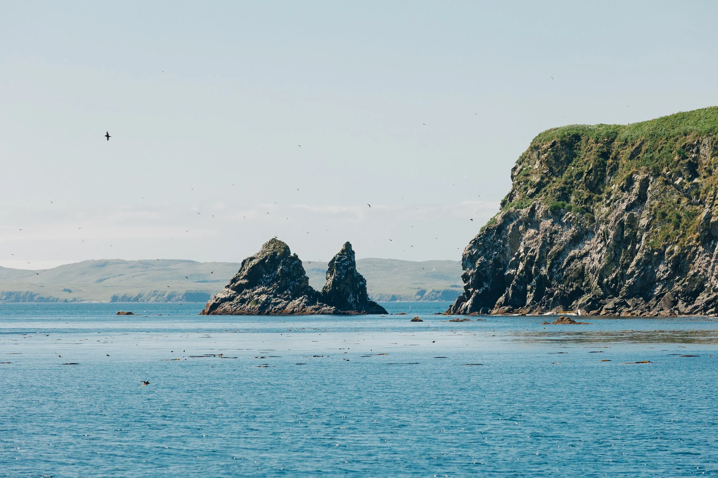
At anchor, we watched the sun melt into the horizon, the sky igniting in fiery hues mirrored in still water. On the far side of Old Kaguyak Bay lies a ghostly coastline, where the Good Friday earthquake and tsunami of 1964 erased the village here in a single night. The next morning, we crossed over to Flat Island, where puffins wheeled overhead and dove around the boat, their antics one of the joys of our summer in new waters. 
Kaguyak Bay

Kaguyak Bay

Sunset in Kaguyak Bay

Sunset in Kaguyak Bay

Flat Island Puffin Colony
Flat Island Puffin Colony

Flat Island Puffin Colony
Nearing the southwestern tip of Kodiak, we entered Alitak Bay, passing the old Alitak Cannery at Lazy Bay before making our way to Tanner Head Anchorage. From there we rafted to Pebble Beach Spit, a long crescent of wave-polished stones, each one smoothed to a soft gleam. It reminded me of the exposed beach at Icy Bay, a perfect place to watch the sunset and beachcomb for beautiful rocks. 
Lazy Bay Cannery in Alitak Bay

Cape Alitak
Pebble BEach Spit

Pebble Beach Spit in Alitak Bay

S/V Arcturus in Alitak Bay
Though we did not venture to the south near Cape Alitak, we had heard whispers that petroglyphs pepper the rocks: faces and fish etched into the tide line. If you plan on visiting the Alutiiq People Petroglyphs, please do so with care (and ideally with a local guide).
Cape Karluk

Cape Karluk

Ascension of Our Lord Chapel

Cape Karluk

Cape Karluk
On Kodiak’s western side, we gazed across to the mainland of Alaska as we continued our circumnavigation. By August, deer season had opened, and Louie and a friend went hunting up a river near Halibut Bay while the rest of us walked the sand spit, finding both trash and treasures carried here by distant currents. They returned after a successful morning, and we motored upriver where three cinnamon-colored caribou bounded along the shore. That day, wildlife seemed to be everywhere—humpbacks off Cape Karluk, porpoises slicing across our bow, eagles wheeling above the dramatic cliffs. Karluk’s tiny town was home to yet another Russian Orthodox gem, the Ascension of Our Lord Chapel.
Humpback whales with Katmai National Park in the background

Humpback whales on kodiak island
Entering Ugak Bay

Entering Ugak Bay with Katmai National Park in the background
Shelikof Strait often breathes in two directions, winds with a mind of their own: locals call it “up” (SW→NE) or “down.” Southwest gales kick up a short, punishing sea; williwaws can rake the bays. Snowcapped peaks of the mainland tempted us to cross to Katmai National Park, to the famed anchorage at Geographic Harbor, but weather, currents, and schedule held us to our course. As we neared our last anchorage, we saw a school of humpbacks playing against a backdrop of mountains. What a day it had been – deer, caribou, porpoises, humpbacks, eagles and puffins all in one sweep of time. Kodiak’s wildlife is truly extraordinary.
Kodiak Island
We anchored our last night in Uyak Bay near a kelp farm. Mariners should note that mariculture (kelp farming) is a rapidly growing industry around Kodiak. Expect farm lines, buoys, and work skiffs, check charts and the state mariculture map, and give farms a wide berth. On our final day, we pressed on through Kupreanof Strait, passing Raspberry Island, home to a thriving elk herd, before turning back toward Kodiak Town.
Three Sisters Trail on Kodiak Island


Once in town, we docked at St. Paul Harbor and visited Fort Abercrombie State Park, a headland of spruce forests, meadows, and ocean cliffs laced with trails. Built in 1941 but never engaged in battle, the surviving gun emplacements and underground magazines remain as silent sentinels. The Kodiak Military History Museum, tucked into an old bunker, displayed the island’s wartime story, while the Kodiak Wildlife Refuge Visitor Center offered a window into its wilder side. In town, we sought out local flavors: Nuniaq, a Native-woman-owned eatery serving locally sourced dishes, the Kodiak Island Brewery & Still with local brews and cocktails, and Double Shovel Cider Company which is an Alaskan favorite. We happened to arrive during the first annual Kodiak Kelp Festival, held at the brewery, celebrating the island’s growing kelp-farming industry, an endeavor as sustainable as it is creative and delicious.
Summer Sailboat Garden on S/V Arcturus
Our next chapter would be a 550-mile Gulf of Alaska crossing to Sitka, which would be my first multi-day open-ocean passage and my first time sailing through the night. Up to this point, we had traveled nearly 5,000 nautical miles since April, tracing Alaska’s wild edge from Juneau to Lituya Bay to Icy Bay, through Prince William Sound and the Kenai Peninsula into Cook Inlet, and now around Kodiak. We looked forward to returning to the familiar waters of Southeast Alaska after our adventure exploring new shores.Kodiak charmed us with its blend of natural splendor and historical depth, its tapestry of wild coastlines and relentless beauty, and quietly but boldly carved its own space in our voyage. It was one of those places that surprised us, etching itself into memory with its rich, untamed shores.
Adventures, Words & Photos by Lerina Winter & Captain Louis Hoock
Originally Published: September 6th, 2025
Search for Treasure and Explore Kodiak Island

Off the coast of Kodiak, Alaska, lies a wilderness where Kodiak bears roam ancient spruce forests and the sea hides shipwrecked secrets. From the town of Kodiak, journey across storm-whipped coves and windswept beaches that echo with Aleut and Russian heritage. This Treasure Map leads to real hidden treasure on Kodiak Island, each edition comes with a digital poetry cipher to decode the lines on the map and unveil your destination. Follow the footsteps of mariners and create your own legend.
HOW TO USE THIS TREASURE MAP:
Upon purchasing the map, Your treasure map will be shipped to you via USPS. You'll receive two emails: one with the digital poetry cipher worksheet, meticulously crafted to hold the key to unraveling the secrets of the treasure; and second, your shipping details once your map has shipped.
Put your sleuthing skills with the poetry cipher worksheet to the test as you decipher the clues hidden within. Each line holds a clue, guiding you closer to the location of the hidden treasure.
With your decoded clues in hand, embark on an exhilarating adventure to search for the treasure. Explore the landscape, follow the hints, and let the thrill of the hunt lead you to the ultimate prize. Please note you will not need your physical treasure map present to locate the treasure.
DETAILS:
16”x24” Limited Edition Print Run of 1,000
Printed in the USA on premium matte paper (230 gsm) acid-free with archival ink
Purchase includes print only, frame not included
See Where S/V Arcturus is now on No Foreign Land: