Through Mist and Granite: Kenai Fjords’ Rugged Coast

A Passage Along the Untamed Edge of the Kenai Coast
As the month of June came to a close, we left behind the serene waters of Prince William Sound, where reflections held steady and silence lingered long, to follow the pull of the tide westward. Past the calm anchorages and glassy inlets, we crossed into a realm more rugged, where the coastline grew wild and the sea seemed to breathe with a more ancient force. The Kenai Peninsula lay ahead, its fjords carved by ice and wild weather, promising both challenge and wonder. Our two-week sojourn in the fjords of the Kenai Peninsula had begun, and July welcomed the warm embrace of the Alaskan summer. I awoke to the rhythmic cadence of waves lapping against our hull, the scent of salt and spruce mingling in the crisp morning air. As we rounded the Kenai Peninsula into Port Bainbridge, anticipation coursed through me. From the outset of our trip planning, the fjords had seemed a mysterious place; a realm of dramatic rocks and pinnacles adorned with tufted pine and spruce, a landscape unlike any I'd encountered in Alaska. The coastline unfolded in a hard-worn display of rocky outcroppings and jagged spires thrusting skyward from the restless sea.
Rugged Island, Kenai Fjords

Kenai’s Outer Coast

Rugged Island, Kenai Fjords

Fort Bulkley atop Rugged Island, Kenai Fjords
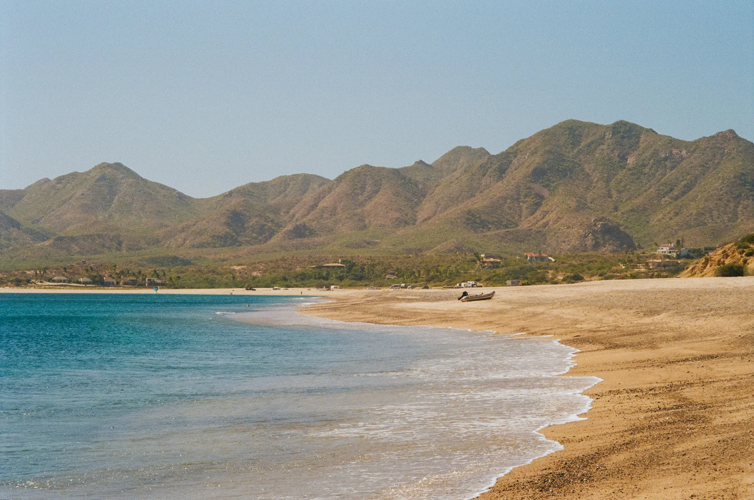
We made our way to Driftwood Bay, a marine park highly recommended by fellow travelers, which became our first anchorage on the Kenai coast. The bay exuded a serene, almost tropical ambiance—the mountain peaks lush with greenery, reminiscent more of Hawaii than the frigid North we usually associate with Alaska. The outer coast's swell reached into the bay, rendering our initial evening anchored there rather wavy, though scenic and beautiful nonetheless.Reflecting on our previous month spent in Prince William Sound, we began to see the profound impact of the 1964 Alaska earthquake on the region’s geology, which was now also visible on the Kenai Peninsula. This monumental seismic event, which registered a magnitude of 9.2, reshaped the landscape, causing tectonic shifts, subsidence, uplift, tsunamis, and landslides. The earthquake’s legacy is etched into the very fabric of much of Southcentral Alaska, altering drainage patterns and ecosystems—transforming areas that once stood above sea level into tidal flats, while others emerged anew from the sea. We often spotted dead trees at low elevations near the shore: ghostly remnants of once-thriving forests drowned by tectonic subsidence.
Driftwood Bay

Exploring the beach at Driftwood Bay

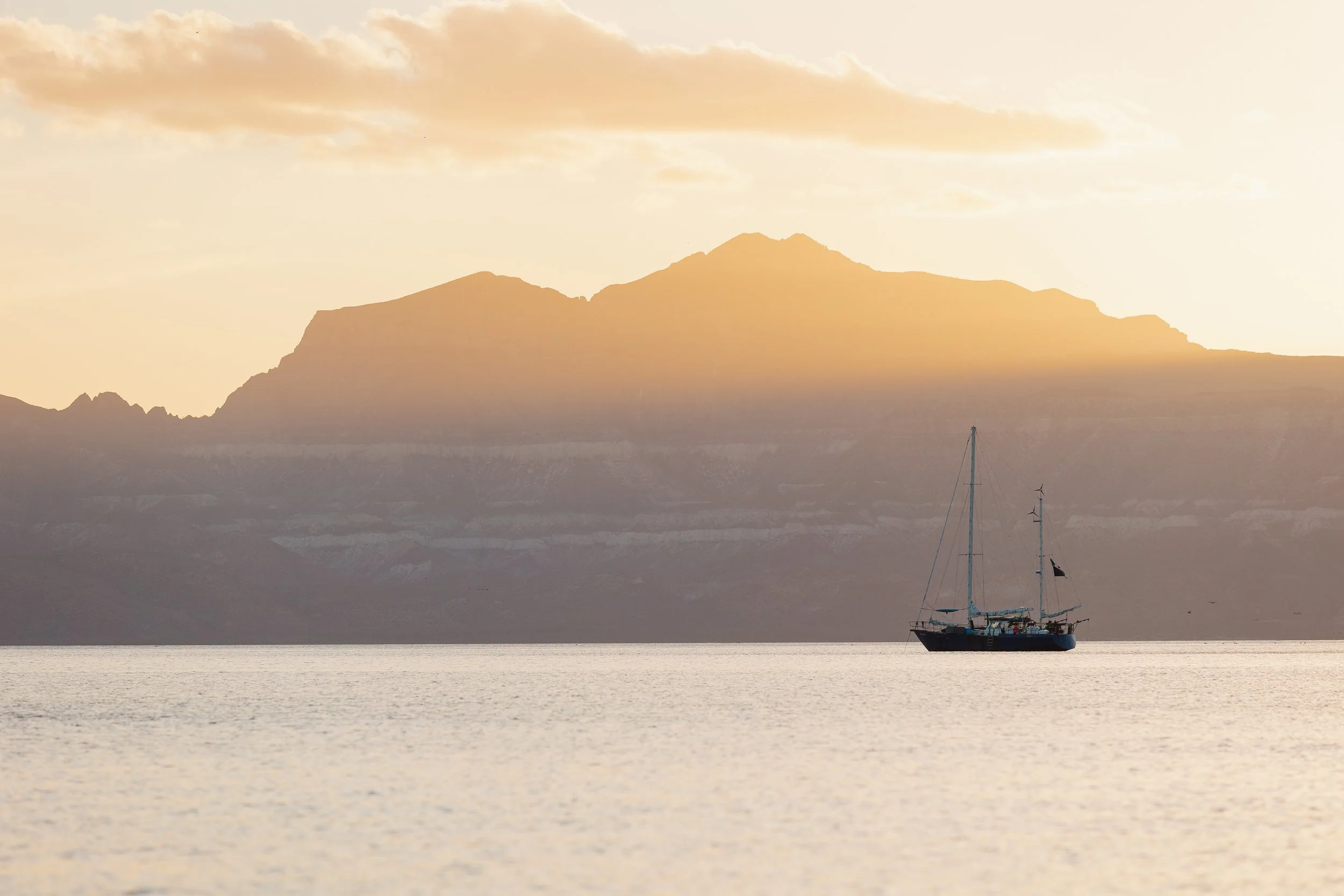
S/V Arcturus in Resurrection Bay
Entering Resurrection Bay, home to the town of Seward, we paused at Sandspit Point State Marine Park on Fox Island (Renard Island) for a midafternoon exploration. Sunlight poured onto the sea and surrounding mountains, still kissed with snow. A kayaker approached, waving with enthusiasm. From the pilothouse, I noticed my aunt and uncle, who were aboard from New Mexico, joyfully exclaiming, “Sally! It’s Sally!”—their friend from the Southwest who spent summers in Seward, serendipitously encountered in this remote cove. We ventured ashore together, discovering primitive campsites catering to kayakers and small boaters, the beach teeming with blooming lupine.
Mountain Views at Sandspit Point

S/V Arcturus in Resurrection Bay

S/v Arcturus at Sandspit Point State Marine Park
On the 2nd of July, we docked in Seward, intentionally timing our visit to partake in the town’s Fourth of July festivities. Following a festive boat parade out of the harbor, which we watched aboard Arcturus, fireworks illuminated the sky at midnight on the 3rd, a celebration where twilight barely yielded enough darkness for a proper display. The next day, we were captivated by the Mount Marathon Race, a local tradition that takes place every 4th of July. We greatly enjoyed our visit to the Alaska SeaLife Center, where we delved into the region’s rich marine life and marveled at puffins that seemed to fly underwater.
Fourth of July Fireworks Display in Seward, Alaska

topographic reconnaissance map of Kenai Peninsula, Circa 1915
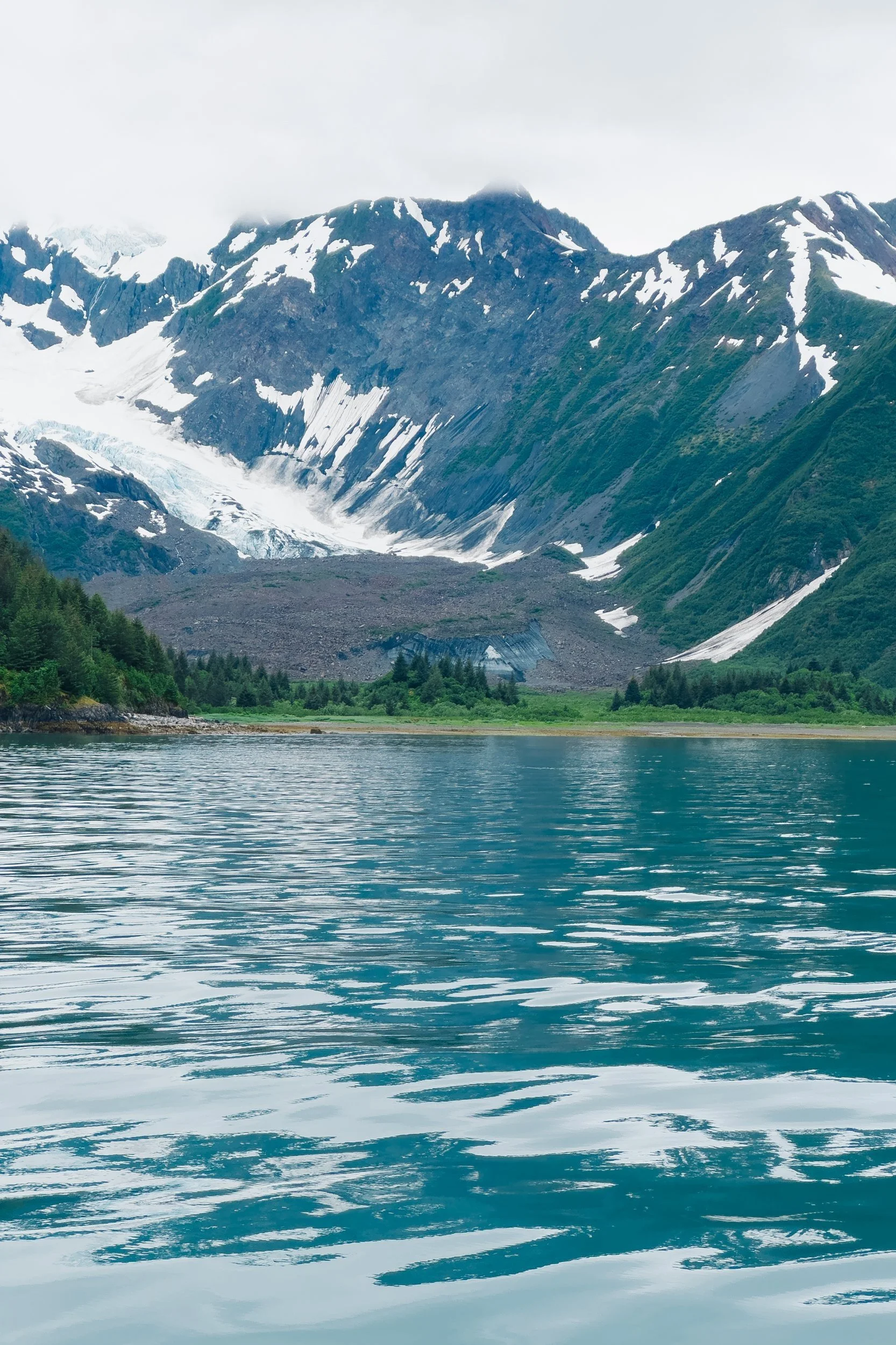
Departing Seward, we ventured west to Aialik Bay, anchoring for the night in McMullen Cove. The following morning, we approached Aialik Glacier under a sunlit sky, passing a multitude of kayakers weaving through icebergs. Slate and Squab Islands shimmered in verdant hues, framed by dramatic mountains cascading into the sea. We discovered that, unlike Glacier Bay National Park, the waterways here are not encompassed within national park boundaries of Kenai Fjords National Park. Tour boats are permitted to traverse the fjords at full speed, often producing waves that disturbed seals resting on icebergs. There was a constant cacophony of radio chatter echoing from Seward’s fleet—a reminder of the proximity of wilderness to tourism.
Aialik Glacier with slate Island in the foreground, Kenai Fjords National Park

Slate Island in Aialik Bay

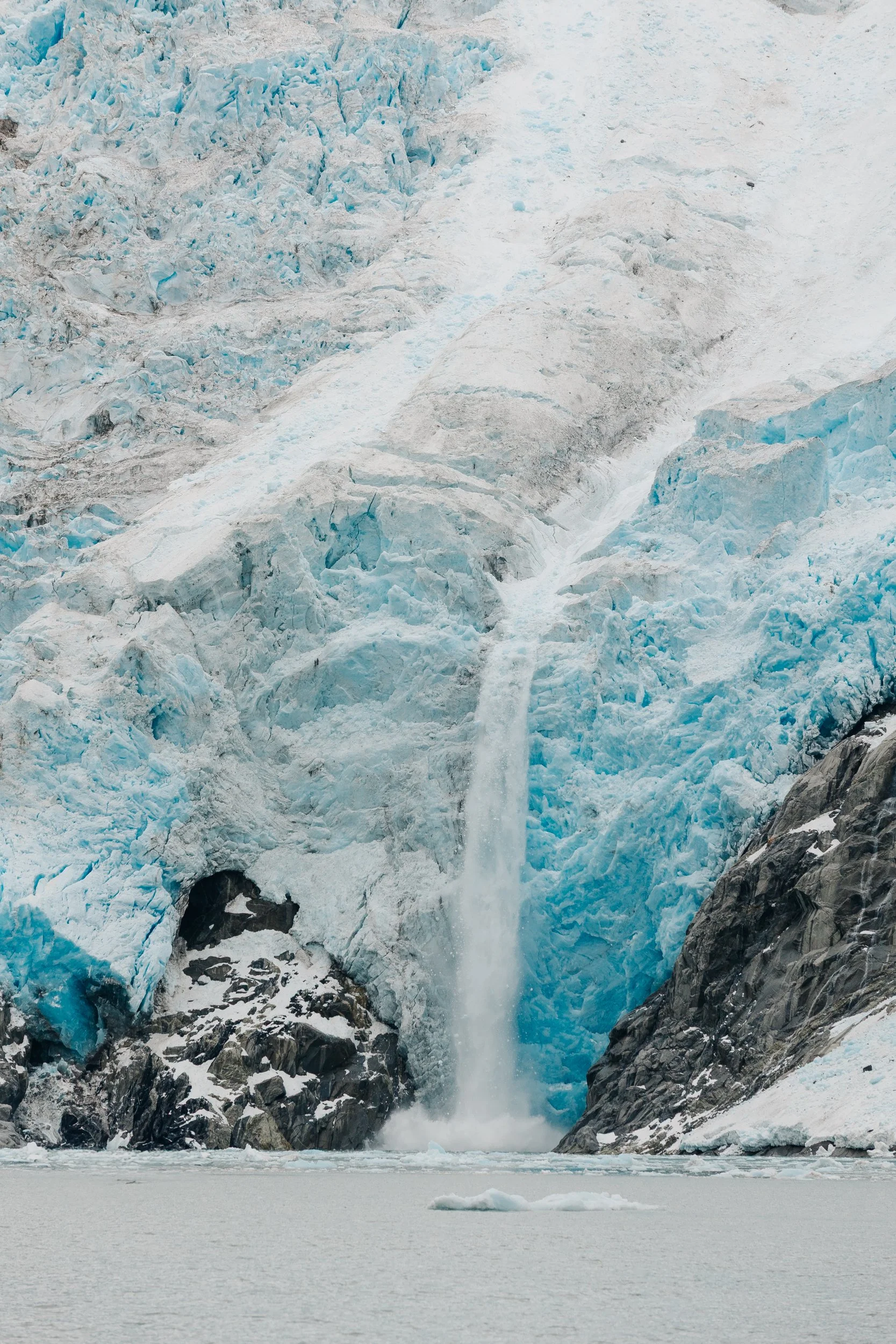
Face of Aialik Glacier
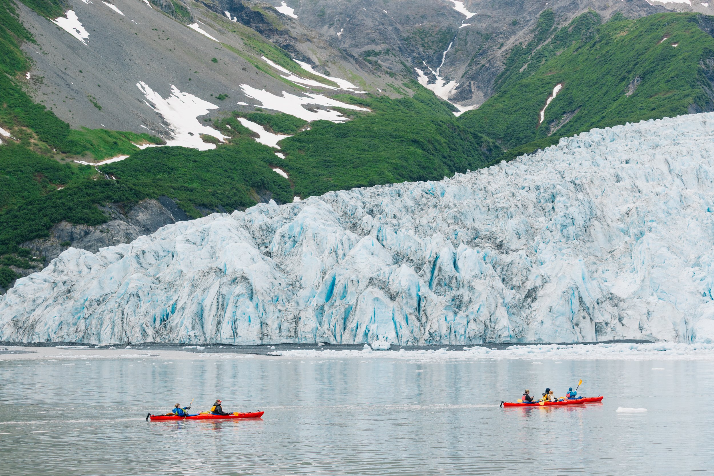
Kayakers in front of Aialik Glacier, Kenai Fjords National Park

Squab Island in Aialik Bay, Kenai Fjords National Park
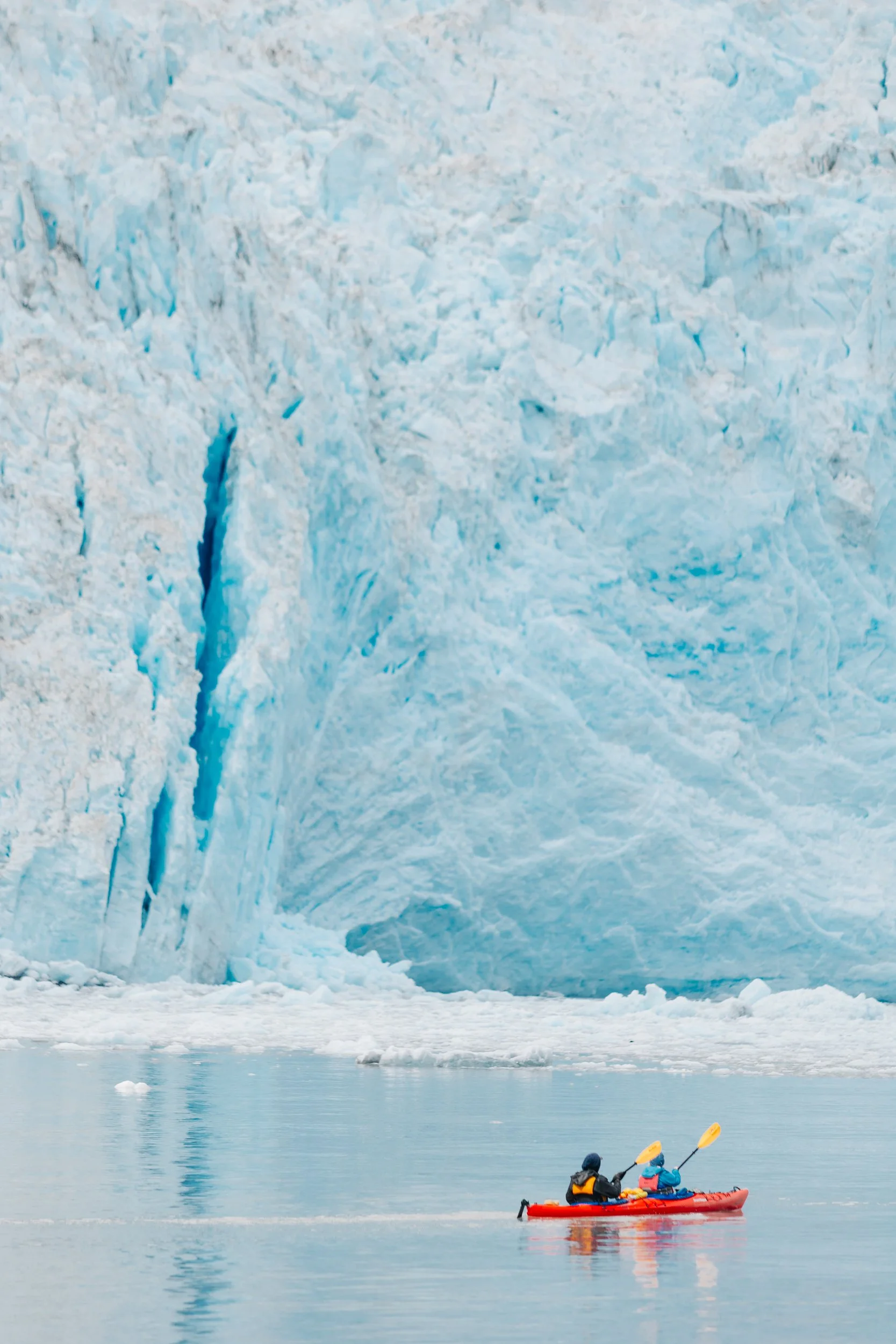
Kayakers in front of Aialik Glacier
Aialik Bay

coastline of Kenai Fjords National Park
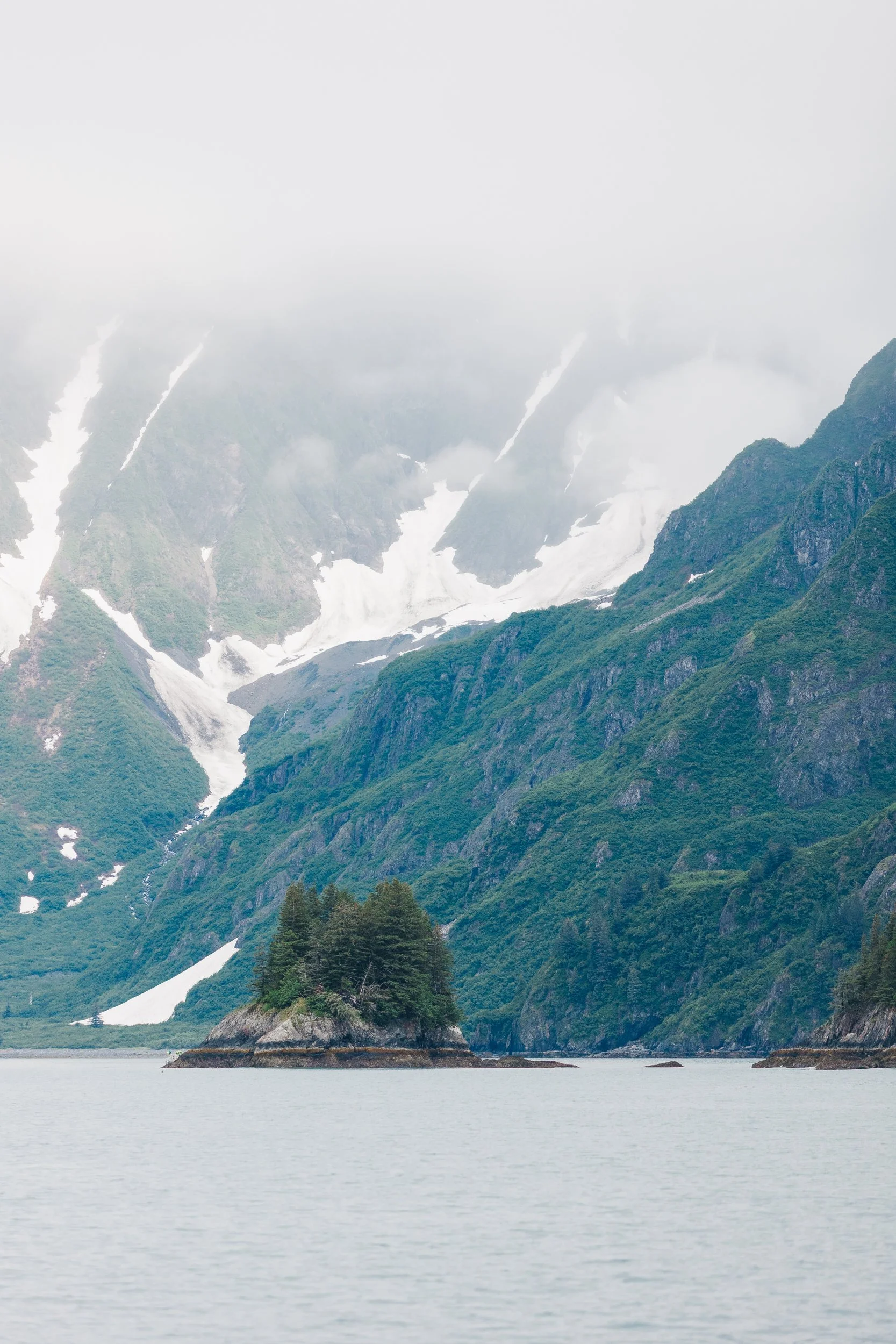
As we continued westward, the weather turned dreary and overcast. Mist veiled the landscape, imparting an eerie beauty to our exploration. My initial visions of capturing sunlit photographs of rocks jutting from the sea against snow-capped peaks gave way to the gentle reminder that in Alaska, sunshine can be a rare luxury. Hopping from bay to bay, we embraced the return to sailing after our calm month in Prince William Sound, recalling the exhilaration of navigating through dynamic seas. I was intrigued to learn that some rocks in Kenai Fjords National Park originated as coral reefs near the equator. Over millions of years, tectonic movements transported these reefs northward, metamorphosing them into the formations we see today.Our journey led us to Granite Island, a slender landmass with towering cliffs southwest of the Harris Peninsula. A British couple we had met in Cordova the month prior had touted its beauty, calling Taz Basin their favorite anchorage in all of Southcentral Alaska. Waterfalls cascaded from the island’s southern tip, fed by recent rains. Entering Taz Basin, sheer black granite cliffs enveloped us, as if we had discovered a secret sanctuary carved by nature’s hand. Navigating into and out of the basin can be tricky and is not recommended during rough sea conditions; see Louie’s notes below for navigational considerations.
Entrance to Taz Basin, Granite Island

Taz Basin, Granite Island

Taz Basin, Granite Island

Taz Basin, Granite Island

Taz Basin, Granite Island
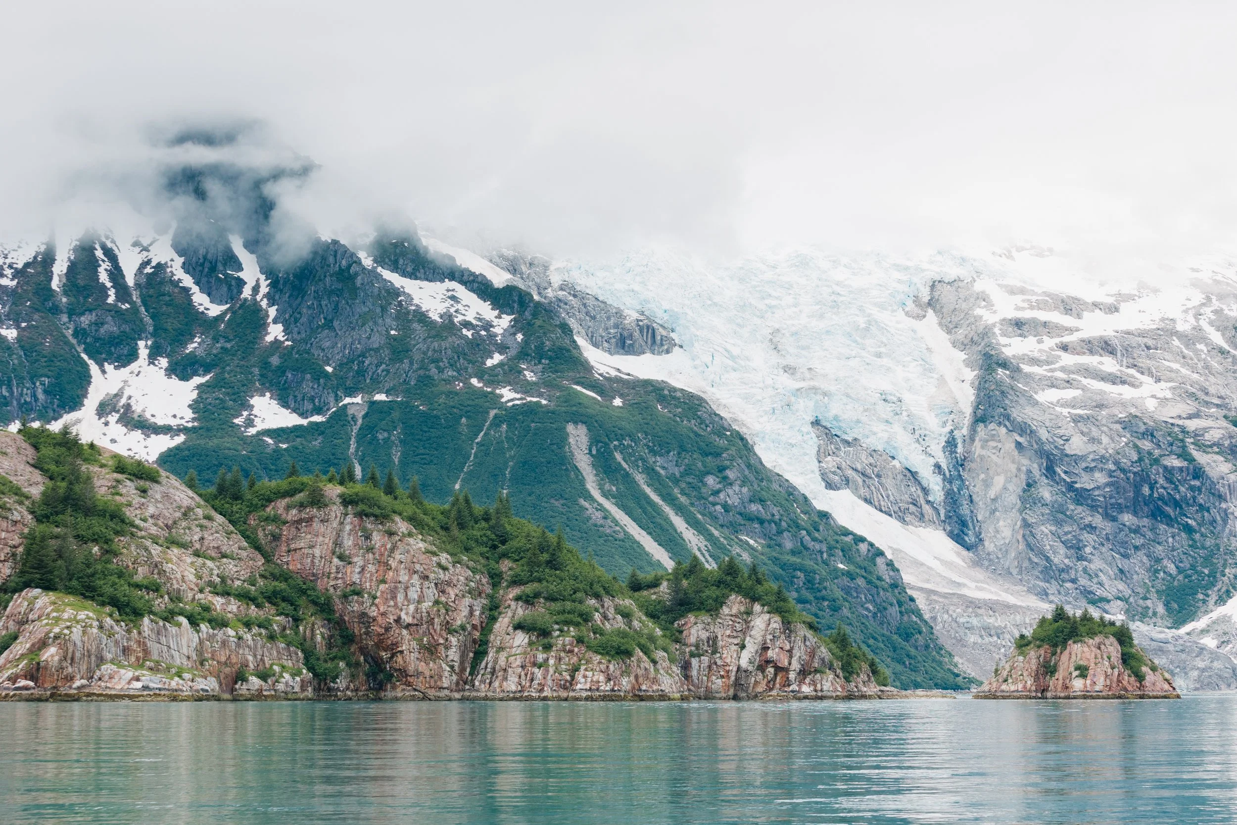
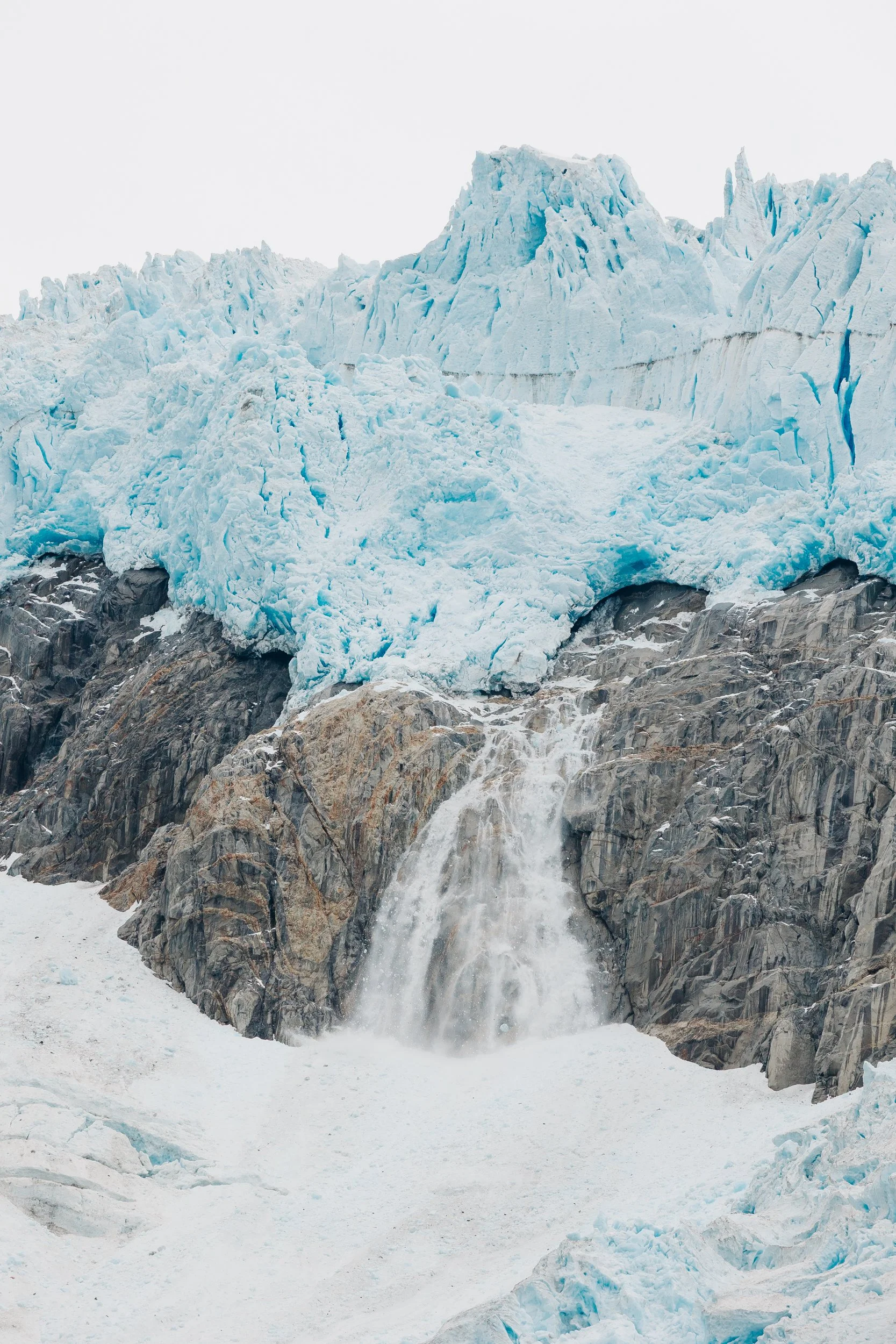
The next morning, as we pointed our bow toward Harris Bay, we were greeted by a school of Dall’s porpoises playfully surfing along the bow. Such sprightly creatures with their joyous energy, they stayed with us long enough for our whole crew to rush forward for a good glimpse. The wildlife along the entire Kenai coast was remarkable, and our fishing efforts proved hugely productive: we caught many rockfish, lingcod, and even a few salmon.We ventured into Northwestern Fjord—a contrasting experience to Aialik Arm. Multiple glaciers descended like frozen rivers from the mountains: Sunlight, Southwestern, Anchor, and Ogive to the west; Northwestern and Redstone to the east. Passing Striation Island, we observed iron-rich red rocks forming a striking backdrop for a family of orcas swimming gracefully up the fjord. Approaching Ogive Glacier, its gray visage resembled stone, while Northwestern Glacier’s cascading icefalls and exposed rock evoked the image of an ancient, bearded man.
Entrance to Harris Bay
Striation Island in Northwestern Fjord
Northwestern Glacier
Harris Bay

Northwestern Glacier

Ogive Glacier
Northwestern Glacier

Orca Whales swim in front of Striation Island in Northwestern Fjord
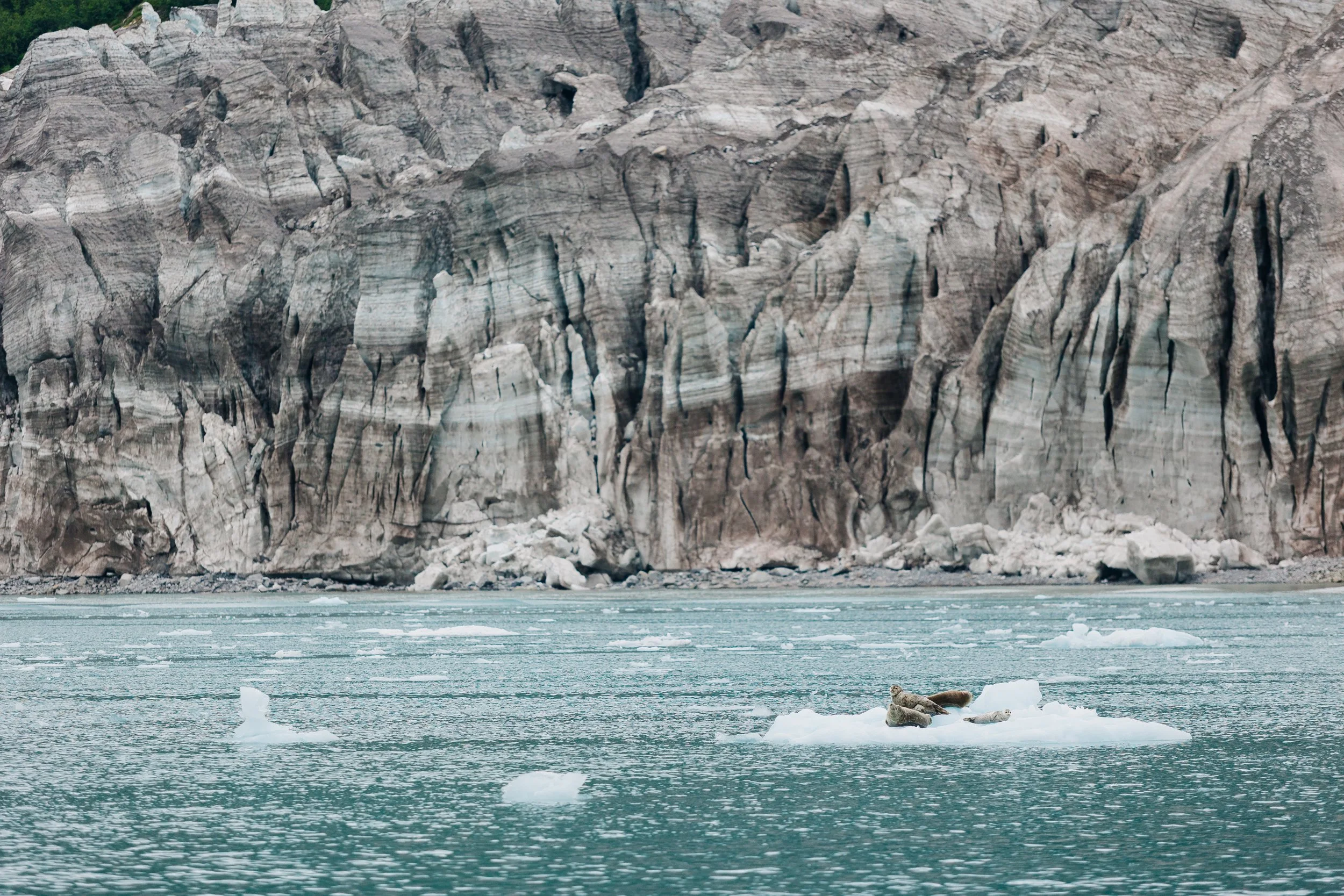
Seals on an iceberg in front of Ogive Glacier in Northwestern Fjord
As our time in Kenai Fjords waned, persistent rain dampened our spirits. We opted to forgo exploring McCarty Fjord and its glacier—the lengthy approach and limited visibility influencing our decision to press on. We had also heard glowing reports favoring Aialik and Northwestern as the most spectacular tidewater glaciers. Setting our course for Nuka Island, we navigated through the narrow McArthur Pass between the Pye Islands and the McCarty Peninsula. A fellow sailor who had called us on the radio earlier that week had lauded Nuka Passage and Nuka Island as their favorite locales in all of Kenai Fjords. Despite anchoring in Berger Bay, dense fog and inclement weather obscured much of the island’s allure, leaving us yearning for clearer vistas.
Coastline of Kenai Fjords National Park

Rocky outcroppings on the coast of Kenai Fjords

Coastline of Kenai Fjords

Coastline of Kenai Fjords

coastline of Kenai Fjords National Park
Continuing toward the tip of the peninsula, the landscape transformed as steep mountains gave way to rolling green hills. We passed the trio of Chugach Islands—East Chugach, Pearl, and Elizabeth—navigating notable currents as we drew closer to Cook Inlet. Anchoring in Port Chatham near the abandoned town of Portlock, we sought remnants of an old cannery—relics of a bygone era. Our voyage would soon lead us into Kachemak Bay, with Homer as our next destination before pressing on to the island of Kodiak.
topographic reconnaissance map of Kenai Peninsula, Circa 1915
As we rounded the final headlands and left the fjords in our wake, I found myself reflecting on the edges where mist met stone. Kenai Fjords had not offered us calm seas or cloudless skies, but rather a raw, unfiltered intimacy with Alaska’s wild heart. It felt as though the coast keeps its secrets close, offering fleeting glimpses to those who brave its weather and heed its tides.Adventures, Words & Photos by Lerina Winter & Captain Louis Hoock
Navigational considerations For Taz Basin:

Taz Basin Entrance: First and foremost, the bathymetry data on Navionics® is completely incorrect and should be taken with a grain of salt. Vessels should enter on the north side of the prominent flat-topped rock that lies in the center of the channel. The northern channel is 25 feet deep at low tide. By hugging slightly closer to the rock wall at the entrance and farther from the island, you may find deeper water. The channel south of the rock is definitely shallower than the north entrance but is navigable. It is nearly awash at a zero (or "low low") tide and has a reported depth of around 17 feet at high tide. Entering and exiting this small basin should be avoided in any significant weather from the south to southwest.Anchoring: In both the northern and southern ends of the basin, reasonable holding ground can be found in 85 to 100 feet of water. There is a small bench in the far northern end of the basin that is 60 feet deep, with snags and large boulders. We took this northernmost anchorage and found it to be very pleasant. As an additional resource, Andy Cross did an exceptional job describing this entrance, with excellent photos, his article "Taz Basin: Sunshine At Hole-in-the-Wall" featured in 48° North magazine. Before entering the basin for the first time, I recommend reviewing his article and photos as well.Originally Published: May 8th, 2025; Last Updated: August 11th, 2025
Search for Treasure And Explore Kenai Fjords

Just a stone’s throw from Seward, Alaska, Kenai Fjords is a kingdom of ice‐chiseled wilderness, where tidewater glaciers tumble into the rugged outer coast. Puffins nest on rocky ledges while black bears wander salmon-filled streams below soaring granite cliffs. This Treasure Map leads to real hidden treasure in Kenai Fjords, each copy is accompanied by a digital poetry cipher, whose lines guide you to the secret cache. Dive into the hush of ancient ice and let every echo become a clue.
HOW TO USE THIS TREASURE MAP:
Upon purchasing the map, Your treasure map will be shipped to you via USPS. You'll receive two emails: one with the digital poetry cipher worksheet, meticulously crafted to hold the key to unraveling the secrets of the treasure; and second, your shipping details once your map has shipped.
Put your sleuthing skills with the poetry cipher worksheet to the test as you decipher the clues hidden within. Each line holds a clue, guiding you closer to the location of the hidden treasure.
With your decoded clues in hand, embark on an exhilarating adventure to search for the treasure. Explore the landscape, follow the hints, and let the thrill of the hunt lead you to the ultimate prize. Please note you will not need your physical treasure map present to locate the treasure.
DETAILS:
16”x24” Limited Edition Print Run of 1,000
Printed in the USA on premium matte paper (230 gsm) acid-free with archival ink
Purchase includes print only, frame not included
See Where Arcturus is now on No Foreign Land: